
Clear Skies, VIIRS and the Great Lakes
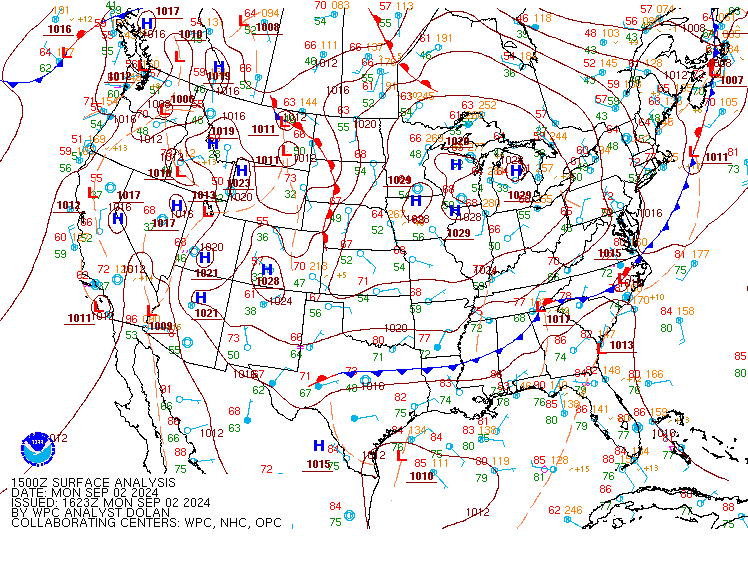
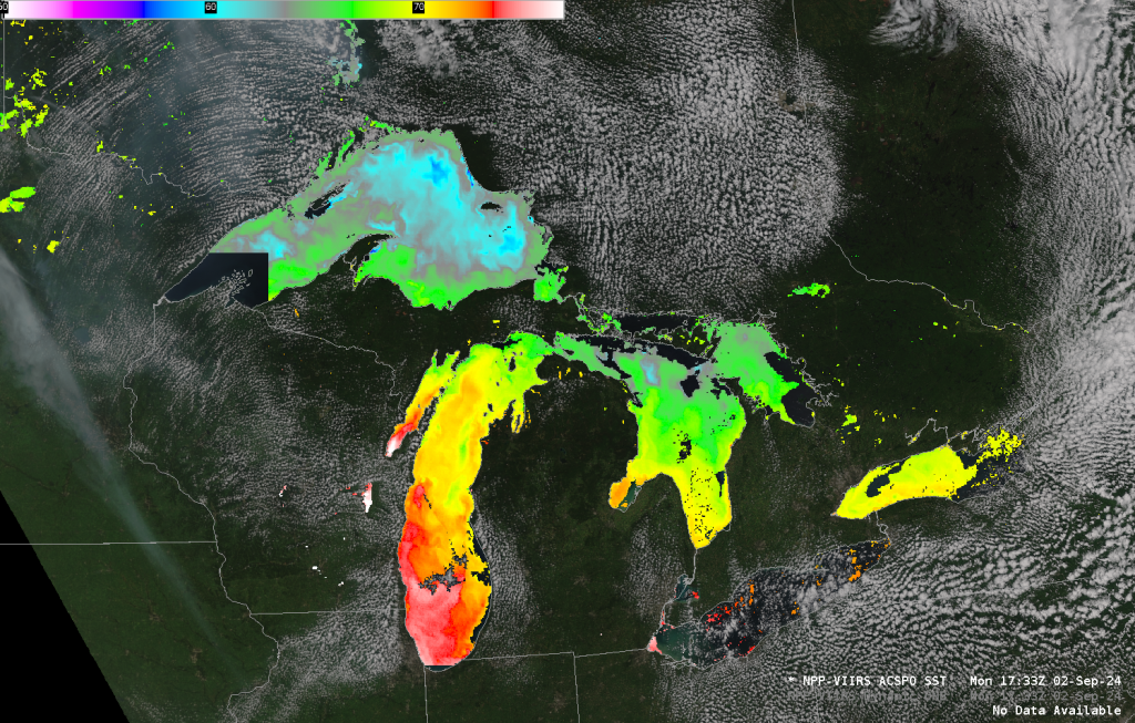
VIIRS data from NOAA-20 at the CIMSS Direct Broadcast download site, above, at 1734 UTC on 2 September were used to create True Color imagery, and SST fields over the largely-clear Great Lakes. Light winds associated with persistent high pressure over the Great Lakes (below) meant suppressed vertical mixing, leading to warm water temperatures on the lake surface. Most of Lake Superior’s surface is warmer than 60oF, with portions of Lake Erie, Saginaw Bay, and Green Bay near 77oF. This is also shown in the AWIPS Screen-capture with the same data, below.
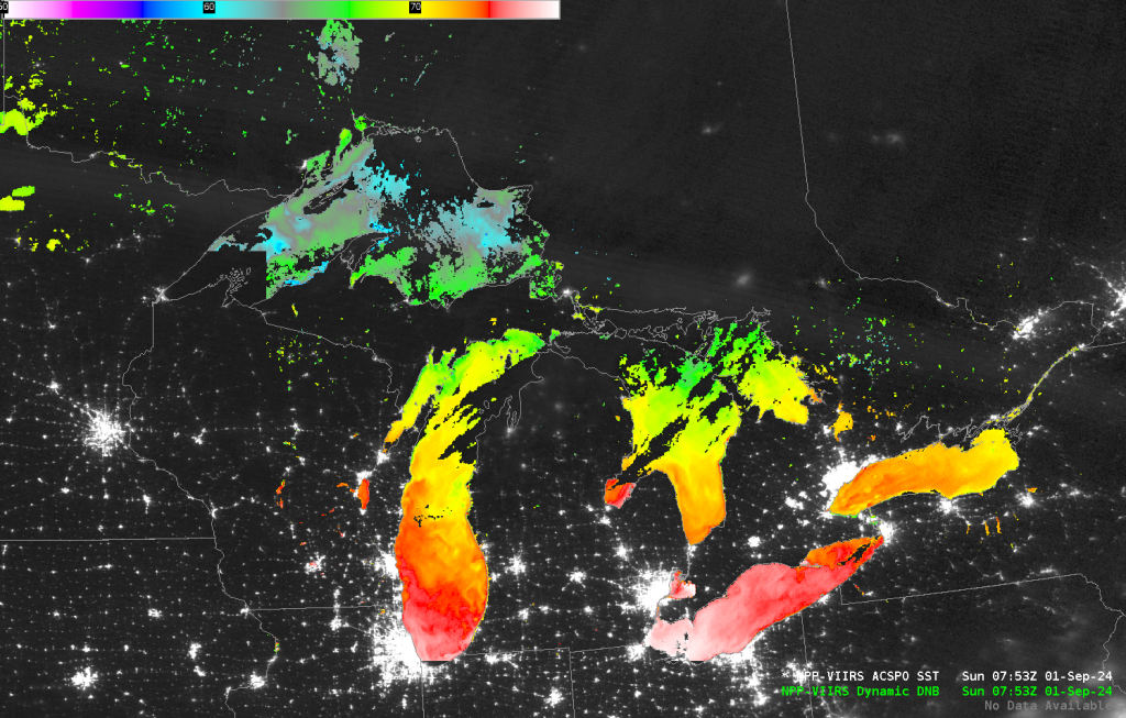
Early on 1 September, skies were also mostly clear, and the VIIRS ACSPO SSTs are shown below in concert with Day Night Band visible imagery. The warmest temperatures in the color enhancement (white) are 77oF (that is, 25oC).
—————
Free Secure Email – Transcom Sigma
Transcom Hosting
Transcom Premium Domains