Baroclinic leaf feature over the Hawai’ian Islands
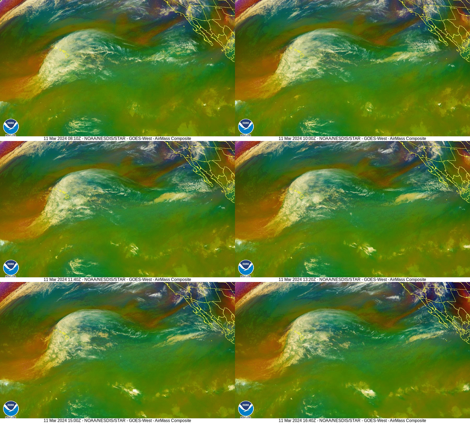
CSPP Geosphere imagery (Night Microphysics RGB), above, shows baroclinic leaf over the Hawaiian islands that is suggestive of the early stages of a developing mid-latitude cyclone. Air Mass RGB over roughly the same time, below (source), is also suggestive of a developing cyclone. The orange values in the RGB to the west and south of Hawai’i can denote air that is rich in Potential Vorticity,
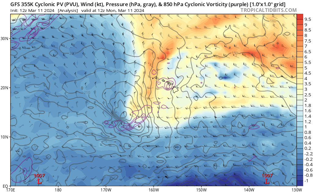
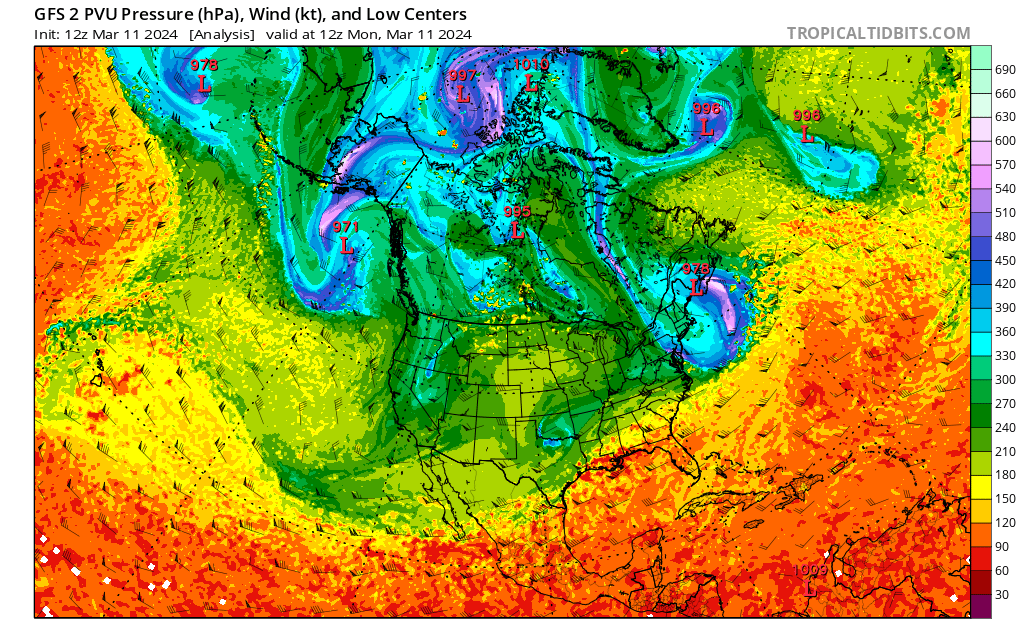
Imagery from the handy TropicalTidbits website, above and below at 1200 UTC on 11 March 2024, show signatures consistent with air rich in Potential Vorticity to the west of the Hawai’ian Islands.
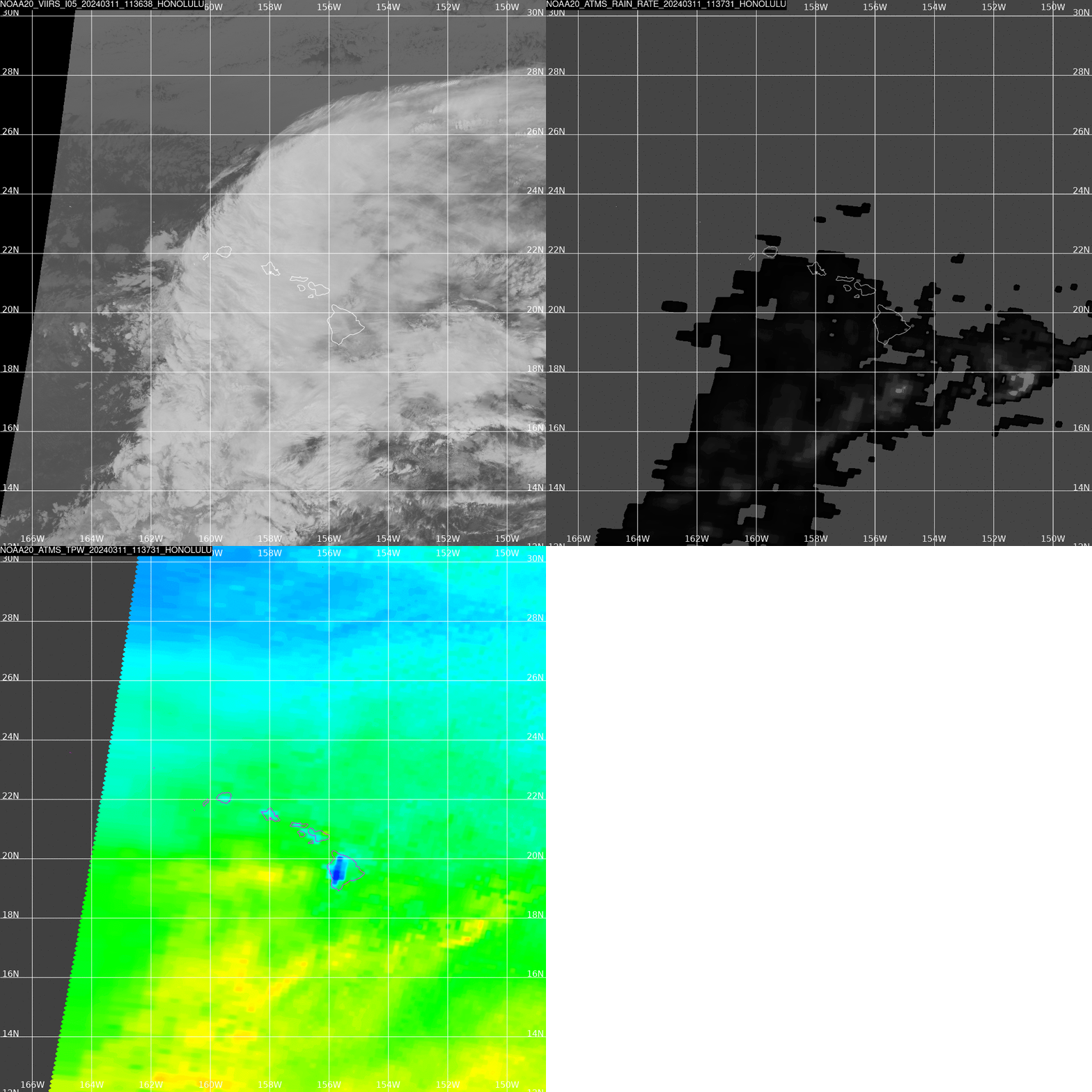
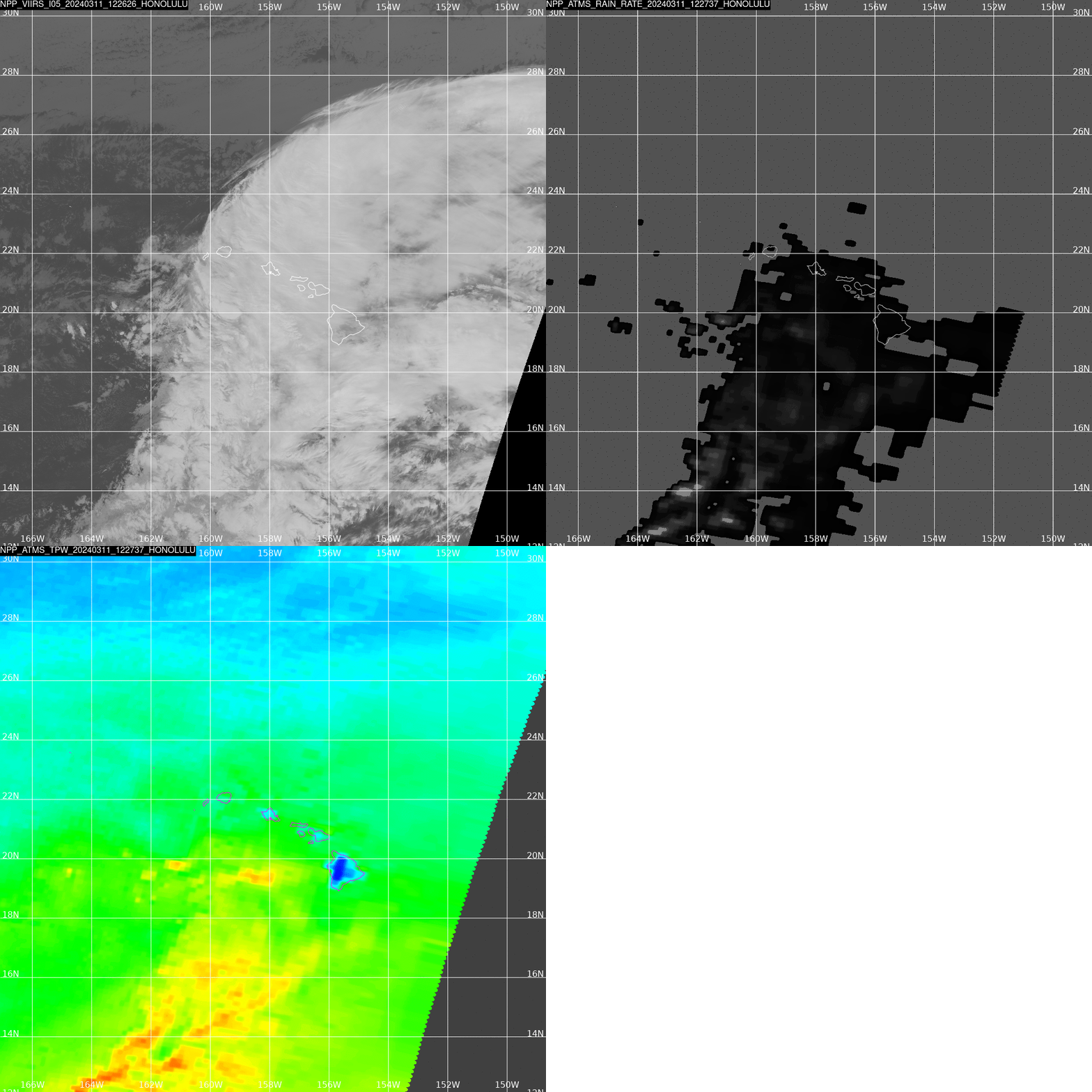
How much precipitation is associated with this extensive cirrus shield? Direct Broadcast data from this site includes VIIRS imagery and MIRS RainRates, and the microwave data can show you the TPW distribution, and the Rain Rates. NOAA-20 overflew the region at 1137 UTC on 11 March. Rain was primarily over and south of the islands, where the moisture-rich atmosphere was. Microwave data gives important information about rain in regions where cirrus clouds might prevent an accurate determination of rains. Suomi-NPP overflew the region at 1227 UTC (imagery shown at bottom) and gives similar information.
—————
Free Secure Email – Transcom Sigma
Transcom Hosting
Transcom Premium Domains
