Airmass RGB imagery and MIRS snowfall rates over northern Alaska
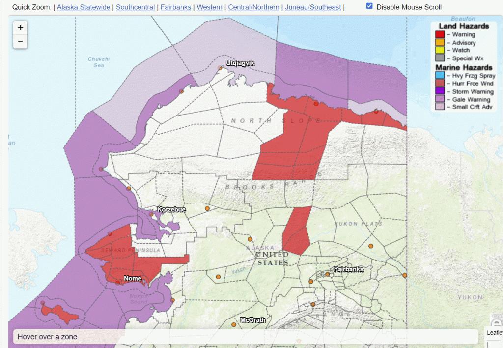
Parts of northern Alaska were under a Winter Storm Warning for much of the weekend, as shown below by the red regions to the north of Fairbanks. (The red regions around the Seward Peninsula were regions where a High Wind Warning had been cancelled after strong winds weakened. This toggle of MetopB and MetopC ASCAT winds from 0530-0630 UTC on 13 October (source) shows the very strong winds offshore). The Airmass RGB animation (created using Geo2Grid software) above shows the abundant mid-level moisture streaming north and the development of a storm system by 1200 UTC on 13 October as evidence by the comma cloud.
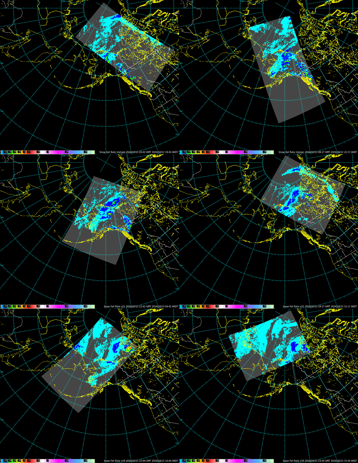
What products can be used to highlight where snow might be falling over northern Alaska, where no radars are present, and where webcams are scarce. Microwave Integrated Retrieval System products include snowfall rate. This product is computed from Microwave sounders on board many Low-Earth-Orbit (LEO) satellites including Suomi-NPP, NOAA-20/NOAA-21, and MetopB/C. The animation below shows values (computed from data downloaded at the GINA Direct Broadcast antenna and processed using CSPP software; created imagery is here). The heaviest snowfall is diagnosed to the south of the Brooks Range through about 1400 UTC (as shown in this image from 0452 UTC, for example), at which point maximum snowfall shifts to the north.
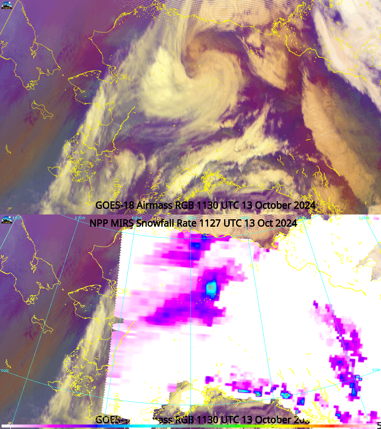
Polar2Grid software can be used to create MIRS snowfall rate imagery with data downloaded from (for example) Amazon Webservice websites that hold Suomi NPP or NOAA-20 data. The toggles below compare the computed Snowfall rates and the airmass RGBs. As is often the case over Alaska, the GOES animations give the evolution of the atmosphere and LEO data gives important smaller-scale information, in this case snowfall rates. The heaviest snow is diagnosed to occur right in the comma head over the near the Brooks Range from 1130-1331 UTC. By 2300 UTC, the heaviest snowfall rates have diminished. MiRS snowfall rates are available in Alaska Region AWIPS machines for a simple comparison to other satellite imagery.
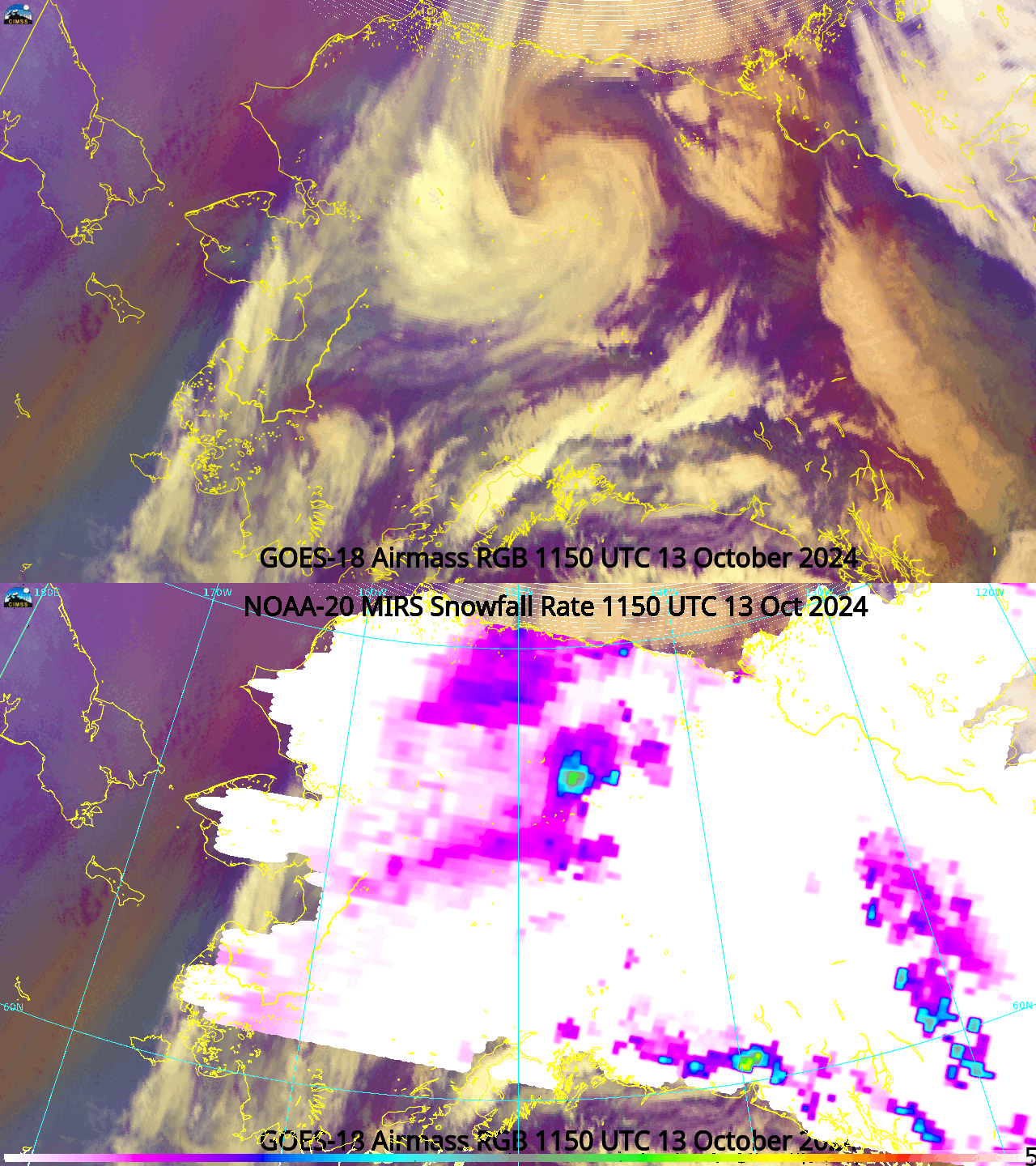
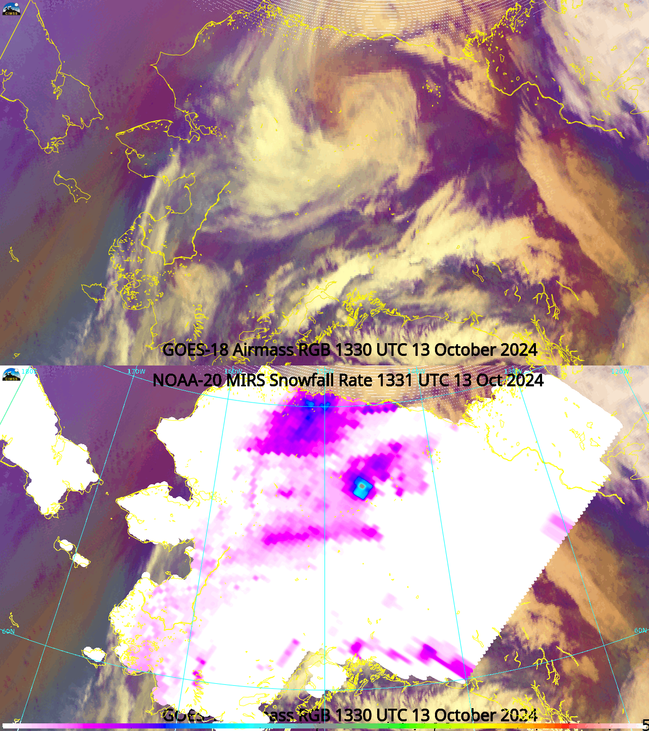
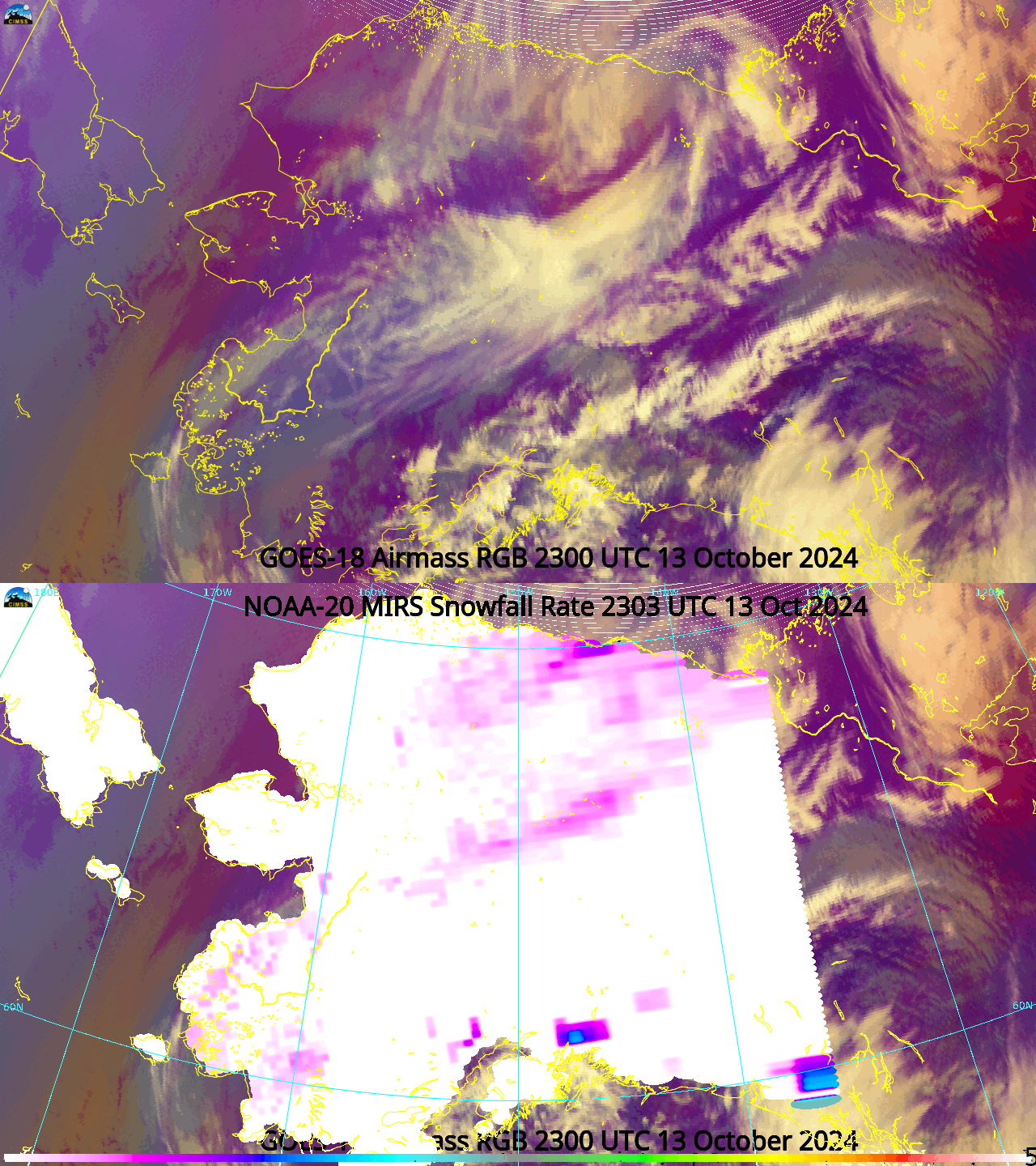
Microwave Snow Fall Rate imagery is also available at this website. The Snow Fall Rate Quick Guide is here.
—————
Free Secure Email – Transcom Sigma
Transcom Hosting
Transcom Premium Domains
