
A wet storm in Alaska
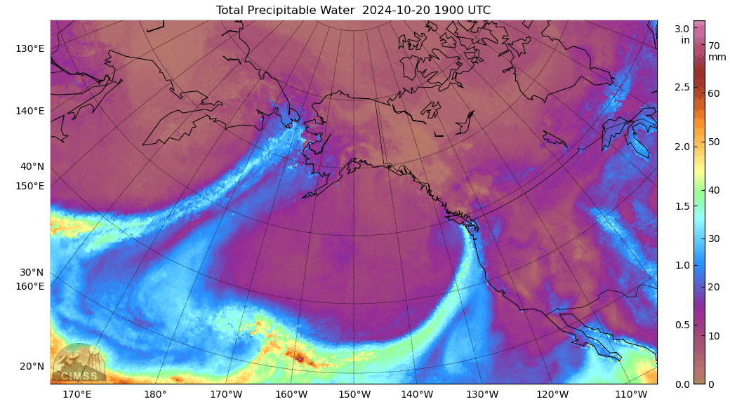
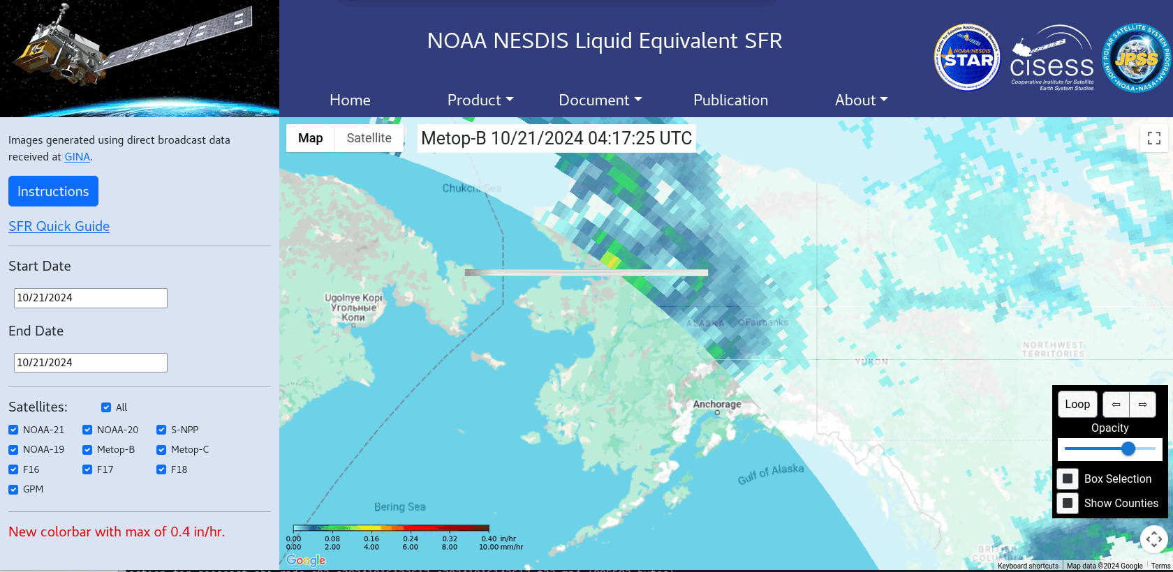
MIMIC Total Precipitable Water fields for the 24 hours ending 1800 UTC on 21 October 2024, above, show a stream of rich moisture pulled northward into Alaska ahead of a strong storm over western Russia. The result was large snowfall rates over much of central and northern Alaska, as shown in the snowfall rate from this website (here is a Quick Guide on MIRS Snowfall rate) animation below. Two principle bands of snow are indicated, one over eastern Alaska, oriented south-southeast to north-northwest, and one over north-central Alaska, oriented by southeast to northwest.
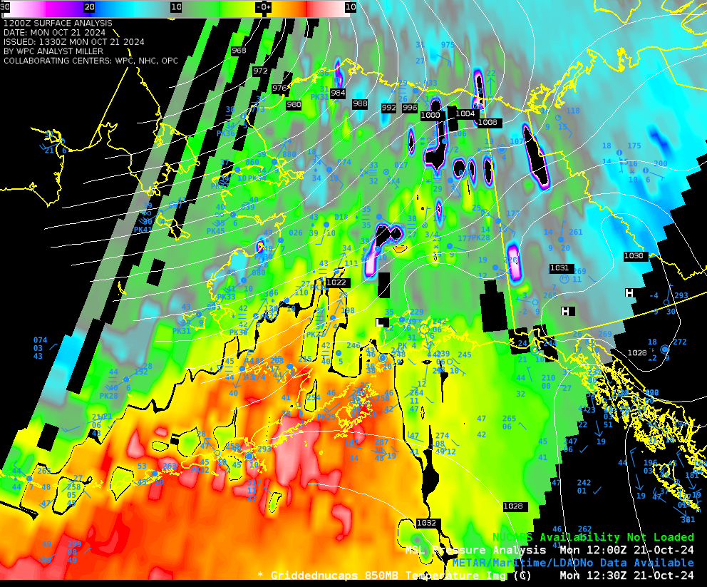
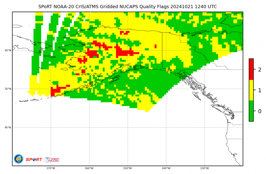
There are NOAA-20 and NOAA-21 overpasses in the animation above, and data (infrared and microwave) from those satellites can be used to create vertical profiles of temperature, that is, NUCAPS profiles. Those profiles can be gridded to show swaths of thermodynamic variables, such as the 850-mb temperature field shown below. The colorbar has been edited in AWIPS so that values near 0oC (i.e., the melting point), are black. However, many regions show temperatures at 850 mb colder than 0oC, but with rain observed at the surface! A possible reason in this discrepancy is that the data being used in the gridding in central AK is from soundings that did not converge, or from soundings that include only microwave data (that is, the infrared retrieval did not converge to a solution). See the image at the bottom, showing ‘Data Quality’; yellow shows profiles for which the infrared retrieval failed (but the microwave retrieval did not) red are regions where both infrared and microwave retrievals failed. It’s also possible that some of these points are below ground! There are many things to consider when interpreting NUCAPS temperature fields.
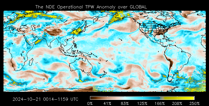
Just how unusually moist is this airmass over Alaska? Percent of Normal fields, from this site, show values in excess of 200% of normal!
—————
Free Secure Email – Transcom Sigma
Transcom Hosting
Transcom Premium Domains