A record wet day on Guam

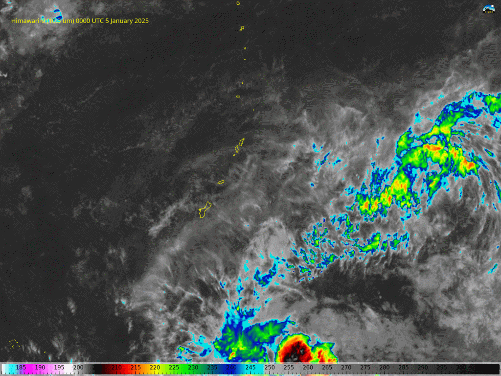
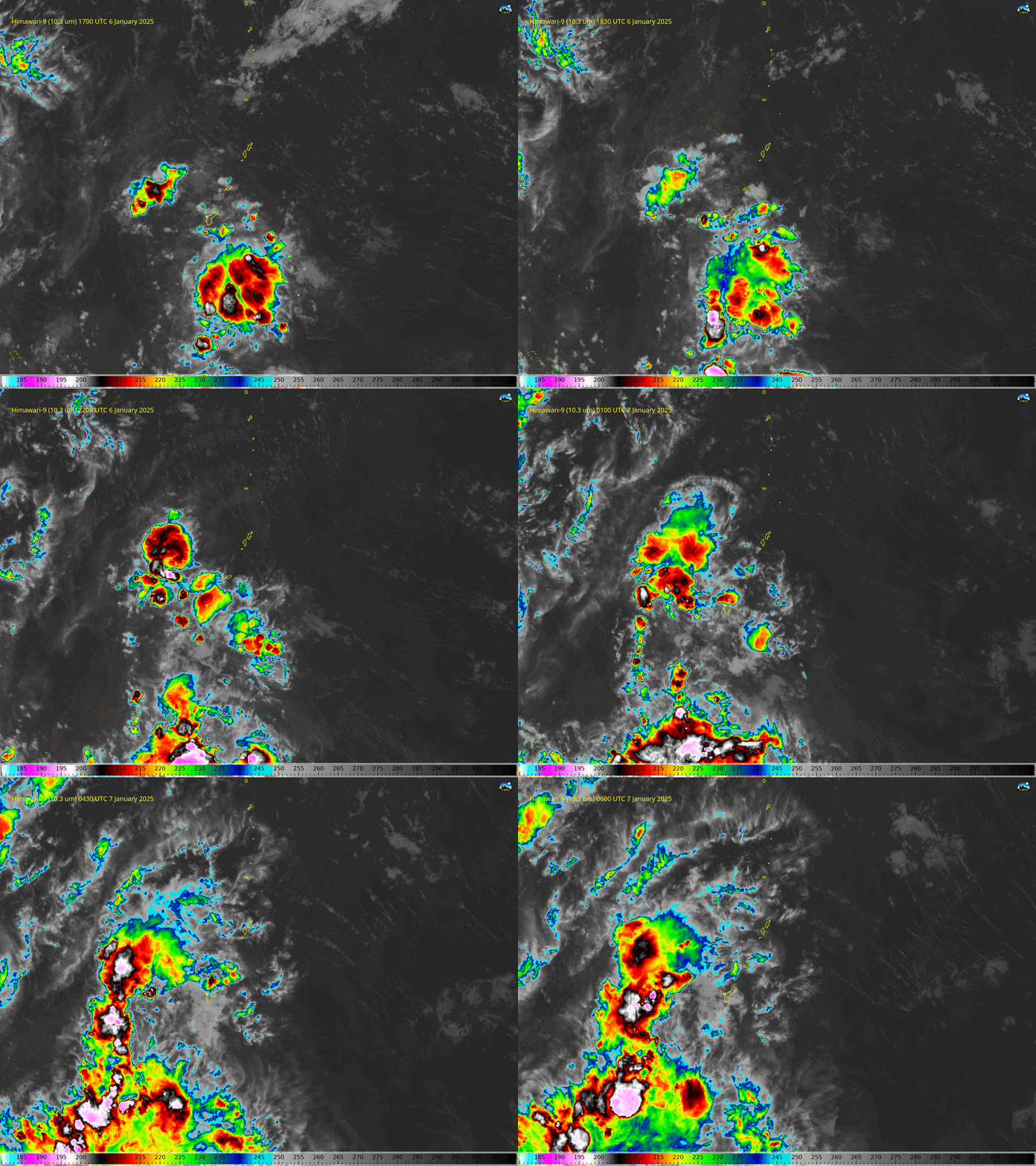
Antonio B. Won Pat International Airport on Guam experienced a record wet 7 January this year when 3.32″ of rain fell, mostly between 1700 UTC/6 January and 0500 UTC/7 January. Himawari-9 Band 13 imagery, above, for the 3 days ending at 0000 UTC 08 January 2025, show a region of thunderstorms approaching the Marianas. A slower animation covering the times of the heavy rainfall is below; the heavy rain was fairly isolated; much of the Marianas remained dry.

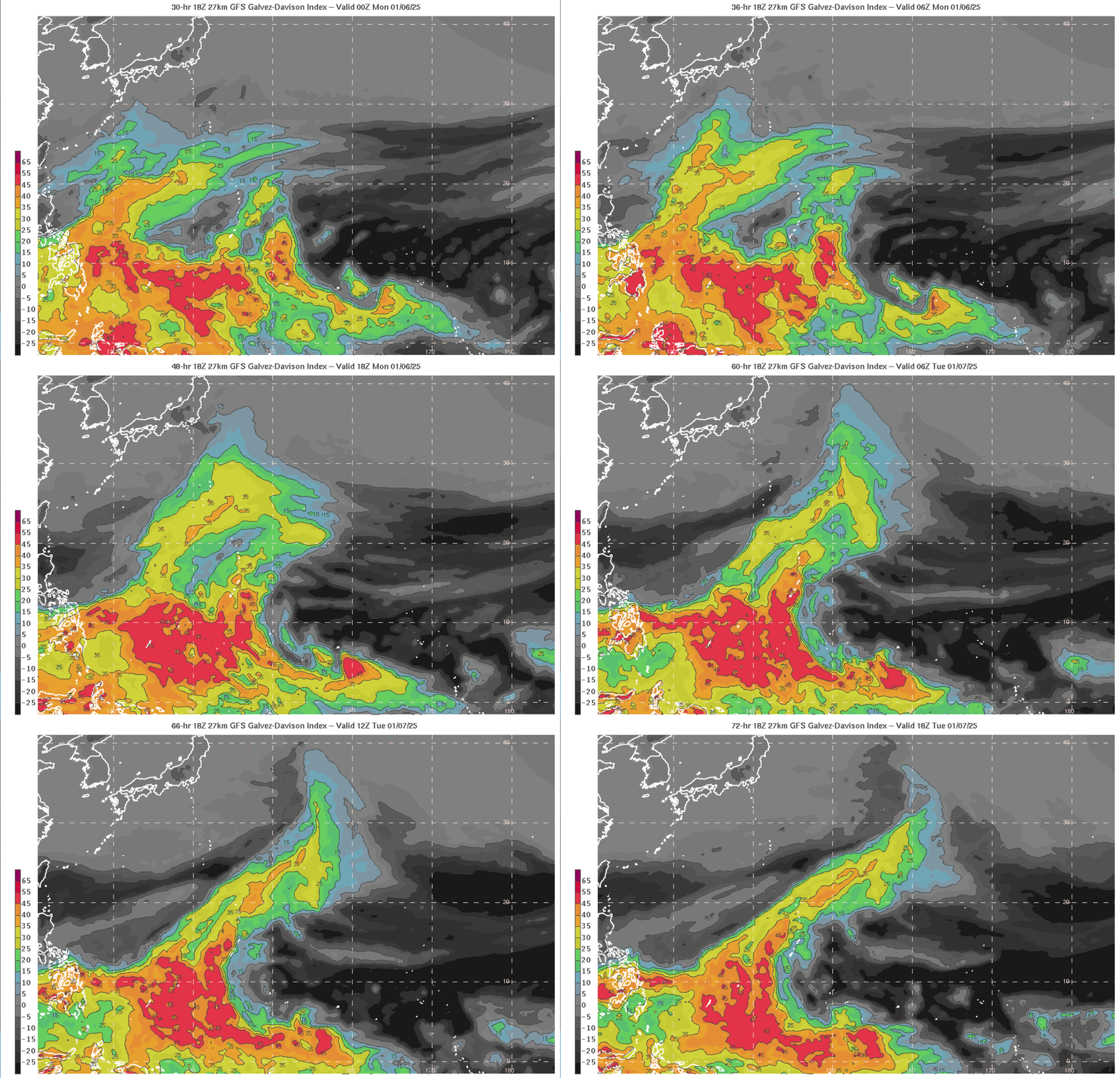
The large-scale conditions that allowed the heavy rain were well-forecast. GFS forecasts of the Galvez-Davison Index (GDI) (source) from the forecast started at 1800 UTC on 4 January 2025 are shown below, and they show a narrow tongue of higher values moving over the Marianas that corresponded with the time of the heavy rains.

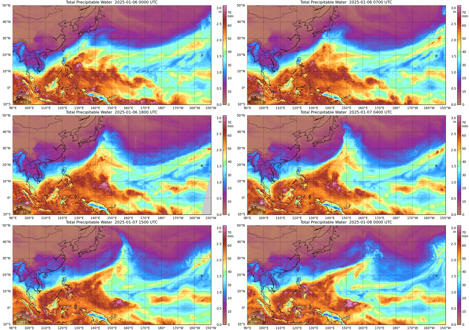
MIMIC Total Precipitable Water (TPW) fields, below, from 0000 UTC 6 January to 0000 UTC on 8 January 2025, show abundant moisture moving over Guam (at 144oE Longitude, 13.4oN Latitude)

The Guam forecast office of the National Weather Service (WFO GUM) receives polar orbiting data from a Direct Broadcast antenna onsite (signals are processed by CSPP software). True-color VIIRS imagery from ca. 0300 UTC on 7 January is shown below, and a line of convection bisecting Guam is apparent.

CSPP also processes microwave imagery, and the computed MIRS estimates of TPW are shown below. The MIRS diagnostics also show the enhanced amount of TPW over the southern Marianas as the rain fell. TPW values dropped quickly by mid-day (UTC) on the 7th (at the end of the animation below).

My thanks to Landon Aydlett, WCM on Guam for alerting me to this wet event, and to Douglas Schumacher, CIMSS, for the Direct Broadcast imagery.
—————
Free Secure Email – Transcom Sigma
Transcom Hosting
Transcom Premium Domains
