
LightningCast version 2
The ProbSevere LightningCast version 1 (v1) model uses machine learning and GOES-R Advanced Baseline Imager (ABI) data to predict the probability of lightning in the next 60 minutes. This version will be operational at NOAA later in 2025.
As research and development continues, a new version of the model (LightningCast v2) adds Multi-Radar Multi-Sensor (MRMS) Reflectivity at -10oC as a predictor. Reflectivity at -10oC is well correlated with imminent lightning activity due to its ability to depict hydrometeors in the mixed-phase region of convection (generally 0oC to -20oC). Other radar-derived parameters are being investigated as well.
Preliminary results demonstrate that the radar-derived predictor adds value to the problem of short-term lightning prediction, without diminishing the power of the satellite predictors—that is, the model appears to have learned and uses the strengths of each data source for making better predictions.
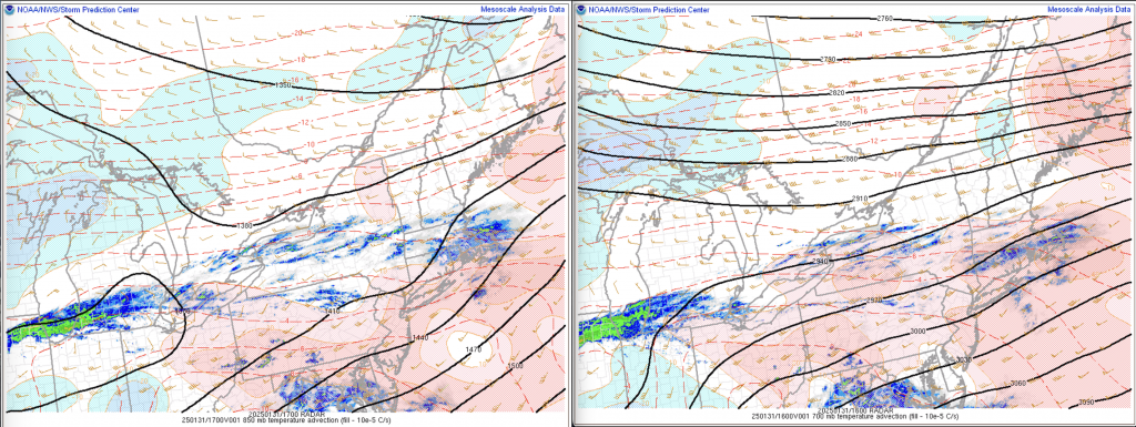
Here are two recent examples. First, in Ohio and Pennsylvania, warm air advection at 850 and 700 mb forced some elevated but shallow thunderstorms.
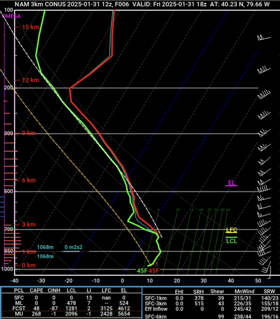
A short-term model profile from the NAM 3-km model also shows the elevated but abbreviated extent of CAPE.
The first animation below is from LightningCast v1. The shallow nature of the storms and the thick layer of ice clouds above the convection obscures key signatures for the satellite-only model, resulting in poor probabilistic guidance.
The animation below uses the LightningCast v2 model. While not a cure-all, the reflectivity at -10oC clearly helps the model provide better guidance to lightning, albeit with little lead time to lightning initiation in this case.
The day prior, weak 850 mb warm air advection forced convective development in northeast Colorado and southwest Nebraska. The thermal profile appeared to be too cold to generate much CAPE or lightning.
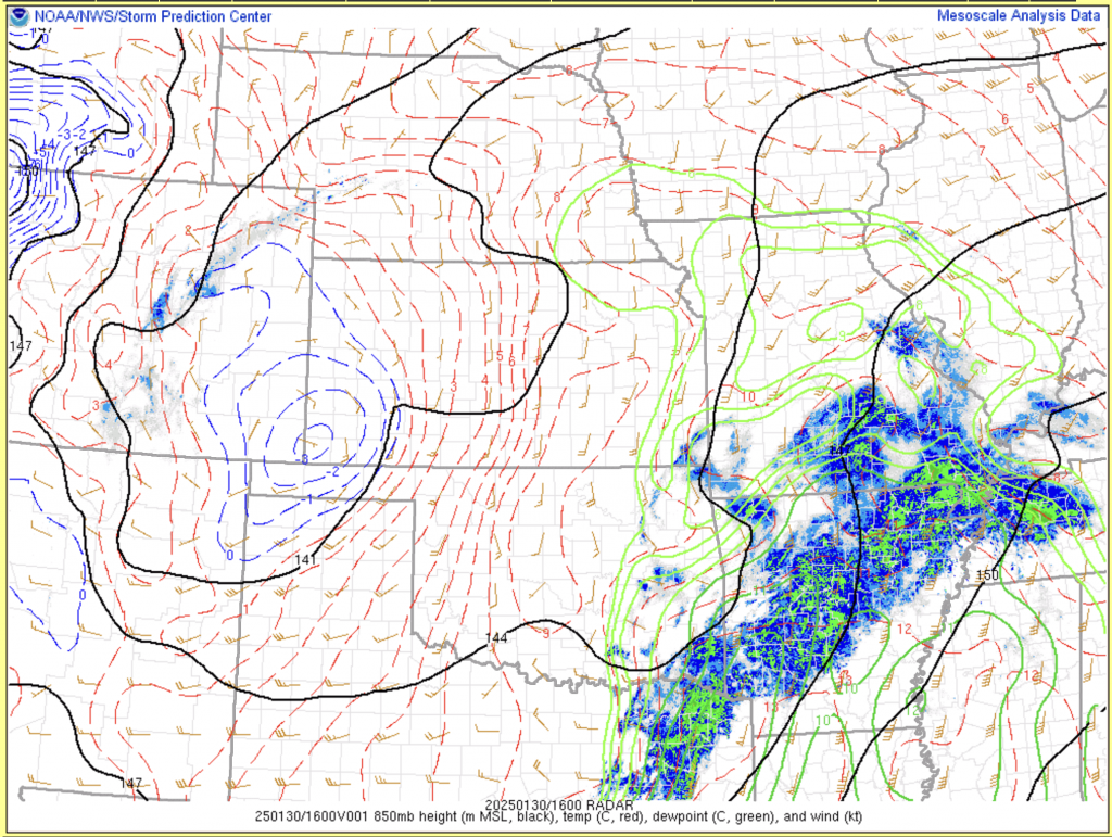
However, from a satellite perspective, the convection certainly looks like it could produce lightning. Thus, the LightningCast v1 output shows high probabilities of lightning (animation below).
But the reflectivity at -10oC predictor generally has convective cores of only 25-30 dBZ. Typically 35-40 dBZ is needed for lightning at this isotherm.
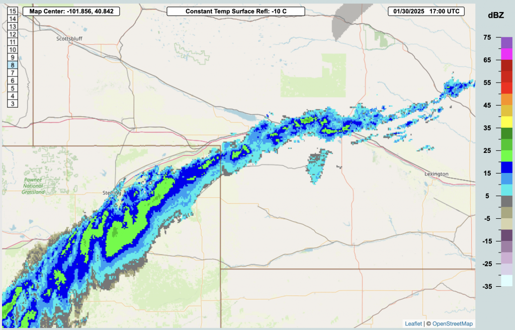
The radar predictor helped reduce the false alarm predictions of lightning markedly. See the animation of LightningCast v2 predictions below.
Overall, we’ve found that LightningCast v2 improves the critical success index over the contiguous U.S. (CONUS), while not harming predictions outside of the CONUS. In the image below, red regions show improvement of v2 over v1, whereas blue regions show degradation of performance in v2, with respect to v1 (note that this is a limited sample).
An assessment of lead time to lightning initiation (LI) has shown that rather than diminishing lead time to LI, LightningCast v2 actually appears to increase lead time to LI over the CONUS by a small amount. Work is on-going to quantify how much ABI predictors alone increase lead time to LI ahead of a radar-only lightning nowcasting model. We hope to have forecasters evaluate LightningCast v2 at the 2025 Hazardous Weather Testbed.
—————
Free Secure Email – Transcom Sigma
Transcom Hosting
Transcom Premium Domains