Pyrocumulonimbus cloud in southeast Australia

JMA Himawari-9 “Red” Visible (0.64 µm, top), Shortwave Infrared (3.9 µm, center) and “Clean” Infrared Window (10.4 µm, bottom) images, with hourly plots of surface reports [click to play animated GIF | MP4]
10-minute JMA Himawari-9 AHI “Red” Visible (0.64 µm), Shortwave Infrared (3.9 µm) and “Clean” Infrared Window (10.4 µm) images (above) showed the formation of a pyrocumulonimbus (pyroCb) cloud that was spawned by a wildfire in Grampians National Park in far southeast Australia on 20 December 2024. The pyroCb cloud exhibited cloud-top 10.4 µm infrared brightness temperatures (IRBTs) of -40ºC and colder (denoted by the shades of blue) — attaining a minimum IRBT of -44º C at 0420 UTC. The pyroCb cloud later drifted southeast over Melbourne Airport (YMML).
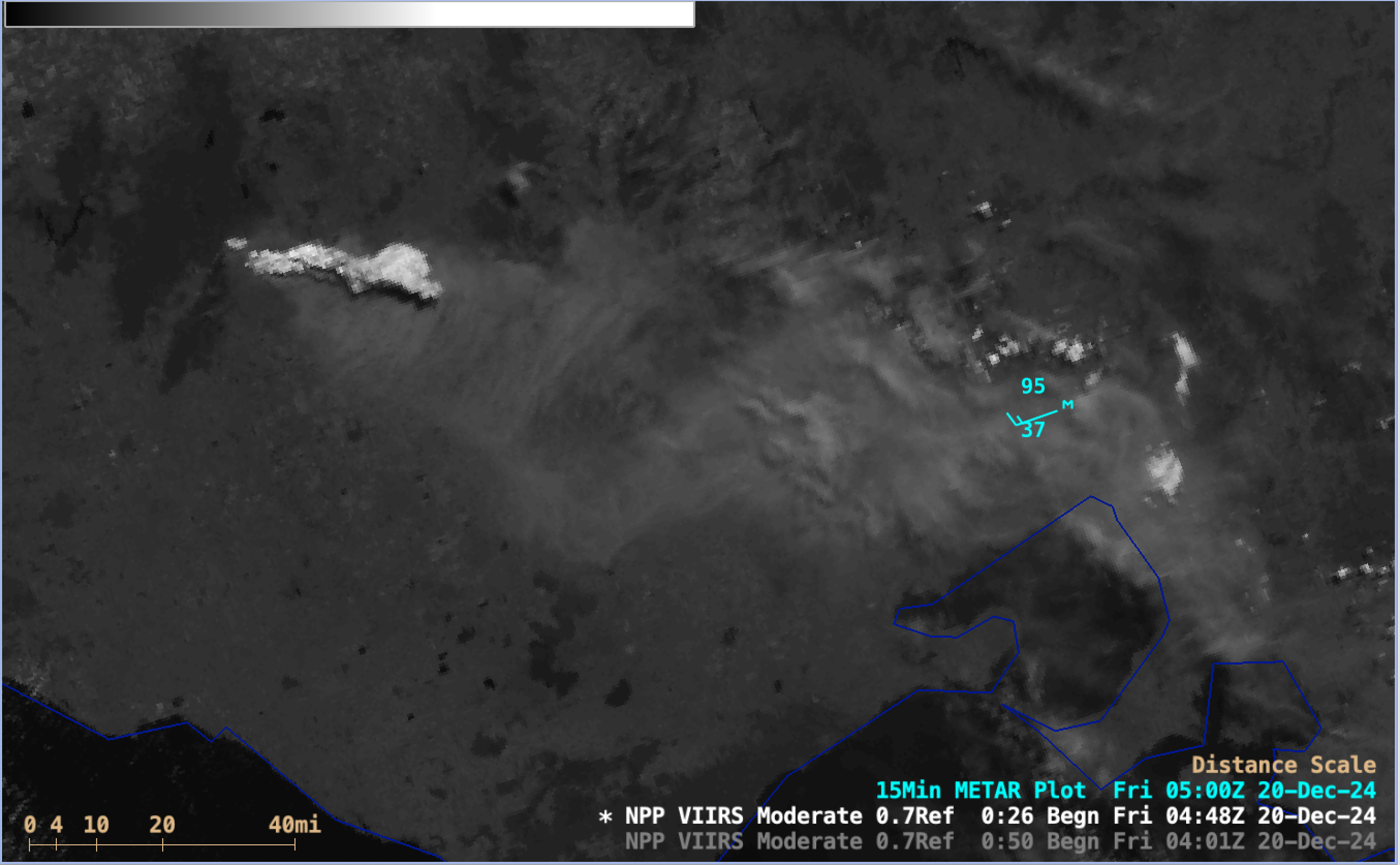
A NOAA-20 (mislabeled as NPP) VIIRS Day/Night Band (0.7 µm) image valid at 0450 UTC (below) provided a detailed view of the pyroCb cloud shortly after its formation.

NOAA-20 VIIRS Day/Night Band (0.7 µm) image valid at 0450 UTC on 20th December; the 0500 UTC surface report for Melbourne Airport YMML is plotted in cyan [click to enlarge]
—————
Free Secure Email – Transcom Sigma
Transcom Hosting
Transcom Premium Domains
