Blowing snow across parts of North Dakota, Minnesota and Wisconsin

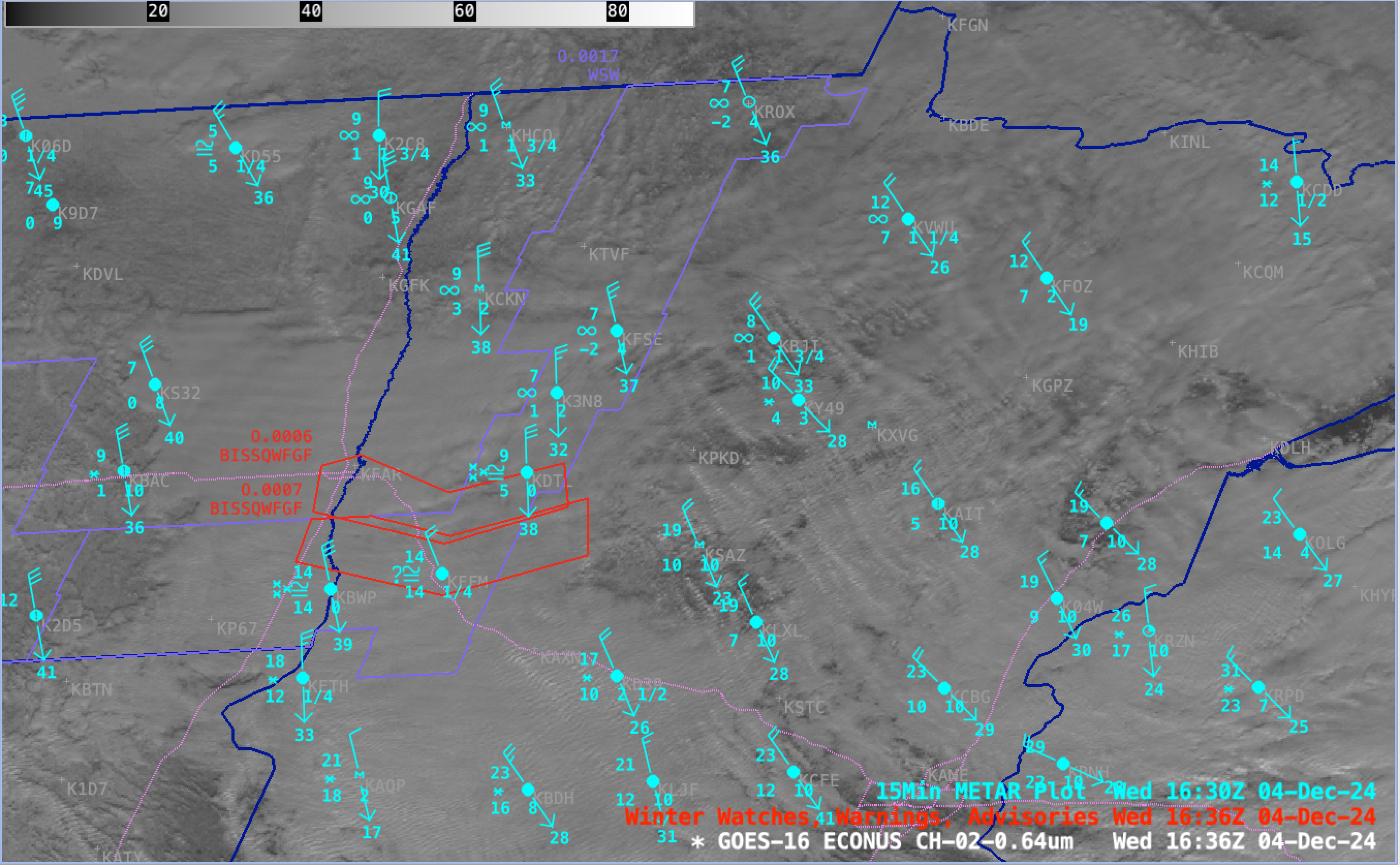
GOES-16 Red Visible (0.64 µm) images from 1401-2201 UTC on 04 December, with/without plots of 15-minute METAR surface reports (cyan), Snow Squall Warnings (red polygons) and Winter Weather Advisories (purple polygons). Interstate Highways are plotted in dotted violet. [click to play MP4 animation]
GOES-16 (GOES-East) Red Visible (0.64 µm) images (above) revealed the presence of horizontal convective roll clouds — a signature often associated with blowing snow — across parts of North Dakota, Minnesota and Wisconsin on 04 December 2024. Strong northwesterly winds in the wake of an arctic cold front were gusting in excess of 40 knots at several locations (including a peak gust of 57 knots or 66 mph in northeastern North Dakota), with blowing snow restricting the surface visibility to near zero at times. These near-blizzard conditions prompted the issuance of several Snow Squall Warnings, with some of those warnings covering portions of Interstates 29 and 94 in North Dakota and Minnesota.
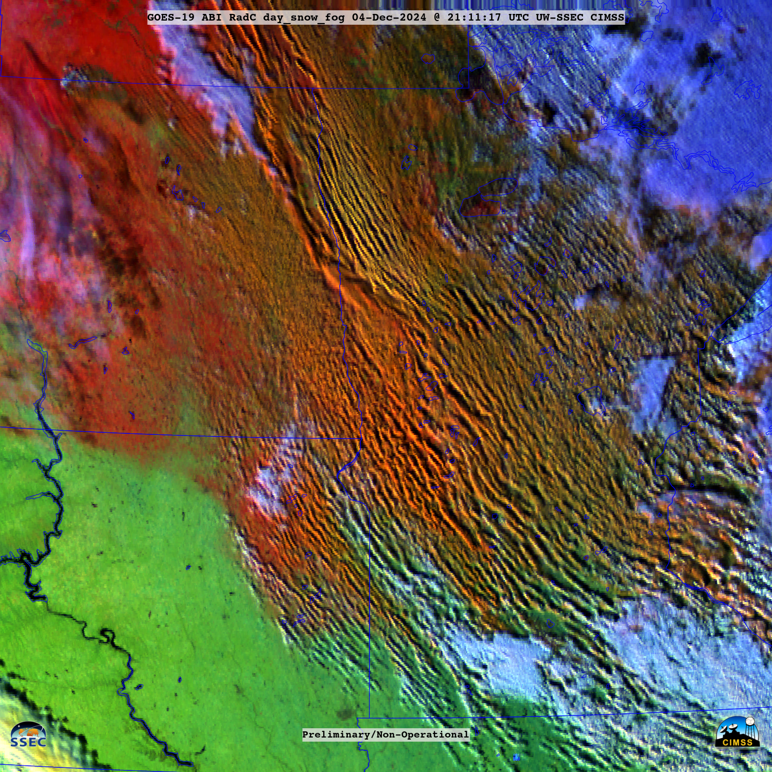
Day Snow/Fog RGB images from GOES-19 (Preliminary/Non-operational) — created using Geo2Grid — provided a more detailed view of the widespread horizontal convective rolls (below). Existing snow cover appeared as darker shades of red in the RGB imagery.

GOES-19 (Preliminary/Non-operational) Day Snow/Fog RGB images, from 1421-2201 UTC on 04 December [click to play animated GIF | MP4]
—————
Free Secure Email – Transcom Sigma
Transcom Hosting
Transcom Premium Domains
