Great Lakes Water Temperatures in mid-November

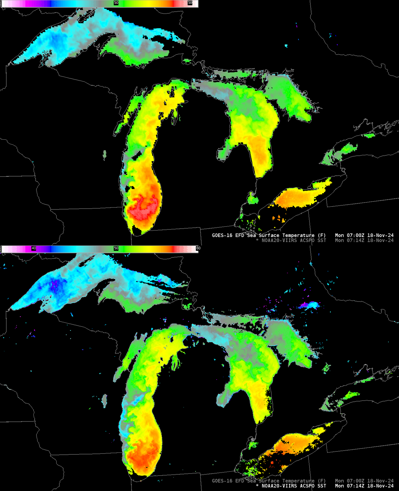
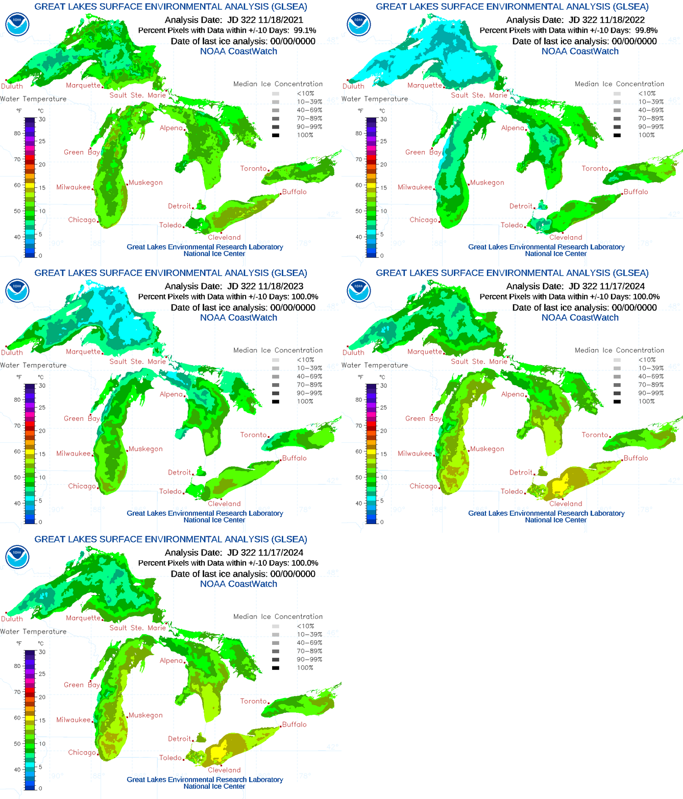
Mostly clear skies over the Great Lakes early on 18 November allowed for good satellite estimates of Lake Surface temperatures. They are, in a word, very warm. The toggle above compares estimates from NOAA-20 and from GOES-16. The stepped animation below (source) compares November 17th values this year with those from 2021, 2022 and 2023, and a tabular comparison for the past 4 years follows.

| Year | Superior | Michigan | Huron | Erie | Ontario |
| 2021 | 8.24 | 10.09 | 10.18 | 11.43 | 10.30 |
| 2022 | 5.49 | 7.95 | 8.89 | 9.44 | 10.15 |
| 2023 | 6.52 | 9.63 | 8.60 | 11.07 | 9.71 |
| 2024 | 8.28 | 11.86 | 10.83 | 13.95 | 11.07 |
Mean temperature plots of the five Great Lakes, shown below in comparison to the mean value (based on 1998-2023), also show the anomalous warmth (source).

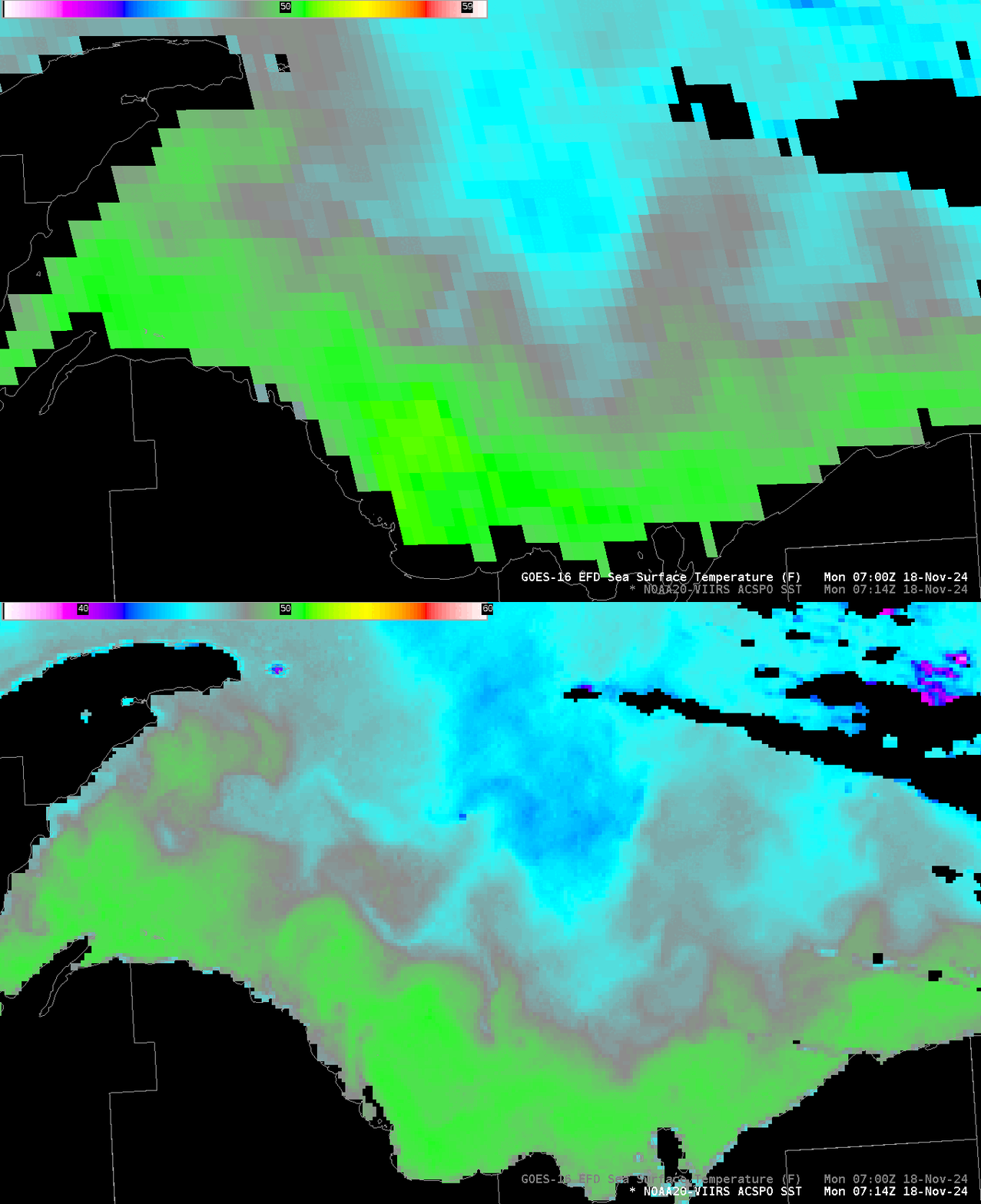
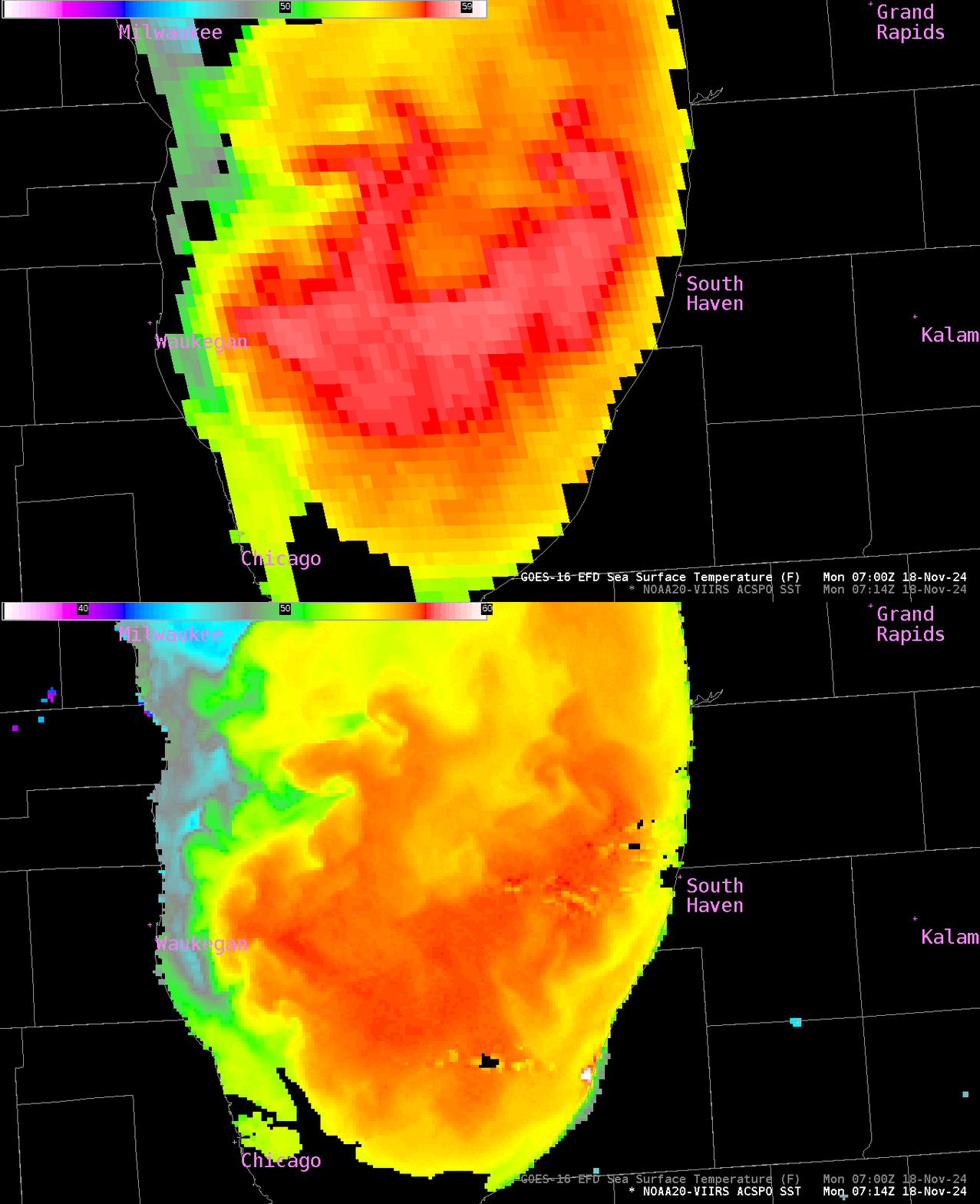
The ACSPO imagery above gives similar results from both satellites, although the higher resolution of VIIRS allows for better identification of small-scale features, and allows for values closer to the shoreline; values between the two satellites agree to within a degree of so Fahrenheit, with GOES estimates showing warmer temperatures generally. The zoomed-in toggles below compare GOES-16/NOAA-20 over Lake Superior to the east of the Keewenaw Peninsula, and over southern Lake Michigan. The pixel size difference is obvious in the zoomed-in imagery.


The unseasonably warm waters of the Great Lakes mean that when temperatures do cool enough to support Lake Effect Snow, that Lake Effect snow might, at least initially, be a lot more intense than in a year with more normal Lake Surface Temperatures. NOAA-20 ACSPO SSTs were created using CSPP software and the Direct Broadcast data downloaded via the antenna located at CIMSS. You can also view the ACSPO SSTs at this (transitory) website.
—————
Free Secure Email – Transcom Sigma
Transcom Hosting
Transcom Premium Domains
