Hurricane Force Low off the US East Coast

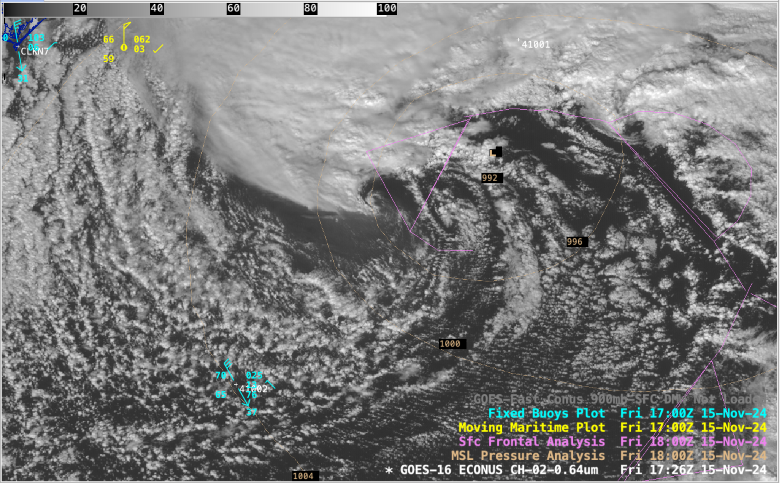
5-minute GOES-16 Red Visible (0.64 µm) images, with overlays of hourly buoy/ship reports and 3-hourly analyses of surface pressure and fronts, from 1426-2101 UTC on 15 November [click to play MP4 animation]
5-minute CONUS sector GOES-16 (GOES-East) Red Visible (0.64 µm) images (above) displayed an intensifying Hurricane Force low pressure system over the western Atlantic Ocean (not far off the North Carolina coast) on 15 November 2024. Note the area of haziness just west-southwest of the center of the surface low — this milky/hazy appearance was due to the enhanced diffuse reflection of sunlight off a very agitated sea surface (where high waves and abundant sea spray were present, caused by a burst of strong surface winds across that particular area).
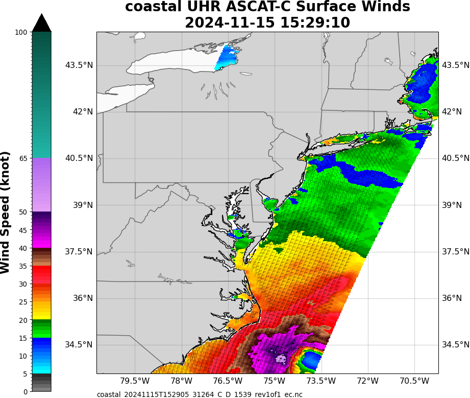
About an hour after the beginning of the GOES-16 Visible image animation, Metop-C ASCAT Ultra High Resolution surface winds at 1529 UTC (source) depicted a small area of wind speeds greater than 50 knots, just west of the light winds near the center of the low pressure system (below) — and the 1531 UTC GOES-16 image also showed a few GOES-16 Derived Motion Wind vectors with speeds of 51-53 knots just west of the surface low.

Metop-C ASCAT Ultra High Resolution surface winds at 1529 UTC on 15 November
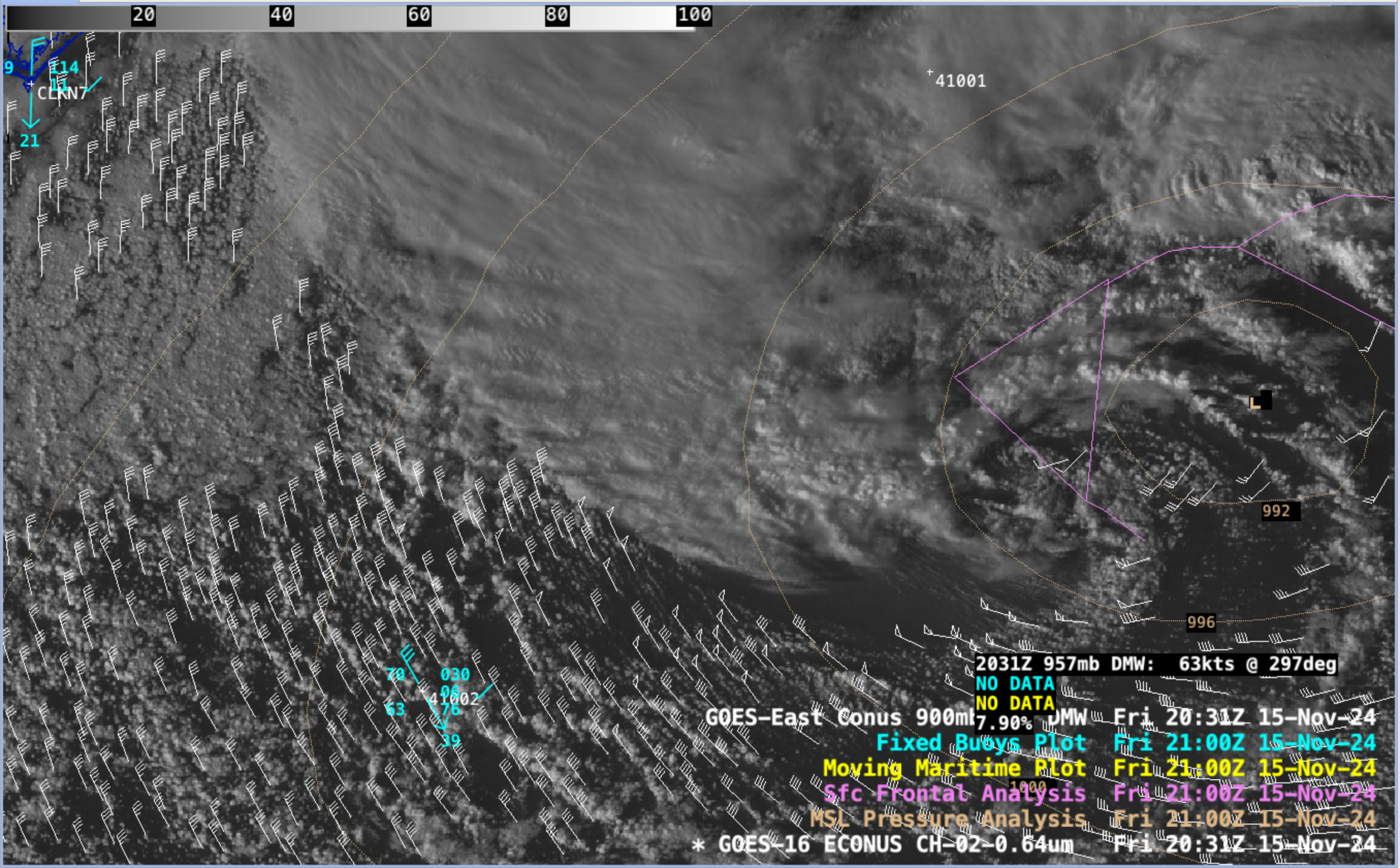
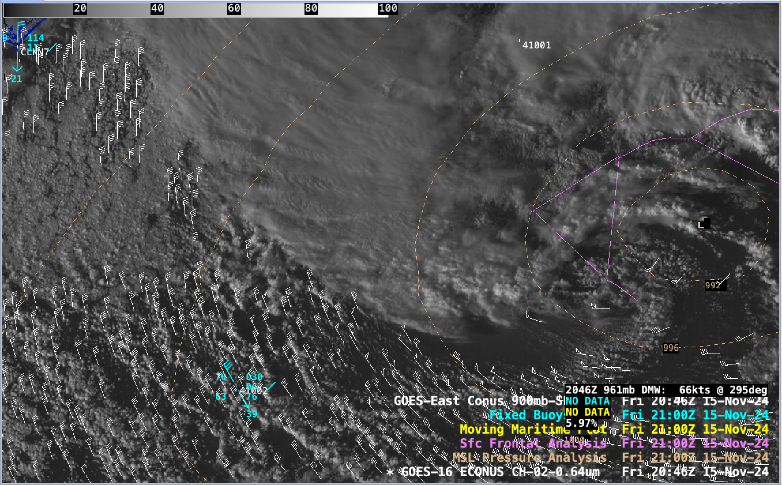
GOES-16 Visible images that included plots of GOES-16 Derived Motion Winds (DMW) within the marine boundary layer (Surface-900 hPa) are shown below — which highlighted cloud-tracked DMW speeds of 63-66 knots (72-76 mph) just south of the hazy-appearing areas of rough seas.

GOES-16 Red Visible (0.64 µm) image at 2031 UTC, with a cursor sample of a marine boundary layer (Surface to 900 hPa) Derived Motion Wind vector having a speed of 63 knots [click to enlarge]

GOES-16 Red Visible (0.64 µm) image at 2046 UTC, with a cursor sample of a marine boundary layer (Surface to 900 hPa) Derived Motion Wind vector having a speed of 66 knots [click to enlarge]
The hazy-appearing area of high waves + sea spray was even more apparent in 1-minute Mesoscale Domain Sector GOES-16 True Color images from the CSPP GeoSphere site (below). A few southeastward bursts of cumulus clouds were also seen emanating from the southern edge of the region of dense convective clouds — a potential signature of a sting jet descending toward the sea surface.

1-minute GOES-16 True Color RGB images, from 1600-2003 UTC on 15 November [click to play MP4 animation]
—————
Free Secure Email – Transcom Sigma
Transcom Hosting
Transcom Premium Domains
