The effect of deep snow cover on surface air temperature across eastern Colorado

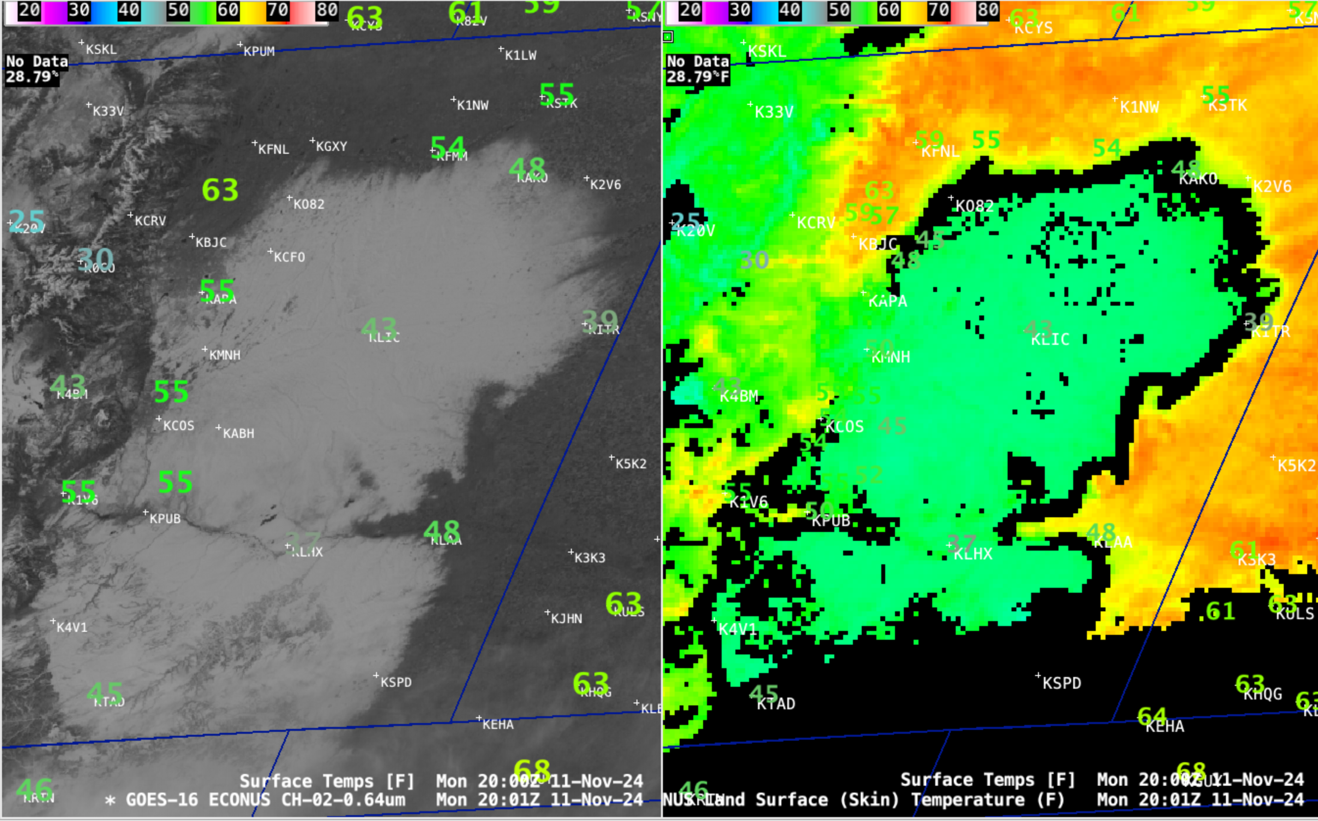
GOES-16 Red Visible images (0.64 µm, left) and Land Surface Temperature derived product (right), with/without an overlay of Surface Air Temperatures [click to play MP4 animation]
GOES-16 (GOES-East) Red Visible images and the Land Surface Temperature derived product (above) showed a large area of relatively fresh snow cover across the Plains of eastern Colorado on 11 November 2024 — this deep snow cover was the result of a closed upper-level low which moved across the area 2-3 days earlier, producing impressive accumulations. This significant snow cover was having a notable effect on surface air temperatures, keeping them anywhere from 10-20 F colder than adjacent areas of bare ground.

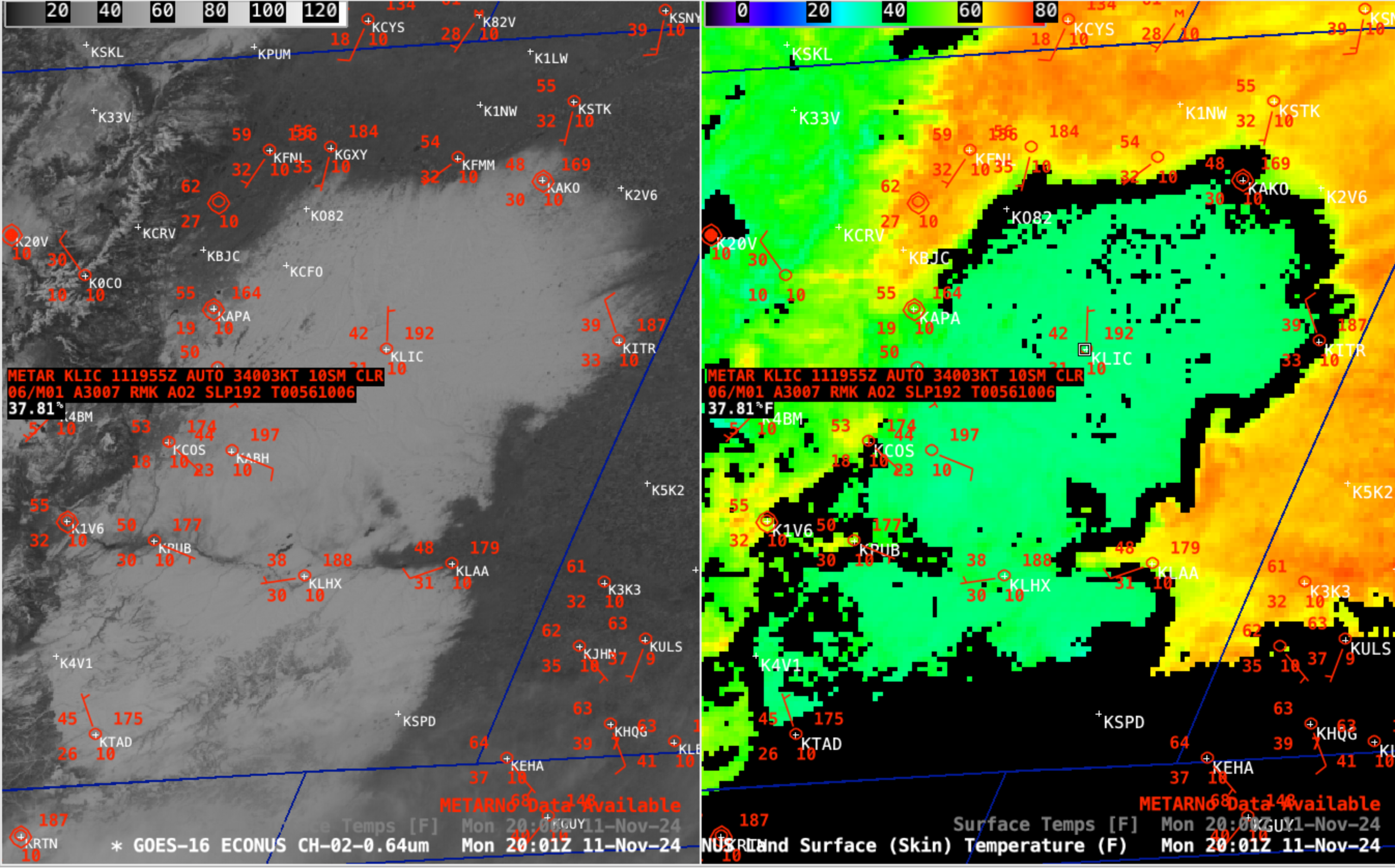
GOES-16 Red Visible image (0.64 µm, left) and Land Surface Temperature derived product (right) at 2001 UTC, with a cursor sample of the METAR surface report (red) and Land Surface Temperature (white) at Limon, Colorado (KLIC) [click to enlarge]
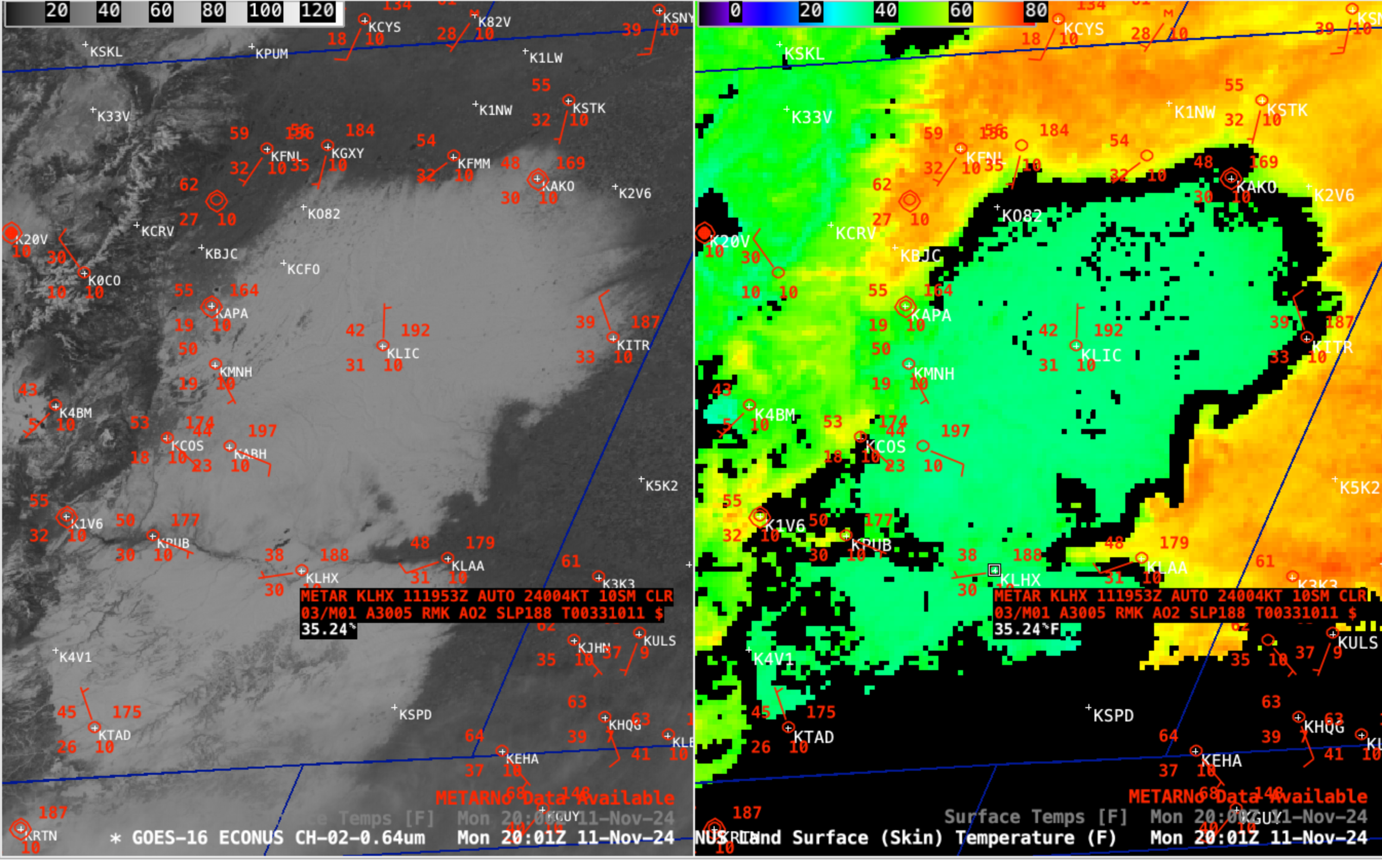
Over interior areas with deeper snow cover, cursor sampling of the Land Surface Temperature at Limon (above) and at La Junta (below) revealed values in the mid 30s F.

GOES-16 Red Visible (0.64 µm, left) image and Land Surface Temperature derived product (right) at 2001 UTC, with a cursor sample of the METAR surface report (red) and Land Surface Temperature (white) at La Junta, Colorado (KLHX) [click to enlarge]
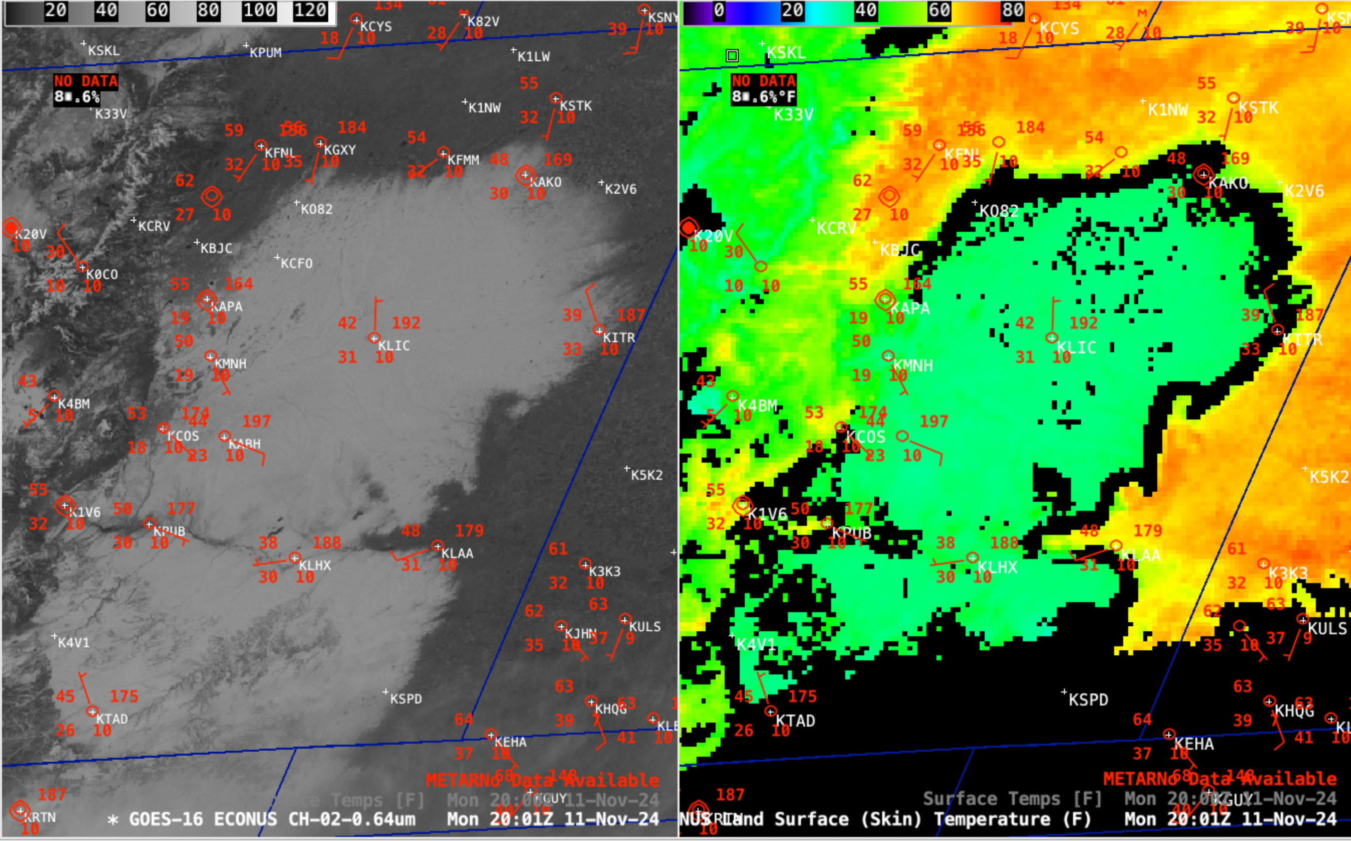
At locations along or near the edge of the snow cover, their surface air temperature was somewhat cooler if winds were blowing off the snow pack. This effect was very apparent at Burlington (KITR) along the eastern edge of the snow cover, with cool NW winds keeping their air temperature in the upper 30s F (below).

GOES-16 Red Visible image (0.64 µm, left) and Land Surface Temperature derived product (right) at 2001 UTC, with METAR surface reports plotted in red [click to enlarge]
—————
Free Secure Email – Transcom Sigma
Transcom Hosting
Transcom Premium Domains
