
Strong winds south of a low pressure system in the Beaufort Sea
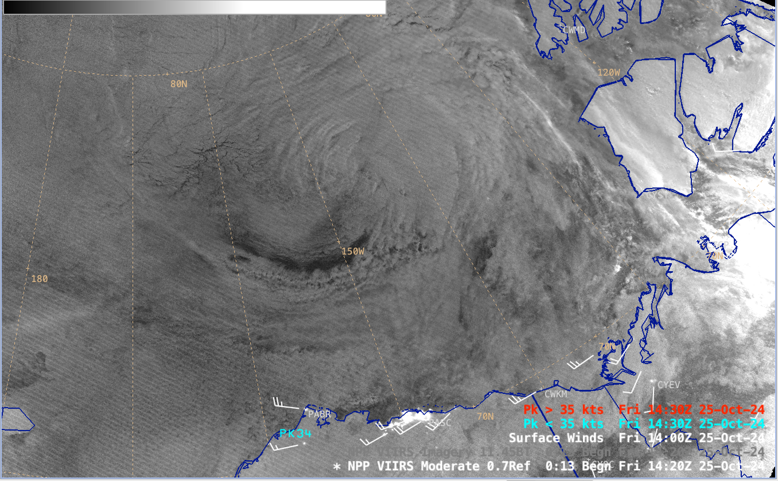
Sequence of Suomi-NPP VIIRS Day/Night Band (0.7 µm) and Infrared Window (11.45 µm) images, with an overlay of METAR site surface winds (white) and Peak Wind gusts (cyan/red) on 25 October [click to play MP4 animaton]
A sequence of Suomi-NPP VIIRS Day/Night Band (0.7 µm) and Infrared Window (11.45 µm) images (above) showed the cyclonic swirl of clouds associated with a low pressure system that was moving eastward across the Beaufort Sea on 25 October 2024. The relatively tight pressure gradient south of this low (surface analysis) was forcing fairly strong W-SW winds across the North Slope and Arctic coast of Alaska (as well as the adjacent Canadian provinces of Yukon and the Northwest Territories).
A Suomi-NPP VIIRS Day/Night Band image with an overlay of Metop-B ASCAT winds (below) depicted the flow across the offshore waters north of Alaska — where Heavy Freezing Spray Warnings were issued for the ice-free waters. Numerous ASCAT wind speeds were in the 30-35 knot range.
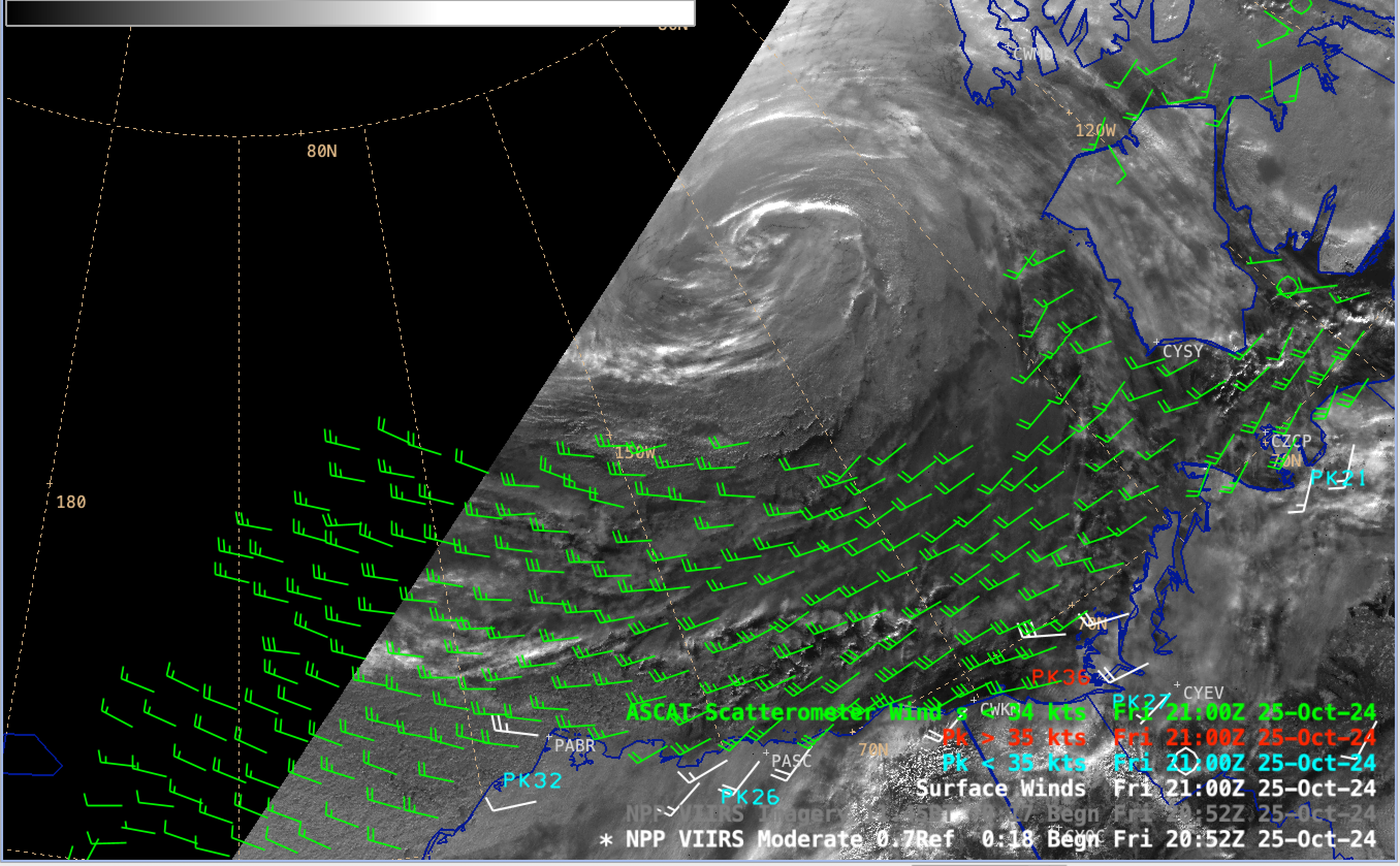
Suomi-NPP VIIRS Day/Night Band (0.7 µm) image, with an overlay of METAR site surface winds (white) and Peak Wind gusts (cyan/red) and Metop-B ASCAT winds (green) [click to enlarge]
—————
Free Secure Email – Transcom Sigma
Transcom Hosting
Transcom Premium Domains