Potential tropical cyclone formation near Guam
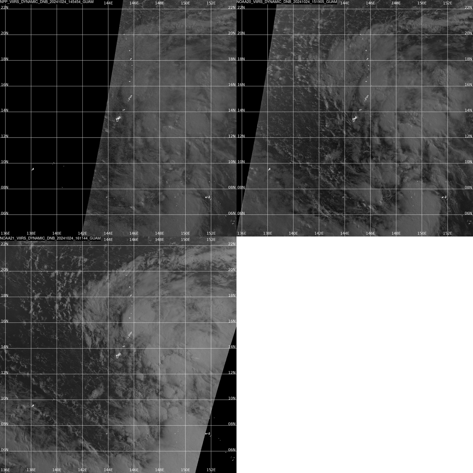
The Joint Typhoon Warning Center is currently monitoring two areas of interest of near Guam for potential tropical cyclone formation. The first, 99W, is located due east of Guam, while the second invest, 98W, is further southeast. During the local overnight hours today between 14:54 and 16:11 UTC, the VIIRS instruments onboard S-NPP, NOAA-20, and NOAA-21 captured the following sequence of day-night band imagery:

Overall, it is clear that the situation is a bit messy. In the DNB imagery, it is easy to pick out a few features of note, including a broad region of convection on the northern side of invest 99W, a narrow stripe of convection extending to the south all the way to invest 98W, and some hints of the low level circulation of 98W. This final feature highlights a case where DNB imagery can be very helpful in conjunction with geostationary IR imagery during the overnight hours.
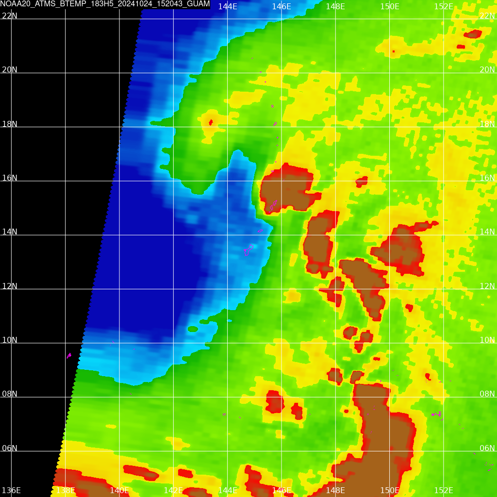
Of course, some other polar satellite instruments can help diagnose the state of these circulations a bit further. For example, the 183 GHz band from ATMS is sensitive to water vapor, and that band’s imagery (processed via CSPP MiRS) from the NOAA-20 pass at 15:20 UTC is below:

Over Guam and points west, there is a rather pronounced “tongue” of drier air. With invest 99W moving across the edge of this gradient, it will likely struggle to gain symmetry to its structure on its west side. Additionally, a key forecast challenge for invest 98W mentioned in the latest Area Forecast Discussion from NWS Guam is uncertainly regarding how this drier air mass will be influenced by the passage of 99W.
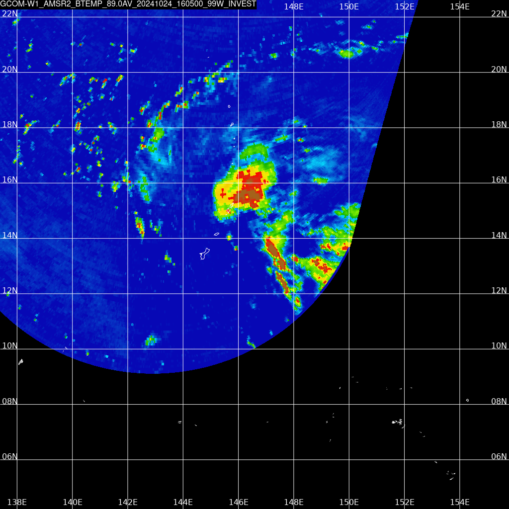
And finally, the AMRS2 instrument aboard GCOM-W1 offers a look inside the clouds of invest 99W at 89 GHz just a bit later at 16:05 UTC. This data confirms that no clear organization of the precipitation bands has taken place at this point.

All imagery in this post was collected by the SSEC direct broadcast antenna system located at NWS Guam. Those with interests in the western Pacific should stay tuned to local authorities for the latest updates. Thank you to Scott Lindstrom for guiding me through the process of writing my first post on the CIMSS Satellite Blog!
—————
Free Secure Email – Transcom Sigma
Transcom Hosting
Transcom Premium Domains
