
Nadine and Kristy
Tropical Storm Nadine made landfall in Belize on 19 October (at 1600 UTC), and parts of this system then crossed Central America and entered the Pacific Ocean (NHC discussion that mentions this on 20 October before Noon). Tropical Storm Kristy formed off the coast of Mexico later in the day on the 21st of October. The GOES-16 animation of clean window infrared imagery, below, shows the cloud features associated with both systems. Nadine maintained a detectable cyclonic rotation through about 1200 UTC on 20 October. Subsequent to that time, the clouds associated with Nadine moved into central Mexico as a large convective complex developed over the Pacific Ocean to the south of Mexico — this is the system that became Kristy.
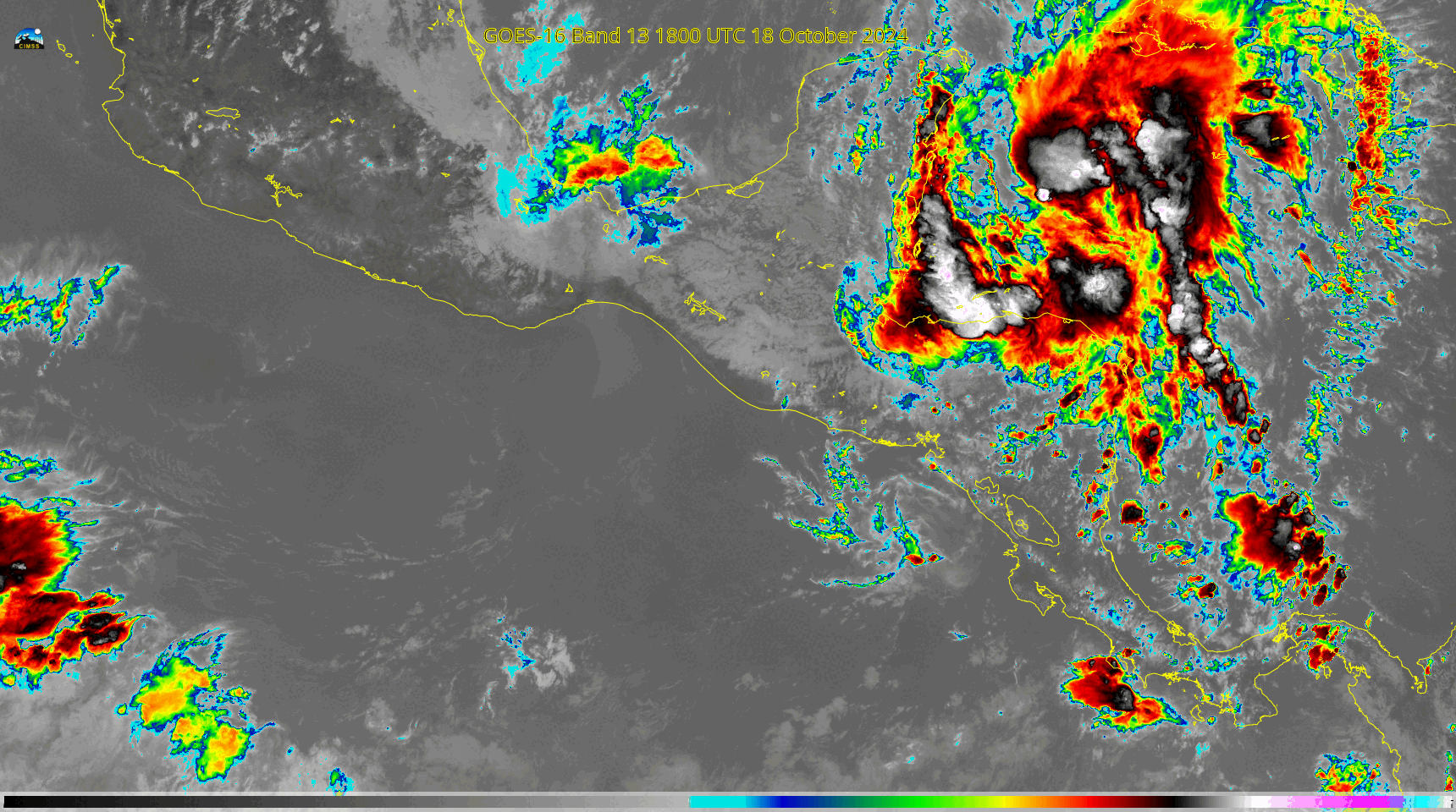
It does happen occasionally that tropical systems in the Atlantic traverse Central America and become tropical systems in the Pacific. Although these two systems, Nadine and Kristy, shared the same airmass, they are not the same system.
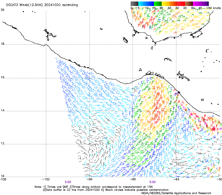
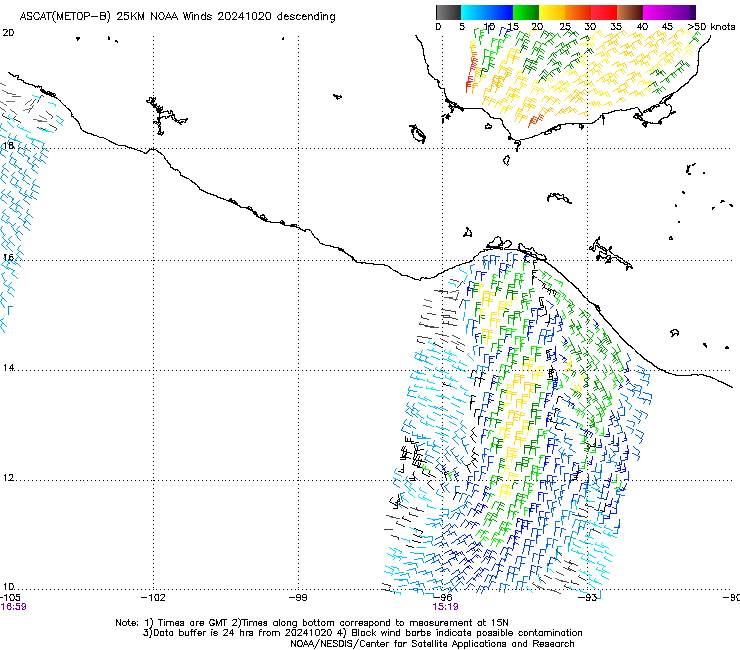
Scatterometry data (from the manati site) from OSCAT (below) and from ASCAT (at bottom), show the evolution from strong northerly winds over the Gulf of Tehuantepec that quickly coalesce into a strong tropical circulation.
—————
Free Secure Email – Transcom Sigma
Transcom Hosting
Transcom Premium Domains