
Lake Effect Season begins
CSPP Geosphere imagery, above (link), shows a band of cumulus clouds over central Lake Michigan. The still image, below, from 1600 UTC shows cool air and surface winds converging into this band.
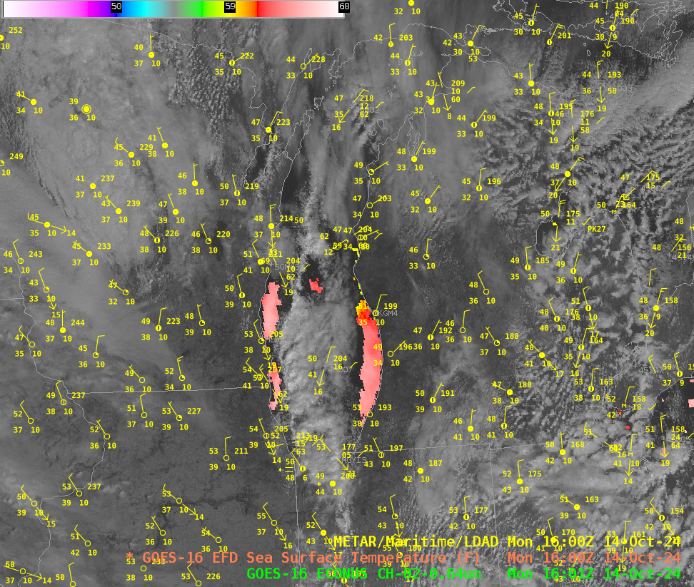
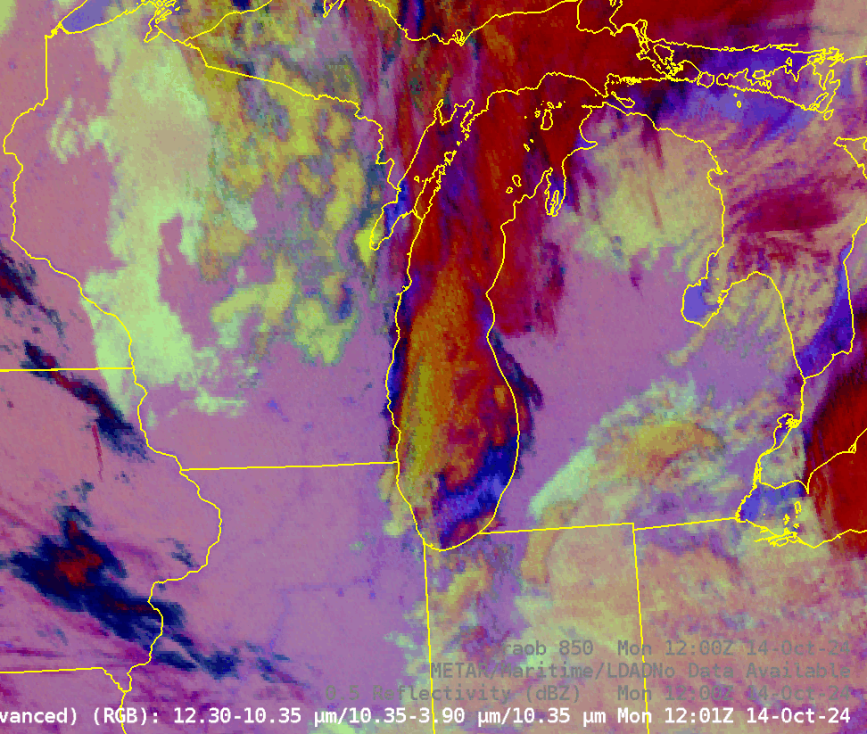
The toggle from 1201 UTC, below, shows the band in the Night Microphysics RGB with NEXRAD reflectivity overlain, and also surface and 850-mb observations. Note the 850-mb temperatures at Green Bay (-2o C) and at Detroit (-1o C) and at Gaylord MI (-5o C).
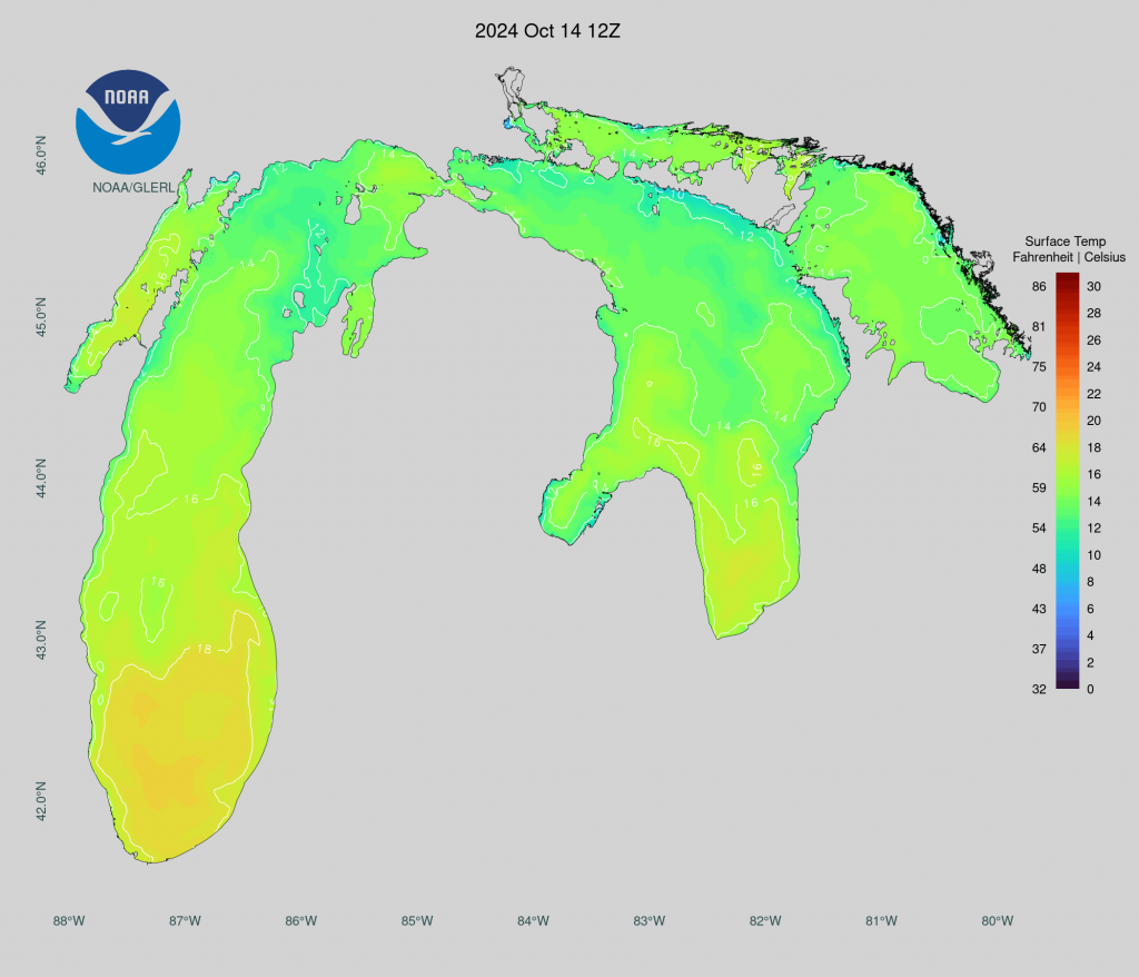
The temperatures at 850-mb are below zero (Celsius) and Lake Surface Temperatures are in the 17-18oC range (below, source). That difference is greater than the ca. 13 Celsius degrees needed to support Lake Effect bands.
The Lake Effect season has begun!
—————
Free Secure Email – Transcom Sigma
Transcom Hosting
Transcom Premium Domains