
Milton in the Gulf of Mexico
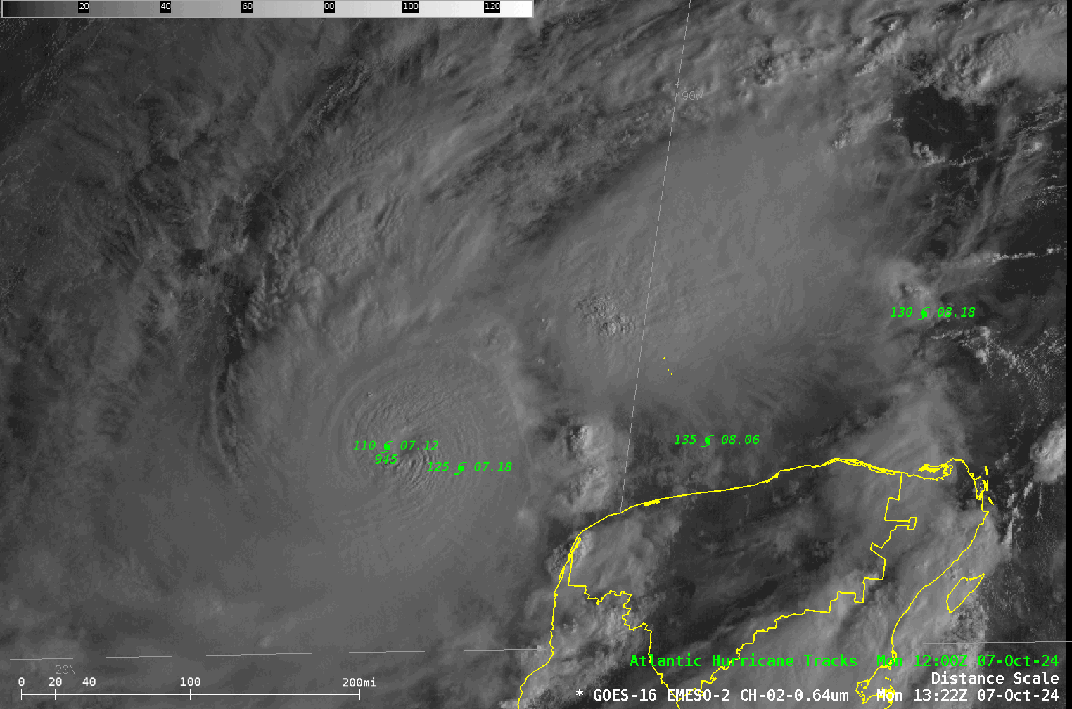
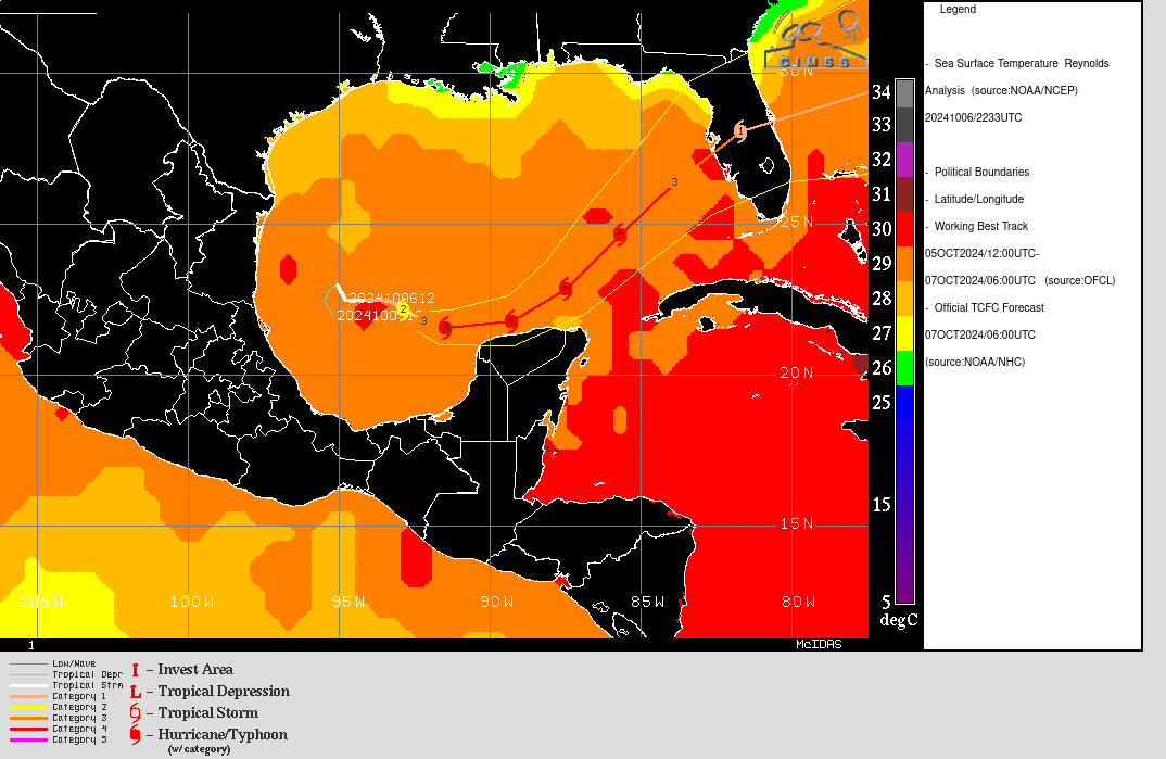
Visible imagery over Hurricane Milton after sunrise on 7 October, above, shows a compact system about 100 miles northwest of the Yucatan Peninsula. The predicted track of the storm center is superimposed on the imagery. Note that Milton’s sustained winds at 1500 UTC, 135 knots, represents an 80-knot increase over the previous 24 hours. Only 2 Atlantic Basin storms have strengthened more rapidly (source). Milton is forecast to move just south of due east, before turning northeastward towards Florida (where preparations for the storm should be completing). Milton on Monday morning is in a region of very warm water, and in an atmosphere with little shear, as shown below (analyses from this website). Much stronger shear is present over the northern Gulf, however.
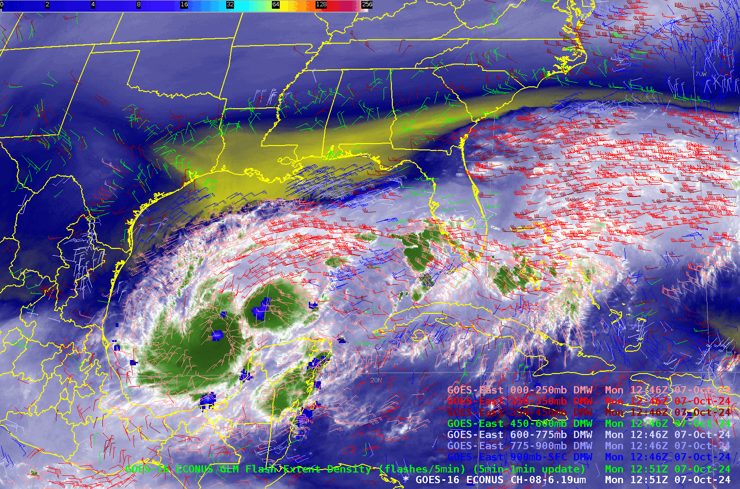
The animation below shows upper-level water vapor infrared imagery (Band 8, 6.19) along with GLM observations of Flash Extent Density and GOES-16 Derived Motion Wind vectors. Lightning is observed within the eye of Milton, a hallmark of rapidly-developing tropical cyclones. In addition, the very strong shear over the northern Gulf is apparent: east-northeast winds at low levels with very strong west-southwest winds aloft. The satellite-derived winds also show the characteristic anticyclone over the hurricane. Note, however, that the Day Night Band imagery over Milton (from NOAA-21, at 0802 UTC, downloaded from this site) shows no evidence of lightning near the eye at that time.
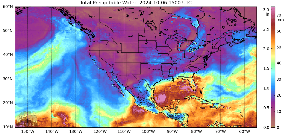
Dry air can weaken hurricanes. Is there any evidence of dry air in the vicinity of Milton? The Band 8 imagery above shows dry air over the northern Gulf, far from Milton. MIMIC Total Precipitable water fields, below (source), for the 24 hours ending a 1400 UTC show abundant moisture surrounding the storm. Also apparent in that animation: the front moving south into the Deep South. The circulation with this system will have a bearing on the future path and strength of Milton.
Interest on Florida, on both west coasts from north of Tampa to the Keys, and on the east coast from Jacksonville to north of Miami, should closely monitor the progress of this storm. For the latest information refer to the National Hurricane Center, and the NWS Forecast offices in Tampa, Jacksonville, Melbourne, Miami and Key West.
—————
Free Secure Email – Transcom Sigma
Transcom Hosting
Transcom Premium Domains