Gilma and Invest 91E (update: Tropical Depression 1C) over the eastern Pacific
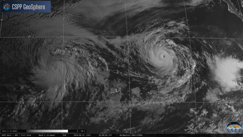
GOES-18 Visible imagery, above, from the CSPP Geosphere site, shows Gilma and Tropical Invest #91E (the invest became a tropical depression at 1500 UTC on 22 August; see below) at around 17oN latitude on 21 August 2024 in the tropical eastern Pacific. The animation below shows the same scene on 20 August, and the organizational improvement in the invest is apparent. On the 20th, the low level circulations were separate from the convection. On the 21st, above, the low-level circulations are underneath the convection. Slow organization has occurred.
By sunrise on the 22nd, below (link), Gilma is a hurricane, with an invest to its east; Invest 91E has moved west of 140oE, become the responsibility of the Central Pacific Hurricane Center in Honolulu, and organized enough to become a tropical depression.

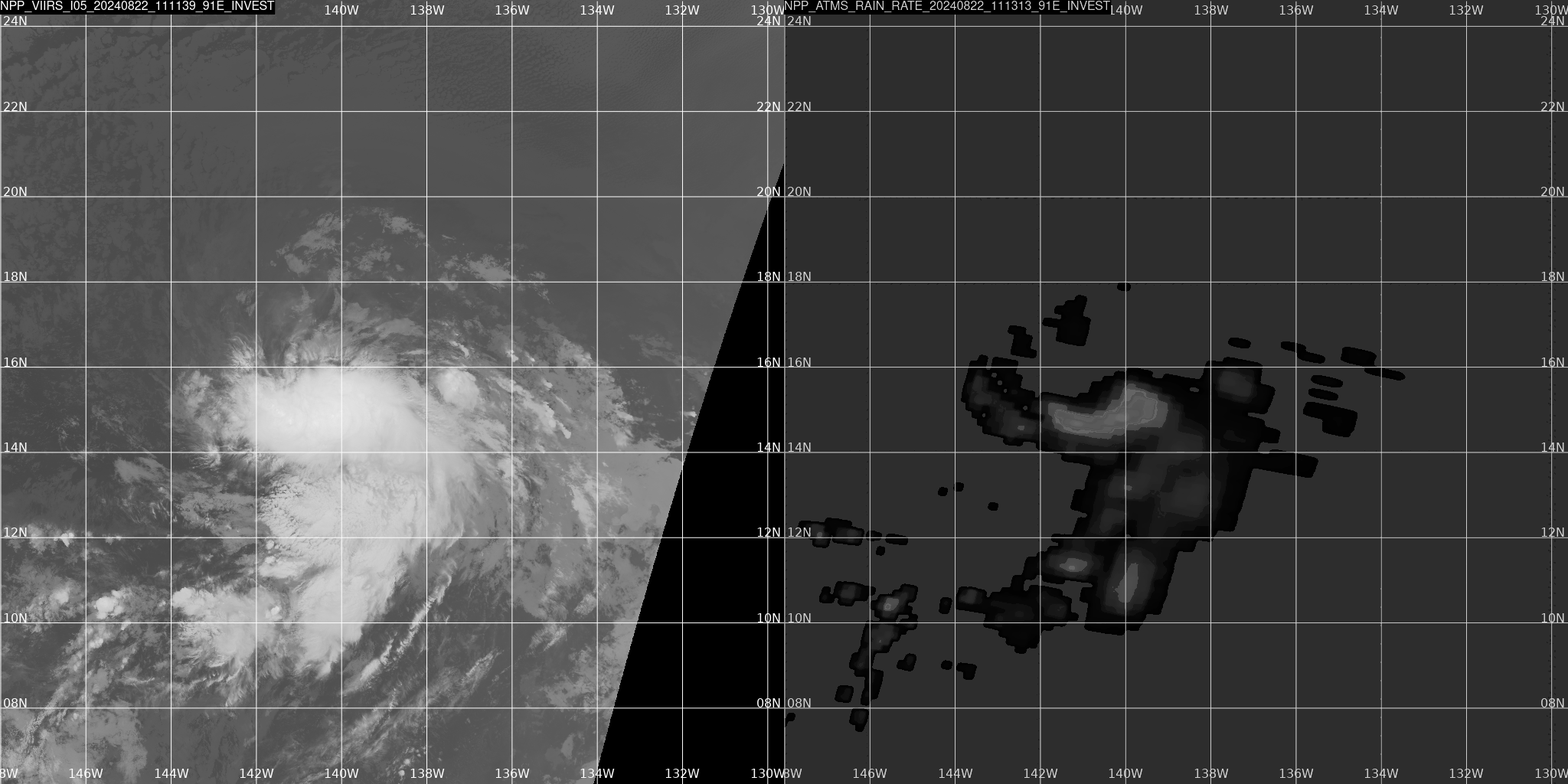
The invest was sampled from the direct broadcast site at Honolulu (data here). The toggle below compares Suomi-NPP I05 VIIRS imagery (11.45 µm) and the Suomi-NPP ATMS Rain Rate shortly after 1100 UTC on 22 August. The system is in a region of warm SSTs and low shear. Interests in Hawaii should continue to monitor its evolution.

For more information on this system, refer to the Central Pacific Hurricane Center and the National Weather Service office in Honolulu. CPHC has started issuing advisories on this system (tropical Depression 1C) as of 1500 UTC on 22 August.
—————
Free Secure Email – Transcom Sigma
Transcom Hosting
Transcom Premium Domains
