The Bear Fire in California and NGFS detection
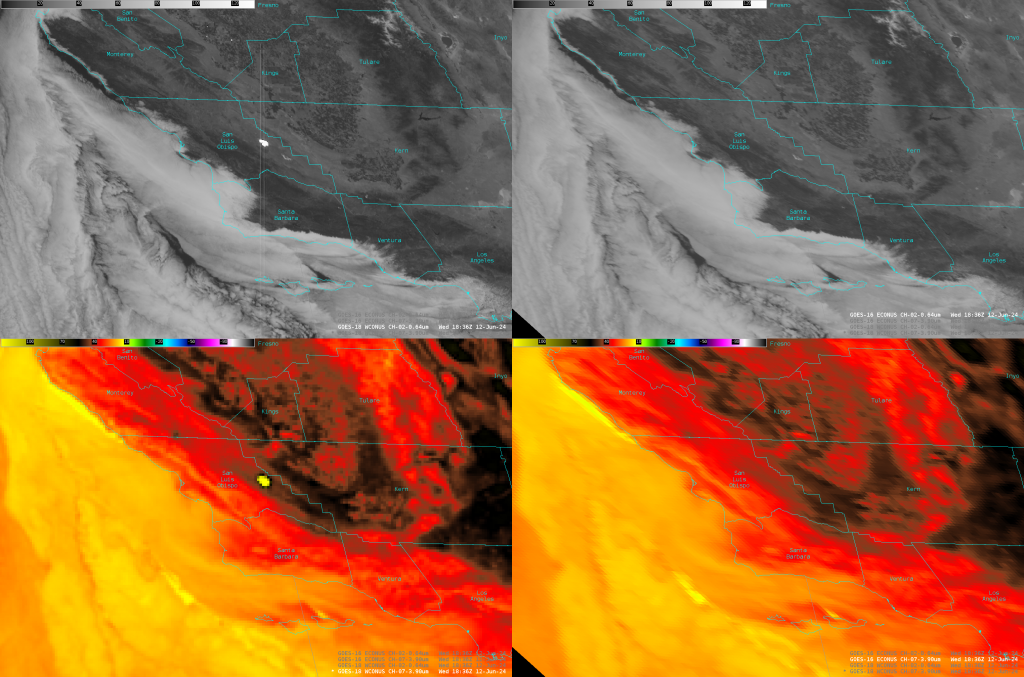
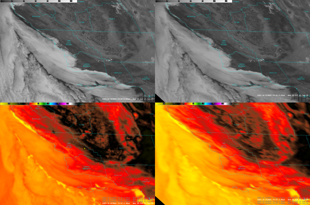
GOES-18 imagery over California at 1836 UTC (above, left) show a very strong signal over San Luis Obispo County: very bright in visible imagery and warm in the shortwave infrared. In the GOES-16 imagery, that signal is not present. In contrast, the warm signal in the shortwave infrared in GOES-18 imagery below has a similar signal in the GOES-16 imagery. (Click here for a shortwave infrared animation from GOES-16 animation, and here from GOES-18). In the imagery above, the lack of a signal in GOES-16 might mean this is an example of reflection off solar panels In contrast, imagery below suggests a fire is present, as the detection is present in shortwave infrared imagery from both satellites.
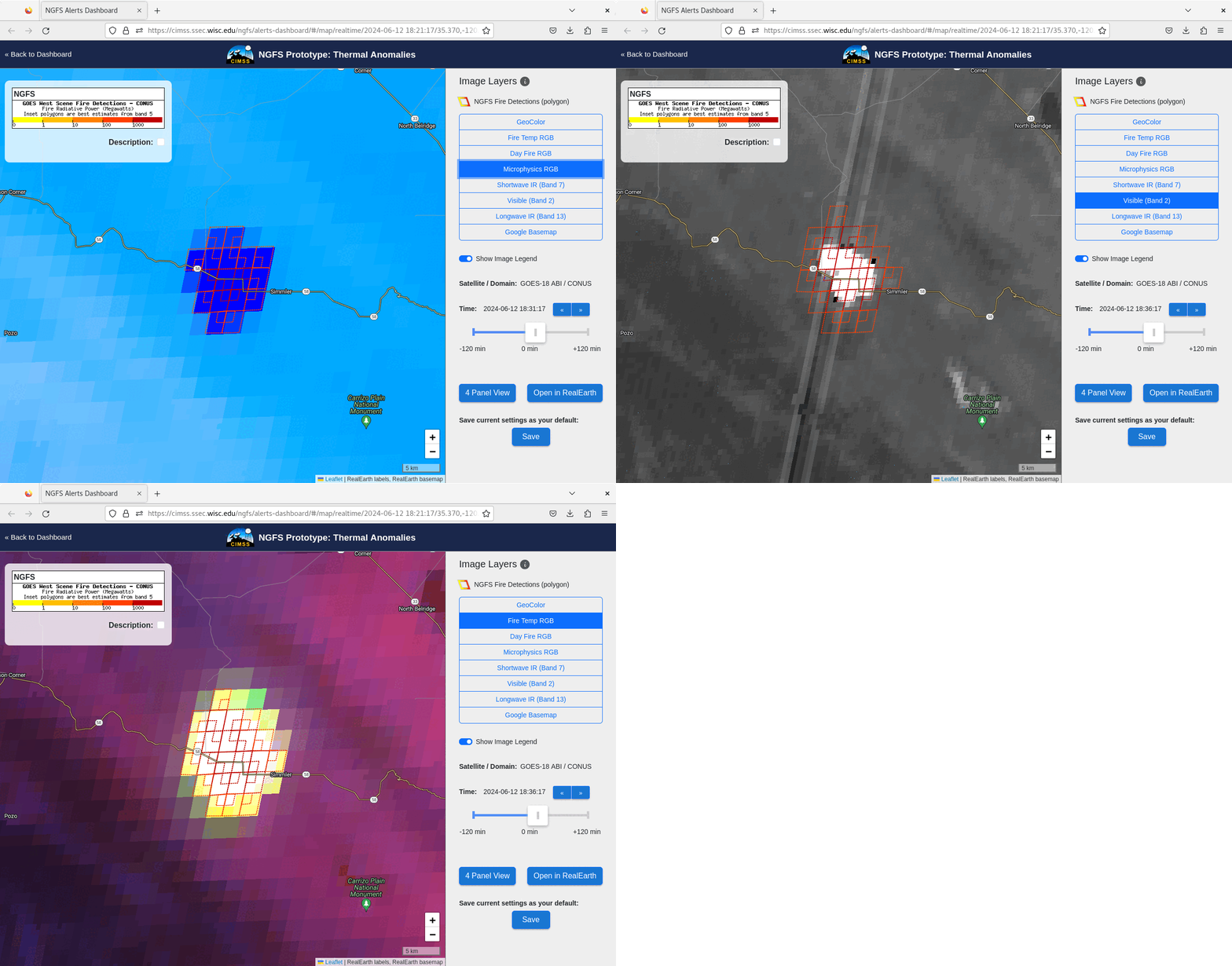
The Next Generation Fire System (NGFS) is a NOAA/NESDIS initiative to streamline the detection of fires as soon as they occur. The NGFS Alerts Dashboard (Documentation on the NGFS is here) shows the results of continuous automatic monitoring of satellite data for the development of hot spots such as those seen in the still images and animations above. What kind of information was available for the two events above, one a result of reflection off solar panels, and one a result of a fire? NGFS output at 1831 (Microphysics RGB) and 1836 UTC (Fire Temperature RGB and Visible imagery) is shown below.
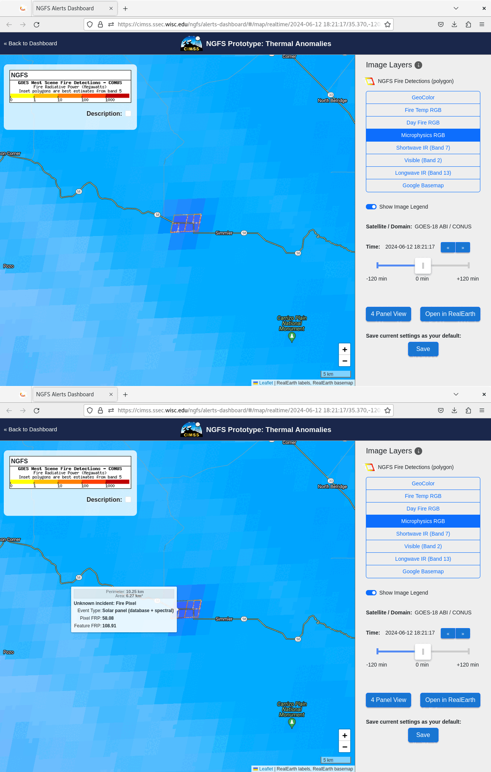
The NGFS report allows a user to scroll forward and back in time. The NGFS Microphysics imagery at 1821 UTC, when the detection above first happened, is shown below. A simple probe shows that this detection is associated with a solar farm based both on a spectral analysis and a knowledge of where solar panels exist (if you look as the Google Basemap, available in the menu below, and zoom in, you’ll see the panels); given the sudden strong onset of a signal, perhaps a Fire Meteorologist would feel justified in ignoring the signal at these pixels (one clue is the vertical striping emanating northward/southward from the bright signature in Visible imagery, due to detector saturation from intense reflection of sunlight off the large Topaz Solar Farm). Note that information from more than one satellite band is needed to be certain that a solar farm is being detected.
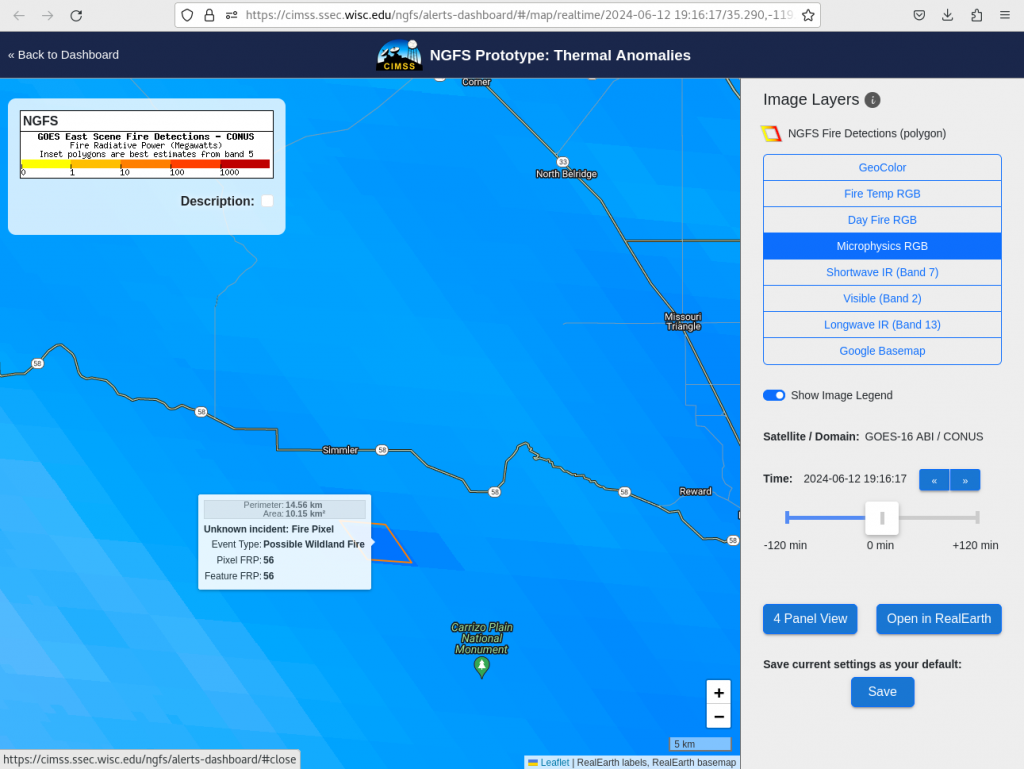
Not long after, an actual fire did occur southeast of the Solar Panel detection (Note Highway 58 in all images!). The NGFS detection for that incident is shown below. It is detected as a Fire Pixel in this case.
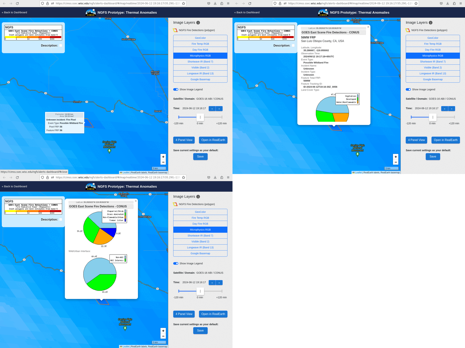
The detected hot spot can be probed to detect the flammability of the pixels, as shown below.
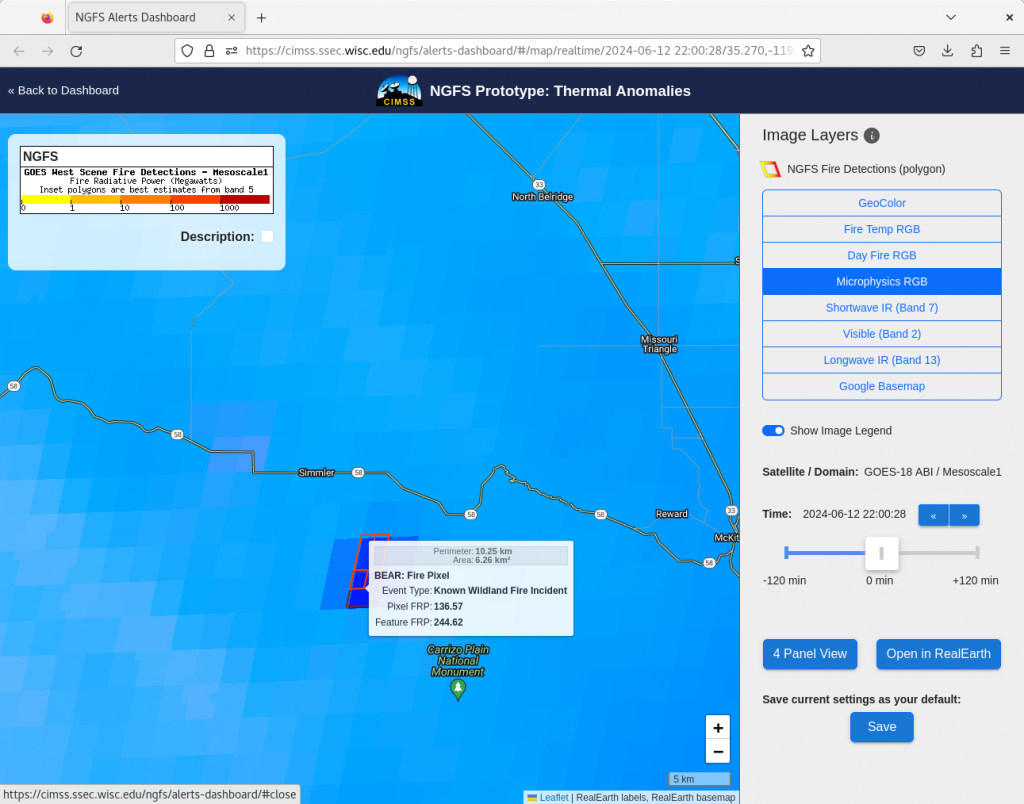
One the fire has been named, that name (Bear Fire) is also included in the information on the NGFS website, and in the probe, as shown below.
NOAA/NESDIS is sponsoring a Fire Testbed in Boulder CO this week to show the capabilities of the NGFS website.
—————
Free Secure Email – Transcom Sigma
Transcom Hosting
Transcom Premium Domains
