
Using LightningCast Probabilities as an aviation tool
This blog post shows satellite imagery with a Singapore Airlines Boeing 777-300ER that encountered severe turbulence while flying over southern Myanmar (information from flightradar) at 0749 UTC on 21 May 2024. This graphic from Sarah Griffin, CIMSS, shows the turbulence location/time; other graphics/animations from this event are in this directory that Sarah Griffin created.
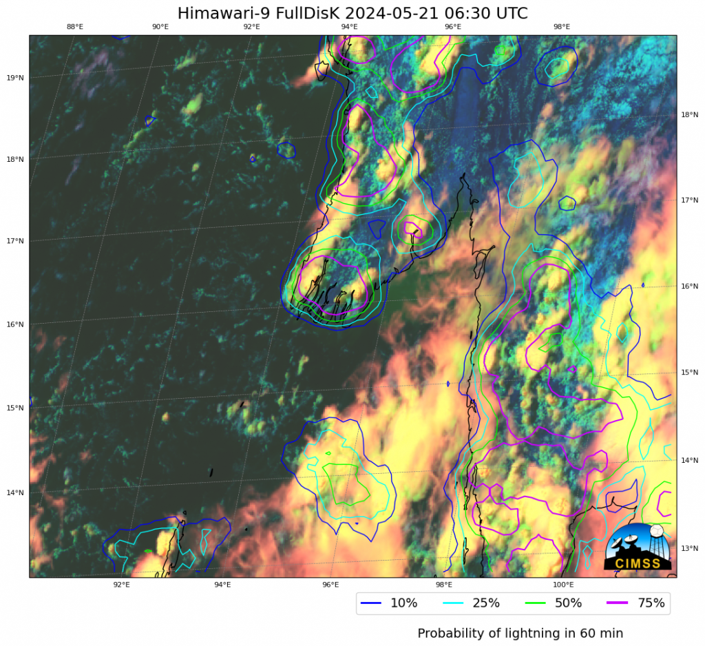
LightningCast probabilities predict where an (in this case, hypothetical) GLM instrument would detect a lightning flash in the next 60 minutes based on current ABI or AHI imagery at 0.64 µm, 1.61 µm, 10.3 µm and 12.3 µm. Although this machine-learning tool was trained on GOES-East ABI and GLM imagery, it is being applied to the similar AHI instrument that flies on Himawari-9. (Real-time Himawari-9 LightningCast imagery is available at this RealEarth instance under the ‘Guam’ sector). The LightningCast contours shown in this blog post were created using a CSPP Geo software package in development/testing at CIMSS, with a Beta release on the horizon. More than an hour before the turbulence that affected the Boeing 777, LightningCast is suggesting the region is very likely to have lightning. The animation below shows how the LightningCast contours (and satellite imagery) changed between 0630 and 0800 UTC on 21 May. Diagnosed probabilities of lightning remain high over the region throughout the 80-90 minutes prior to the turbulent encounter.

—————
Free Secure Email – Transcom Sigma
Transcom Hosting
Transcom Premium Domains