
Lightning and Turbulence Probabilities to the northeast of Hawaii
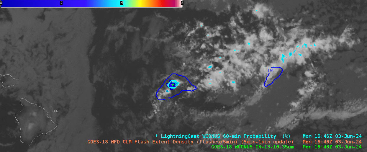
A period of high-based convection to the east and northeast of Hawaii was producing occasional lighting on 3 June 2024, as shown in the animation above. LightningCast Probabilities plotted show values around 50%, and lightning is occurring. Note that the Flash Extent Density colorbar has been modified to have a maximum value of only 8.
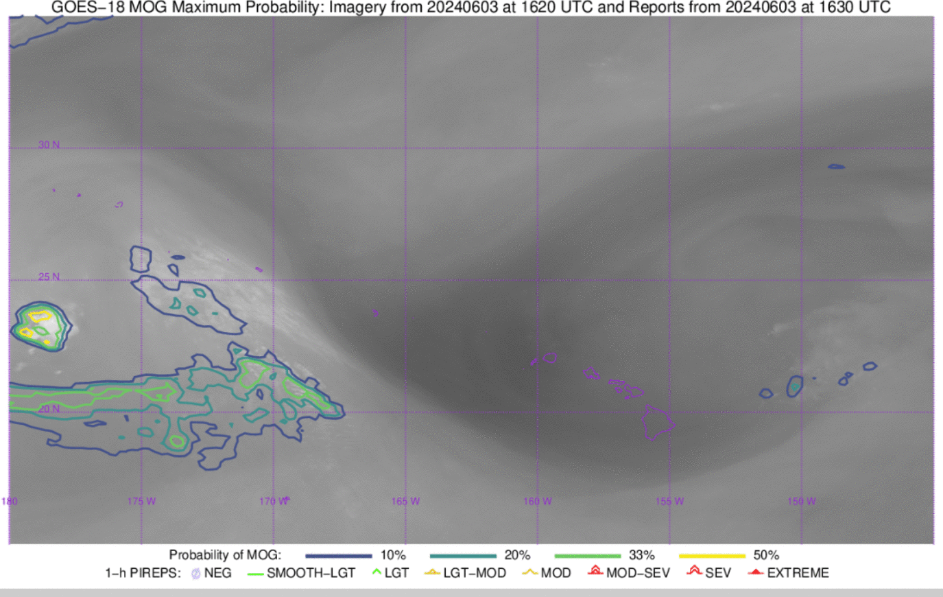
The convection is creating a signal in the CIMSS Turbulence product, shown below in imagery from this website. The animation below shows the contours of the probability of Moderate Or Greater (MOG) Turbulence to the northeast of Hawaii. The animation below also shows water vapor imagery as a greyscale, from which you can infer the upper-level low-pressure system over the Hawaiian Islands that is helping to force the thunderstorms.
Thanks to Robert Ballard, Science and Operations Officer (SOO) at WFO Honolulu for alerting us to this event. He notes the similarity to an event back in the year 2000, mentioned in this AFD. High-based thunderstorms such as these are rare in the tropics. They are decoupled from the tradewind cumulus: the thunderstorms are moving northward as the lower clouds move towards the west.
—————
Free Secure Email – Transcom Sigma
Transcom Hosting
Transcom Premium Domains