
PHS model output during Day 4 of Week 2 at HWT
One focus on day 4 of HWT in Norman was the North Platte, Nebraska (WFO LBF) County Warning Area (CWA) over western Nebraska. This was near a gradient in the Storm Prediction Center Convective Outlook that had an enhanced risk over central Nebraska and a Slight risk over western Nebraska. The first concern was when would convective initiation occur? The 1600 UTC PHS model run had convective initiating at 2000 UTC and building from then on.
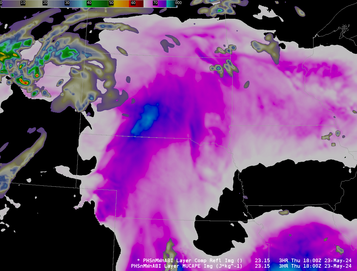
The distribution of moisture modeled in the MUCAPE field above was very similar to the Split Window Difference field (here, from this link).
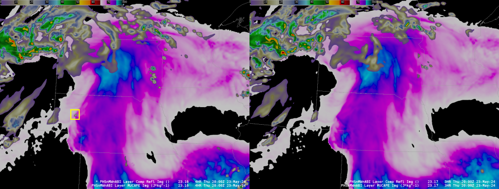
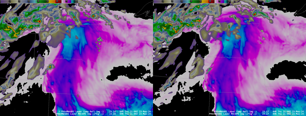
The PHS model runs hourly. The data above shows the 2000 UTC forecast from 1600 UTC (that is, a 4-hour forecast). The 3-h forecast valid at 2000 UTC (from the PHS run at 1700 UTC) did not include initiation until after 2000 UTC. Compare the two fields below, 3-h and 4-h forecasts for 2000 UTC and 2100 UTC from 1600 UTC and 1700 UTC, respectively.
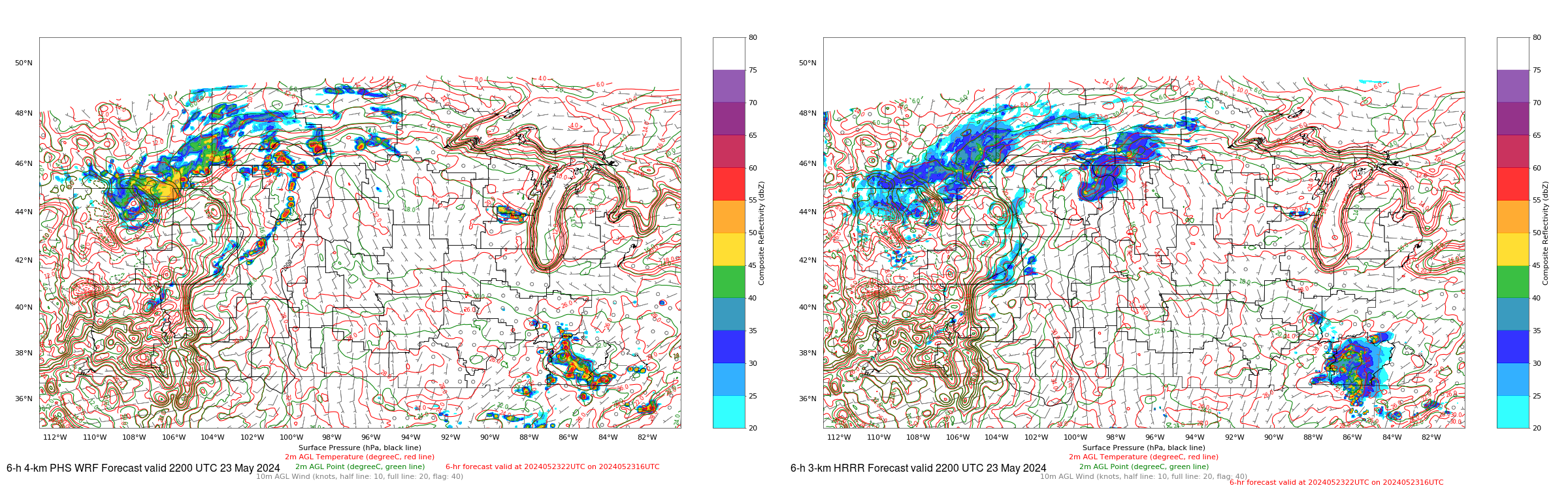
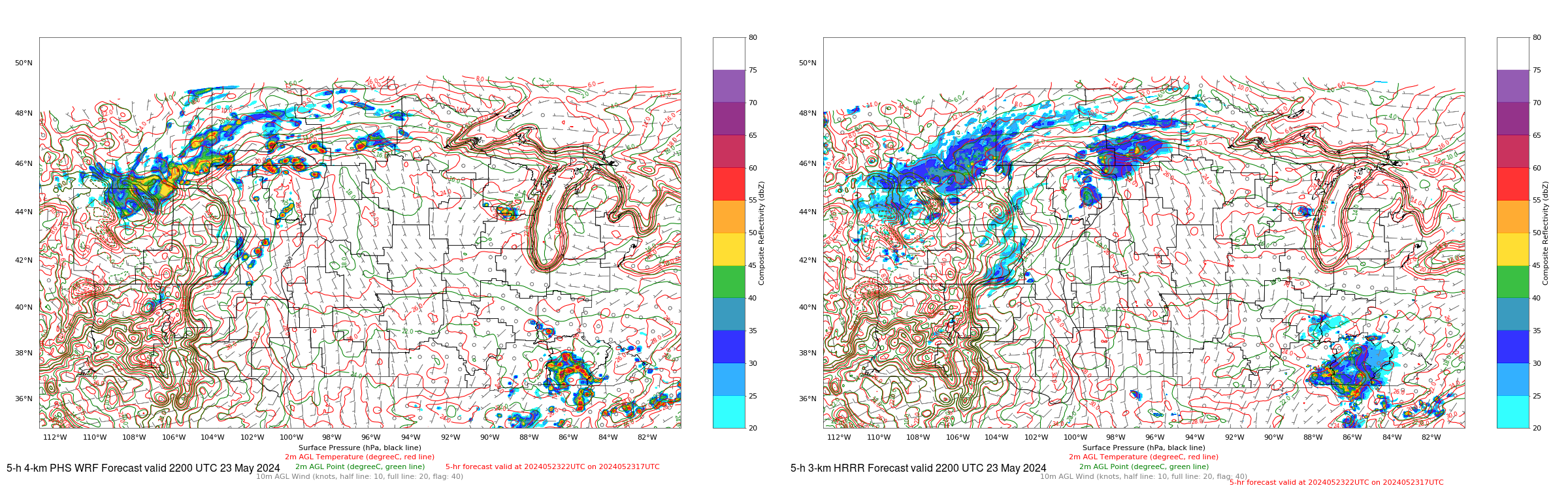
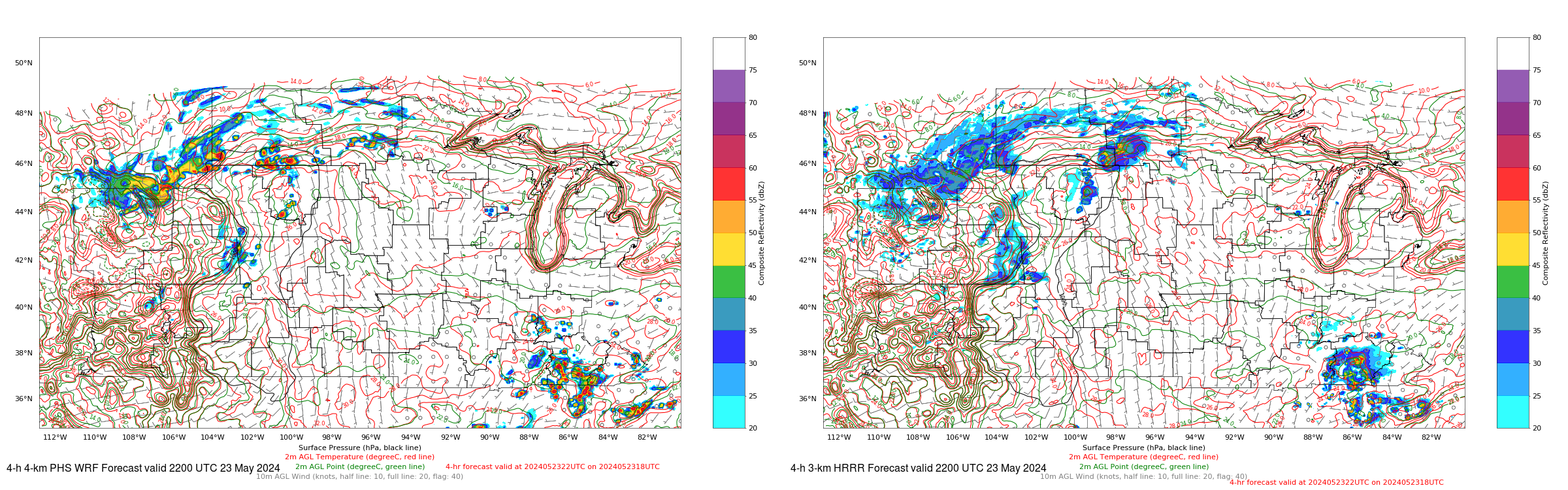
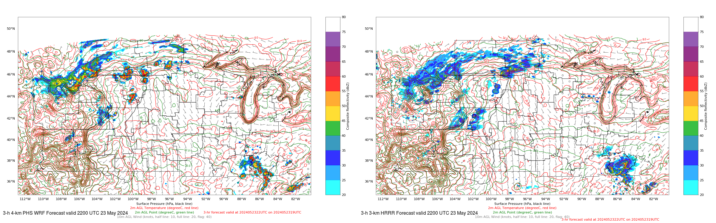
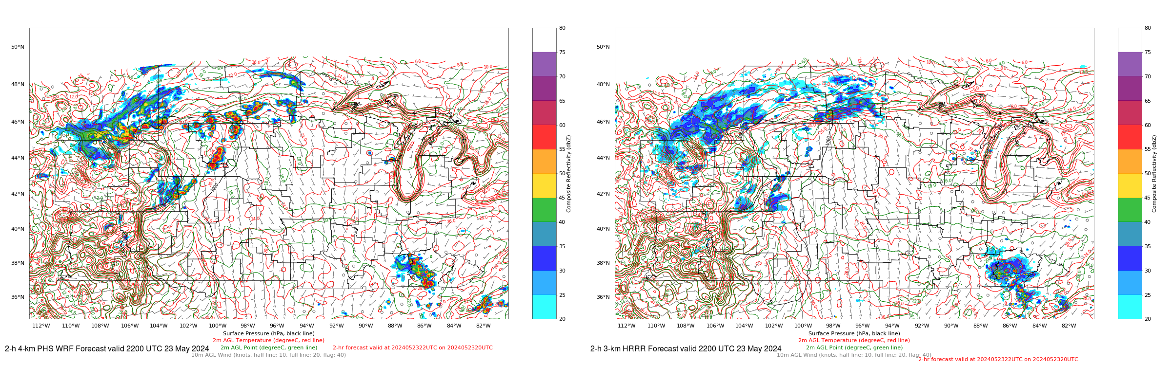
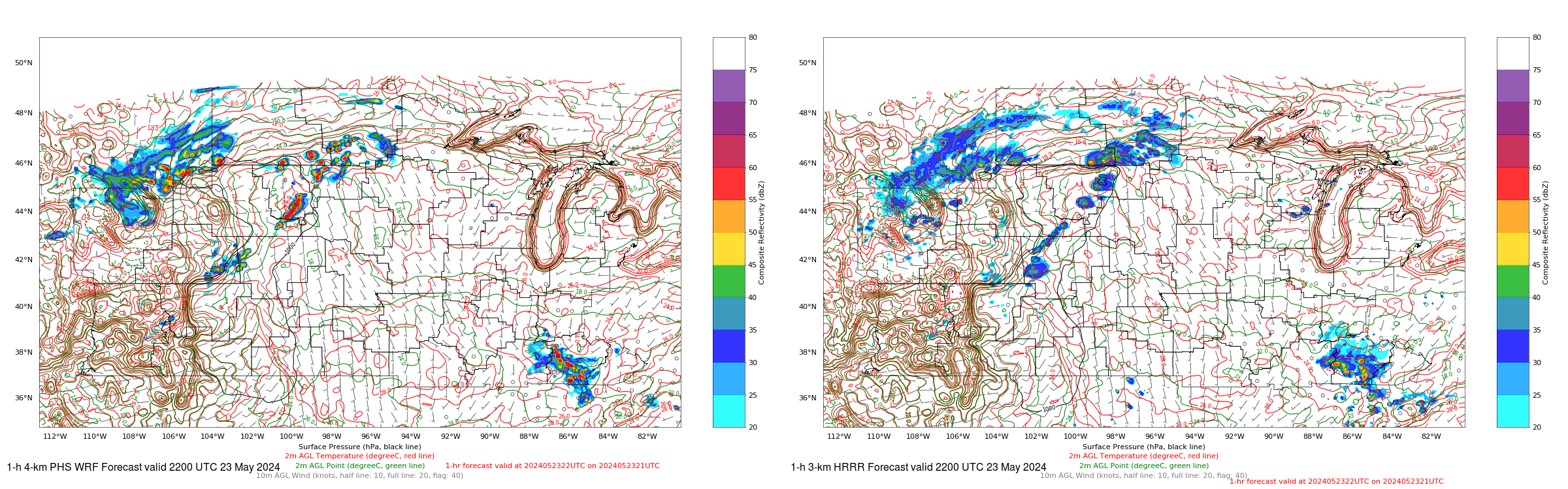
PHS Model Forecasts are available at this website. HRRR model forecasts are available here (and elsewhere). The following six figures compare the forecasts for 2200 UTC in forecasts initialized at 1600, 1700, 1800, 1900, 2000 and 2100 UTC, that is 6-h, 5-h, 4-h, 3-h, 2-h and 1-h forecasts. (Click here for an animation of the forecasts; For views of what was occurring between 2000 and 2220 UTC on 23 May, click here for the North Platte WFO and here for the Aberdeen WFO). The WRF model with assimilated PHS data showed stronger convection forming earlier, closer to the actual time of convective initiation, than was predicted by the HRRR model that does not include PHS information.
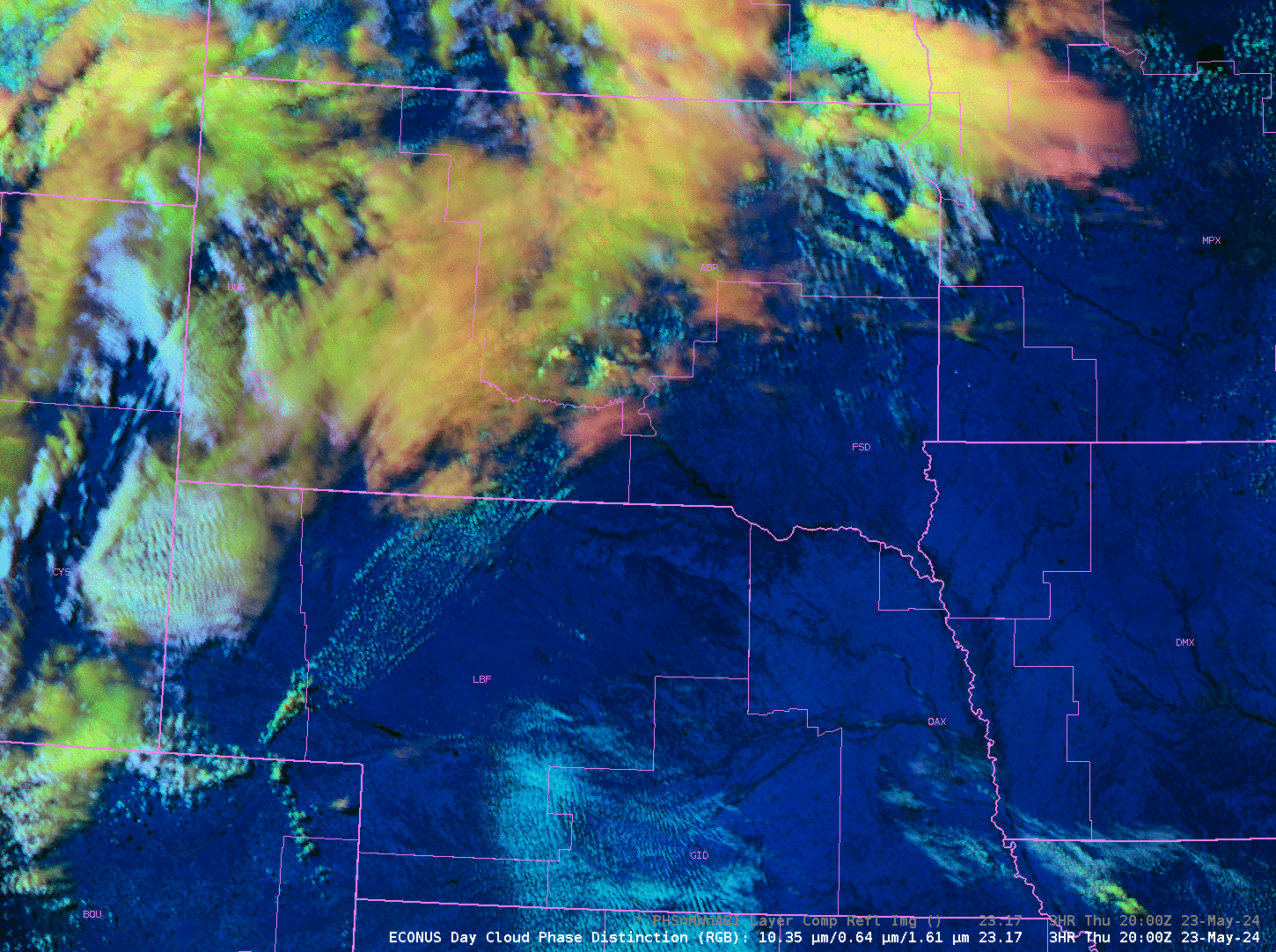
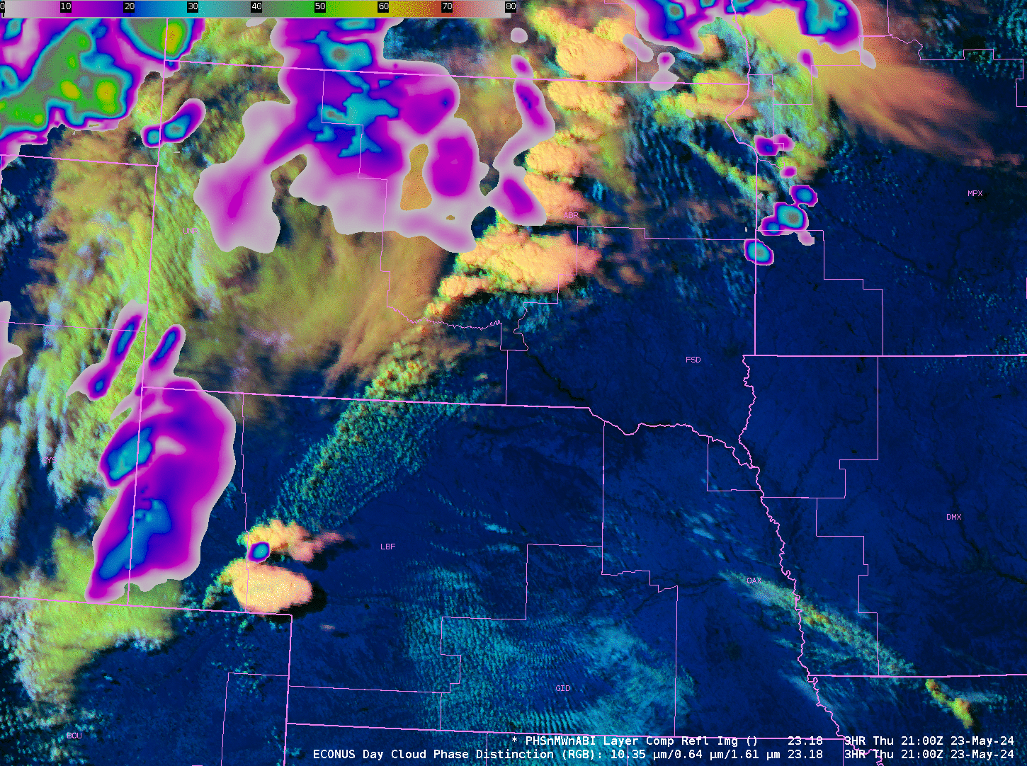
The stepped animations below show the hourly GOES-East Day Cloud Phase Distinction RGB over the northern High Plains from 2000-2300 UTC on 23 May, and the GOES-East Day Cloud Phase Distinction RGB overlain with the PHS forecasts of Composite Reflectivity at 2100, 2200 and 2300 UTC on 23 May. Strong convective growth is apparent in both fields. Severe weather was reported in both the North Platte and Aberdeen CWAs from this convection (SPC Storm Reports).
—————
Free Secure Email – Transcom Sigma
Transcom Hosting
Transcom Premium Domains