PHS model output during Day 1 of Week 2 at HWT
A WRF model run that includes assimilated Low-Earth-Orbit (LEO) satellite sounder data (fused with ABI data) is being evaluated at the Hazardous Weather Testbed (Blog posts from forecasters at HWT are here). On 20 May 2024, the PHS model output included convective development over the eastern Plains of Colorado, as shown in the animation below of model Composite Reflectivity at hourly time-steps. The screenshots below are from AWIPS; model output is also available here.

The PHS model accurately predicted convective initiation, as shown in the (hourly) animation below of GOES-East visible imagery.
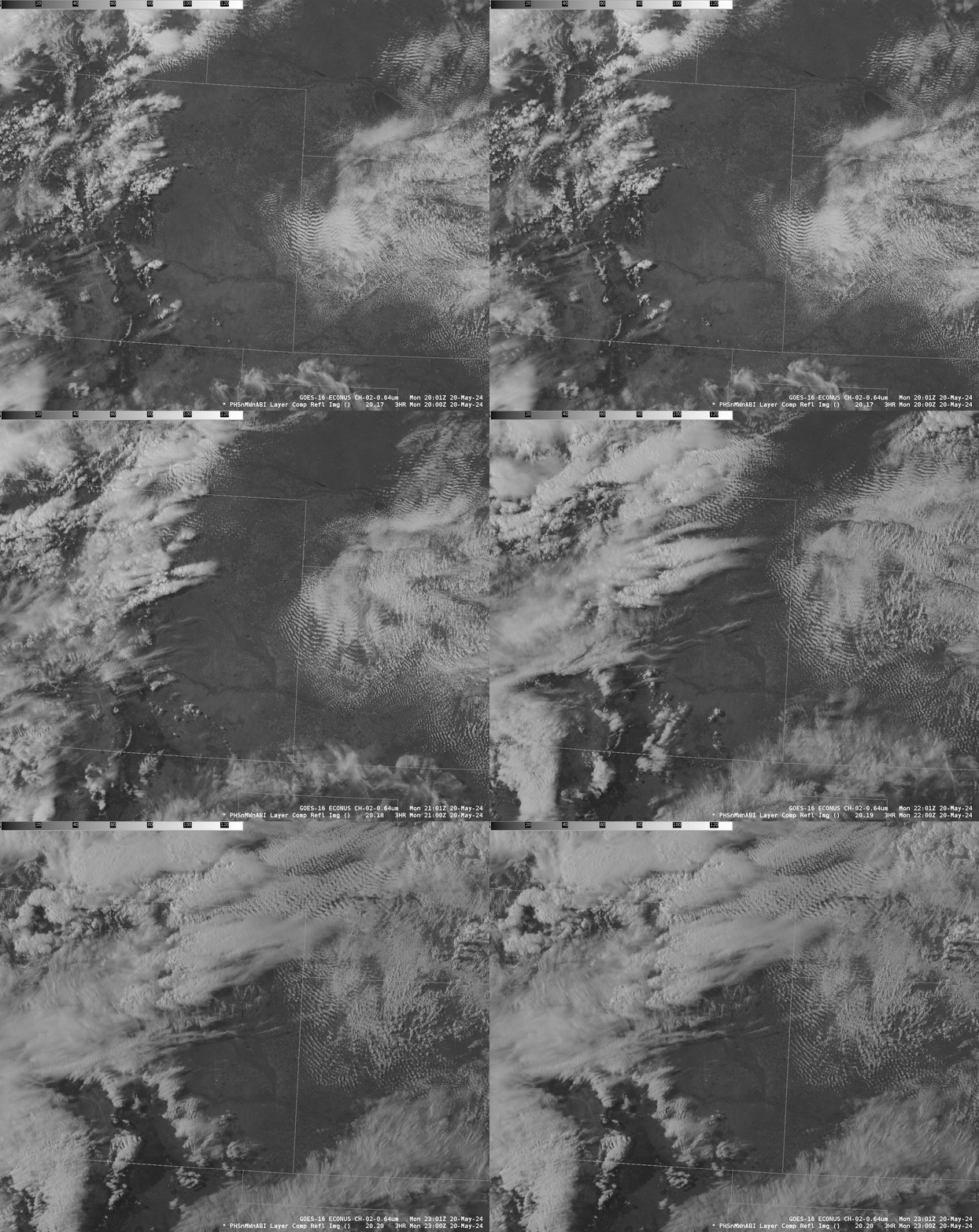
The three toggles below compare the forecasts of Composite Reflectivity and Visible Imagery at 2000, 2100 and 2200 UTC.
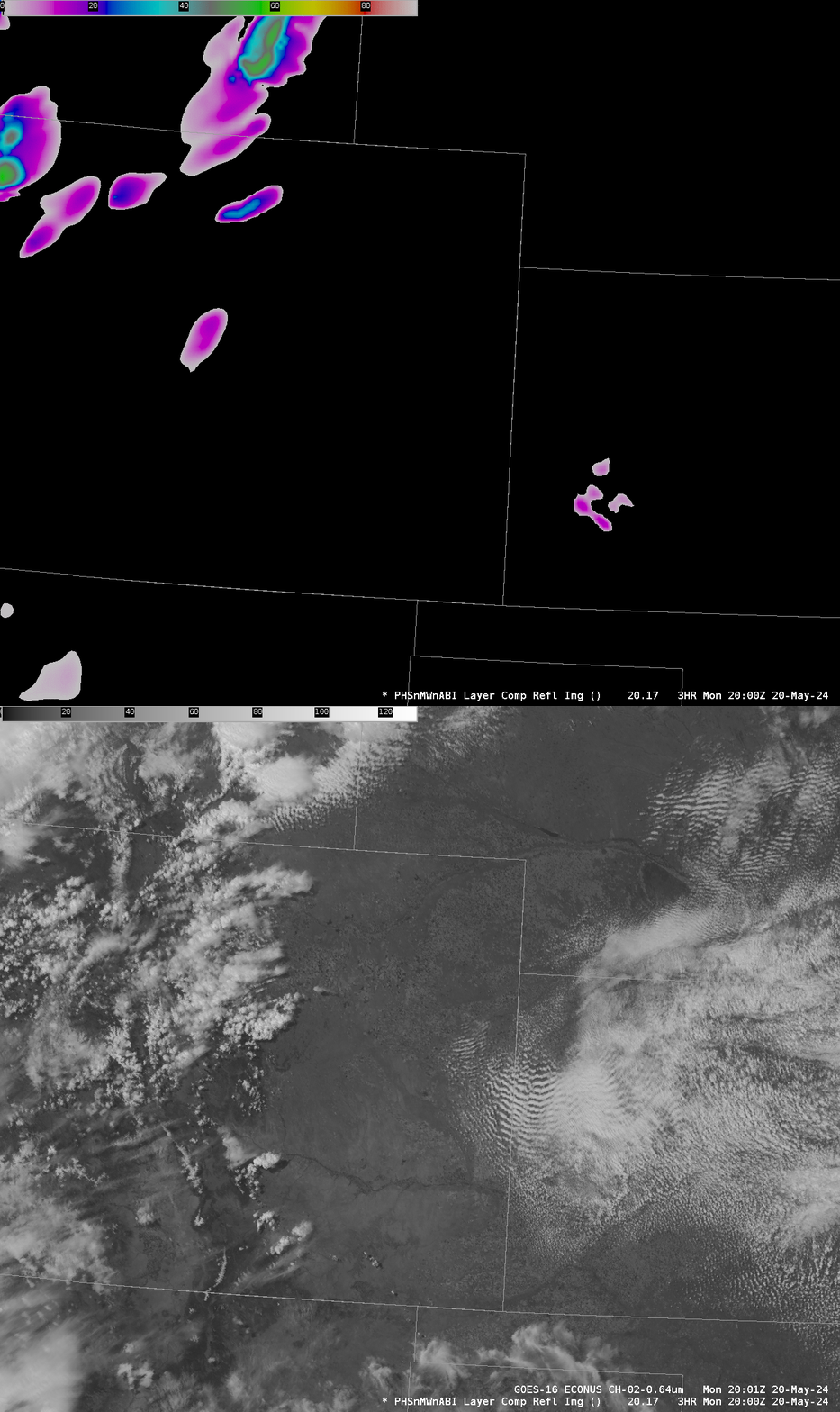
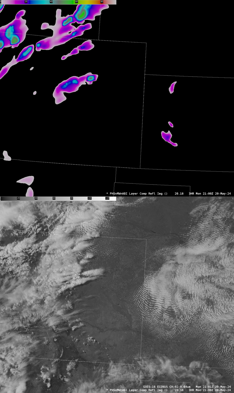
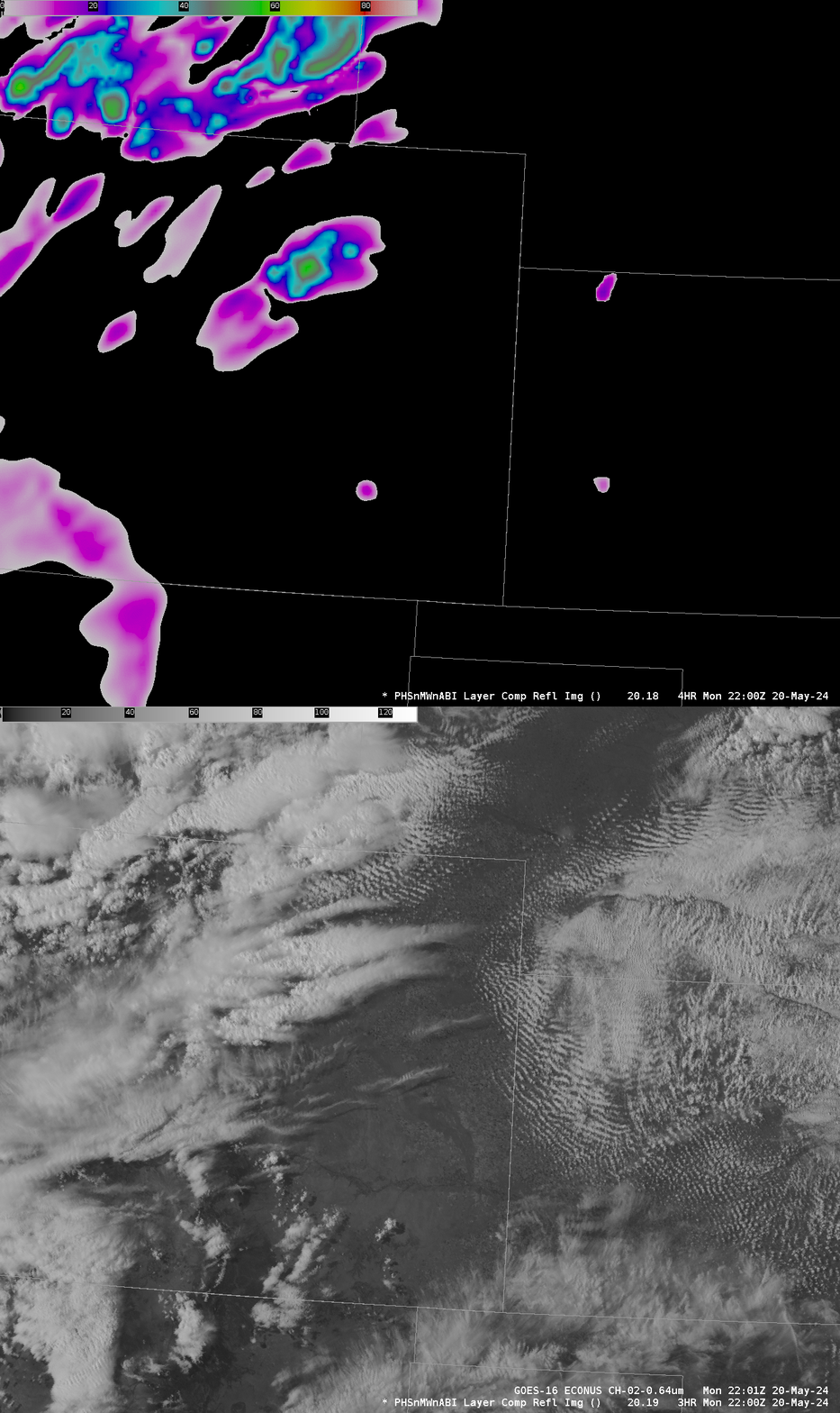
Based on the forecast, a LightningCast monitoring point was created where the model forecast initiation (approximately 39.7oN, 104.7oW; National Weather Service forecasters have the ability to request monitoring points to supplement the airports/stadiums that are done routinely and are available at this website). That LightningCast probabilities are shown below for the point.
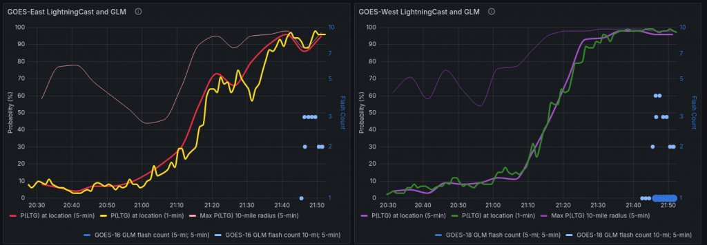
The animation below shows the Day Cloud Phase Distinction RGB and the LightningCast Probability contours over eastern CO (figure above and animation below courtesy John Cintineo, NSSL).
—————
Free Secure Email – Transcom Sigma
Transcom Hosting
Transcom Premium Domains
