
Severe thunderstorms across Kansas
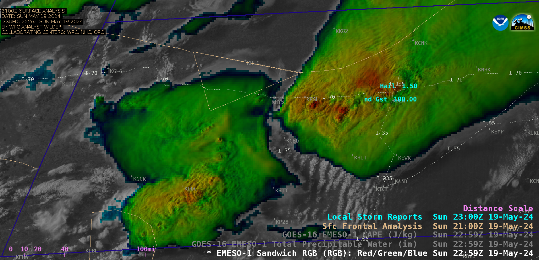
1-minute GOES-16 Visible/Infrared Sandwich RGB images with time-matched Local Storm Reports plotted in cyan [click to play animated GIF | MP4]
While much of Kansas was under a “Particularly Dangerous Situation” Severe Thunderstorm Watch, 1-minute Mesoscale Domain Sector GOES-16 (GOES-East) Visible/Infrared Sandwich RGB images (above) showed thunderstorms that produced tornadoes, large hail (to 3.00 inches in diameter) and damaging winds (gusts of 90-100 mph) (SPC Storm Reports) across parts of Kansas on 19 May 2024. Some flash flooding was also reported, with water covering portions of Interstate 70 and other nearby roads. The discrete supercell thunderstorms that initially developed during the late afternoon hours eventually consolidated into a larger organized Mesoscale Convective System / squall line by about 0000 UTC on 20 May.
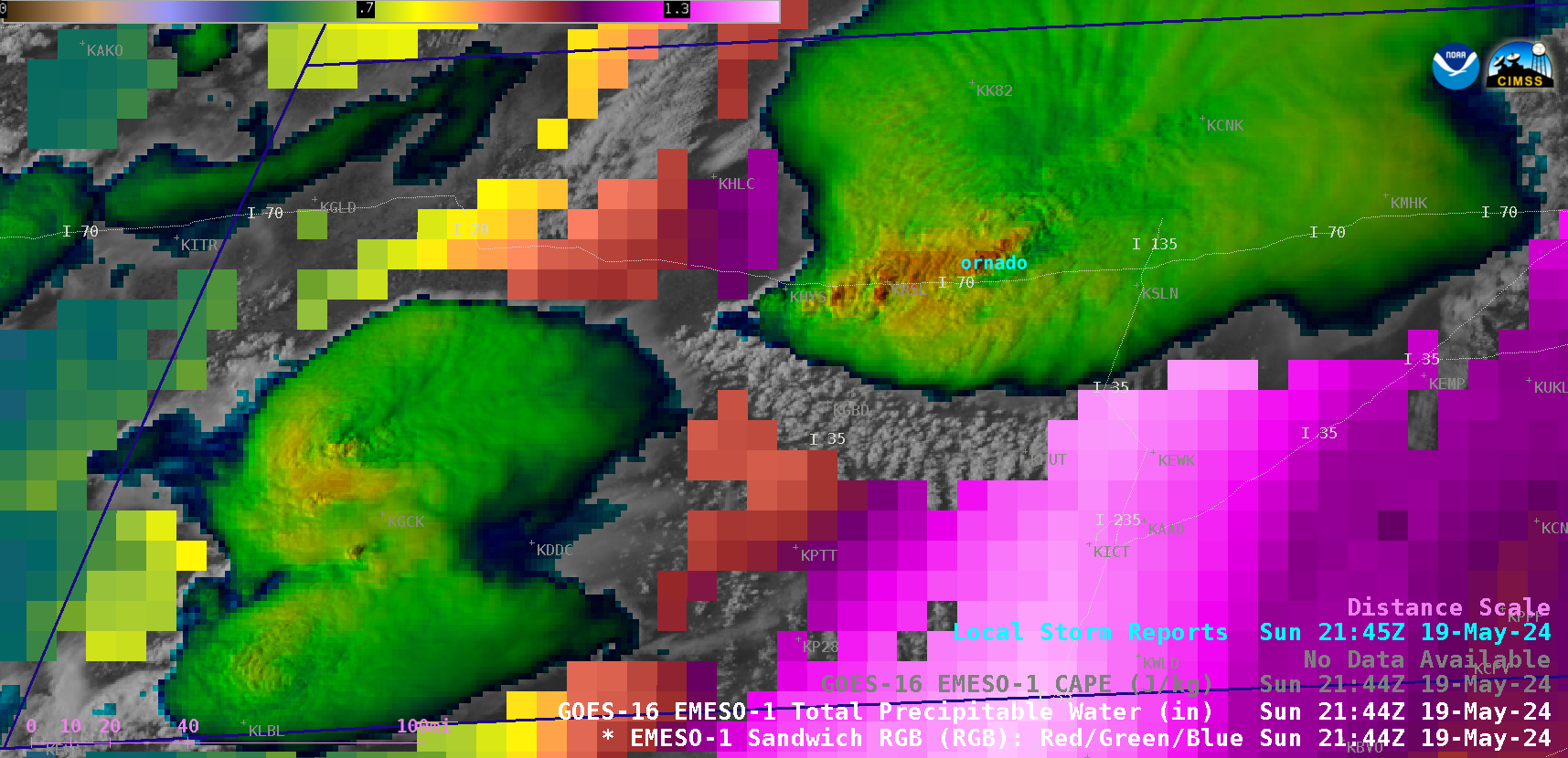
1-minute GOES-16 Visible/Infrared Sandwich RGB images combined with the Total Precpitable Water derived product in cloud-free areas, with time-matched Local Storm Reports plotted in cyan [click to play animated GIF | MP4]
1-minute GOES-16 Visible/Infrared Sandwich RGB images combined with the Total Precpitable Water derived product (above) and the CAPE derived stability index (below) revealed a plume of moisture (TPW values to 1.6 in) and instability (CAPE values to 2200 J/kg) that was spreading northward along the I-35 corridor, feeding into the tornado/hail/wind/flash-flood-producing supercell thunderstorm that was propagating eastward along the I-70 corridor.
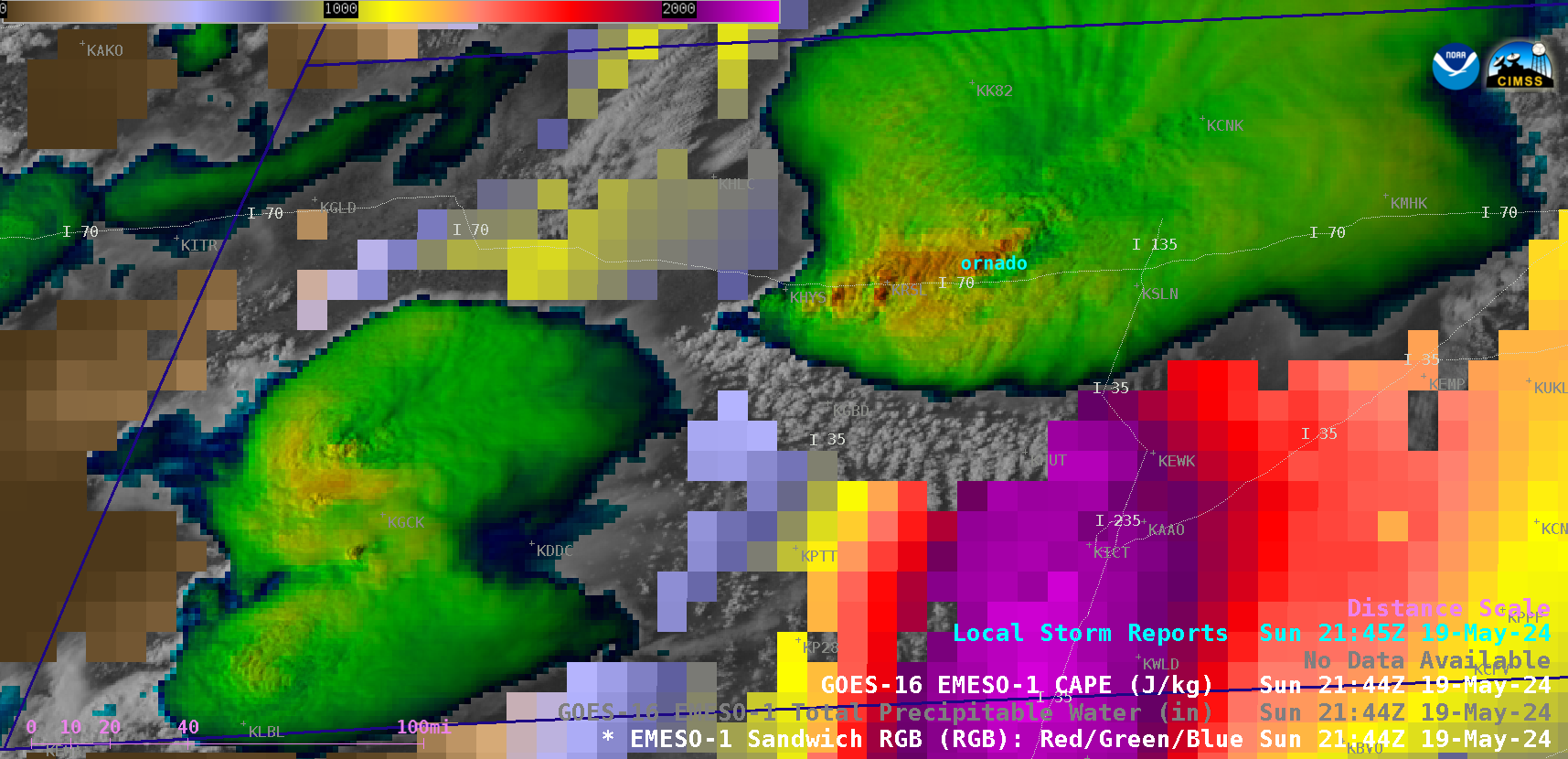
1-minute GOES-16 Visible/Infrared Sandwich RGB images combined with the Convective Available Potential Energy (CAPE) derived product in cloud-free areas, with time-matched Local Storm Reports plotted in cyan [click to play animated GIF | MP4]
—————
Free Secure Email – Transcom Sigma
Transcom Hosting
Transcom Premium Domains