
30-second images of thunderstorms that produced damaging winds (with some fatalities) in the Houston, Texas area

30-second GOES-16 “Red” Visible (0.64 µm) images with time-matched SPC Storm Reports plotted in red [click to play animated GIF | MP4]
Overlapping 1-minute Mesoscale Domain Sectors provided 30-second interval GOES-16 (GOES-East) “Red” Visible (0.64 µm) images (above) — which showed thunderstorms that produced damaging winds (with some fatalities) across the Houston area (SPC Storm Reports) on 16 May 2024. Widespread structural damage occurred in downtown Houston — and there were also power outages across much of the area.
The corresponding 30-second GOES-16 “Clean” Infrared Window (10.3 µm) images (below) revealed numerous pulses of thunderstorm overshooting tops that exhibited infrared brightness temperatures of -80ºC or colder (shades of violet embedded within brighter white regions).

30-second GOES-16 “Clean” Infrared Window (10.3 µm) images with time-matched SPC Storm Reports plotted in cyan [click to play animated GIF | MP4]
Taking a closer look at the Houston metro area, 30-second GOES-16 Visible images with/without an overlay of GLM Flash Extent Density (below) showed the lightning activity associated with these thunderstorms, which included a few brief lightning jumps.
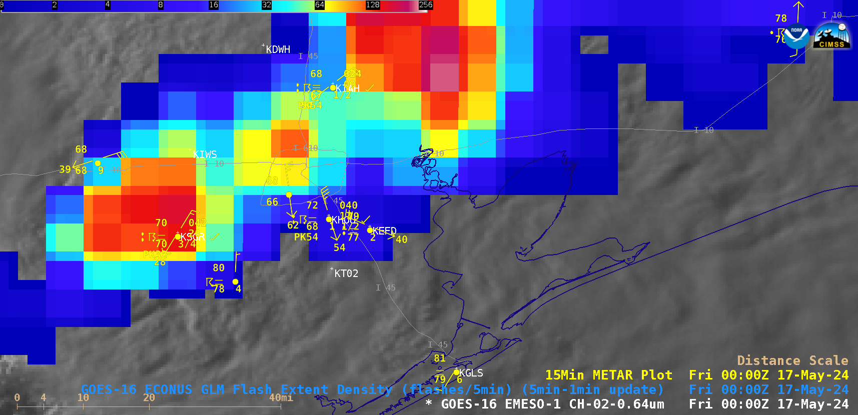
30-second GOES-16 “Red” Visible (0.64 µm) images, with/without an overlay of GLM Flash Extent Density [click to play animated GIF | MP4]
—————
Free Secure Email – Transcom Sigma
Transcom Hosting
Transcom Premium Domains