LightningCast products with Himawari-9 data

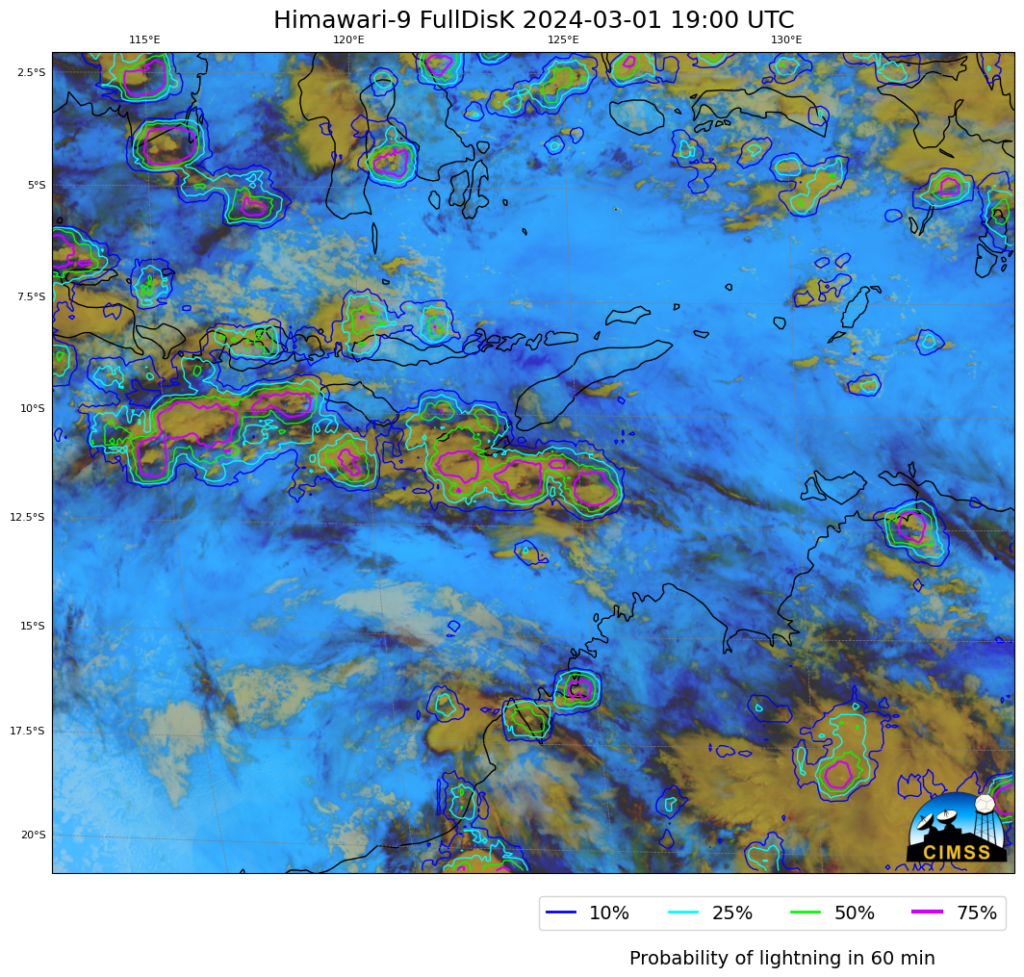
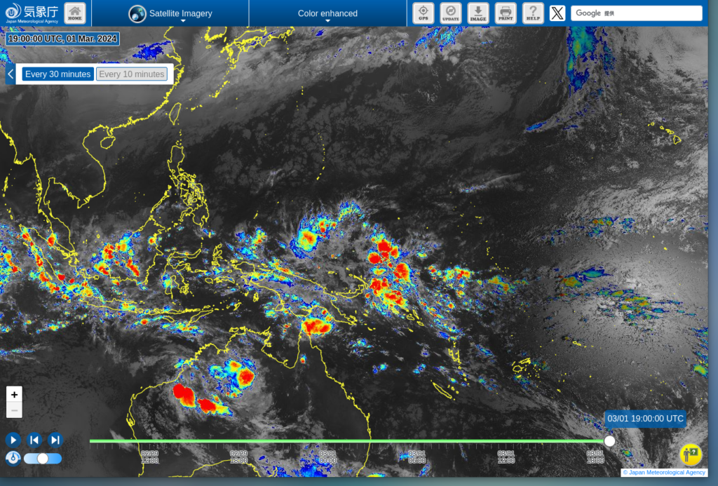
CSPPGeo software to create LightningCast probability fields is in (pre-Beta stage) testing at CIMSS (as noted in this recent blog post). In addition to creating output using GOES-R data, the software will also create imagery from Himawari-9 data. There is a RealEarth instance for LightningCast probability that includes a small Guam sector cut-out, but the CSPPGeo LightningCast software allows a cutout to be created anywhere within the Himawari-9 footprint! The image above shows LightningCast probabilities for portions of northwestern Australia and adjacent oceans/islands to the north. Himawari clean window infrared (10.4 µm) imagery for the same time (from this site) is shown below. LightningCast tells you which of the convective-looking clouds are most likely to be producing lightning in the next 60 minutes. The domain for LightningCast Probability was restricted to a subset of the Full Disk image, from -21oS to -2oS and from 110oE to 135oE.

Thanks to John Cintineo (CIMSS) and Levi Pfantz (CIMSS) for their work on this CSPPGeo product.
—————
Free Secure Email – Transcom Sigma
Transcom Hosting
Transcom Premium Domains
