
Wind, Storms, and Gales in Alaska
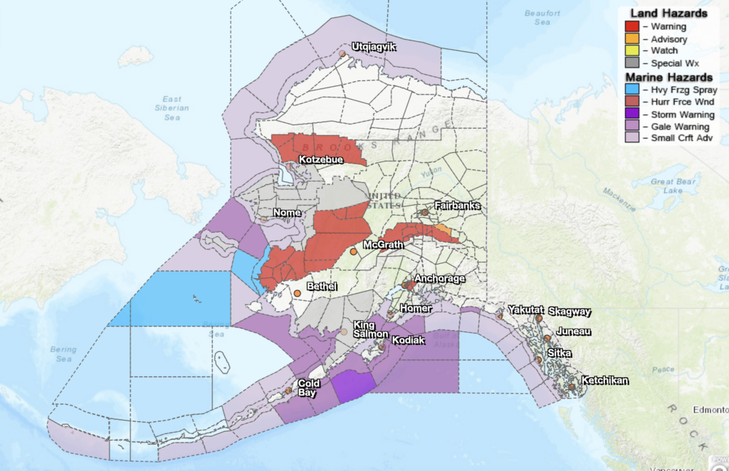
On February 12, 2024, much of inland Alaska is experiencing warnings for wintery precipitation, while coastal Alaska is under warnings for storms, gales, and heavy freezing spray. Southeastern Alaska is also under a small craft advisory.
The low-pressure system associated with this inclement weather is seen easily from the GOES-West imagery. Viewers can see a large hook-shaped rotational system swooping in from the south and affecting much of the state. Figure 2 shows Band 9, the mid-level water vapor channel, from GOES-West, illustrating the low pressure system nicely. On the GOES-West Advanced Baseline Imager (ABI), Band 9 is centered on 6.9 µm and is great for tracking storm systems.
Expectedly, the weather is having unfavorable effects on aviation safety. Marginal visual flight rules (MVFR) cite weather conditions that aircraft pilots can experience at land or ocean surface levels. As seen in Figure 3, satellite and model-derived MVFR probabilities are present throughout inland and coastal areas of Alaska.
The animations in this post are replicable for anyone with web access, using RealEarth. RealEarth is a free weather visualization application. To recreate the animations you see in this post, click the links in the animation captions.
—————
Free Secure Email – Transcom Sigma
Transcom Hosting
Transcom Premium Domains