Ongoing tropical activity in the SPCZ near American Samoa
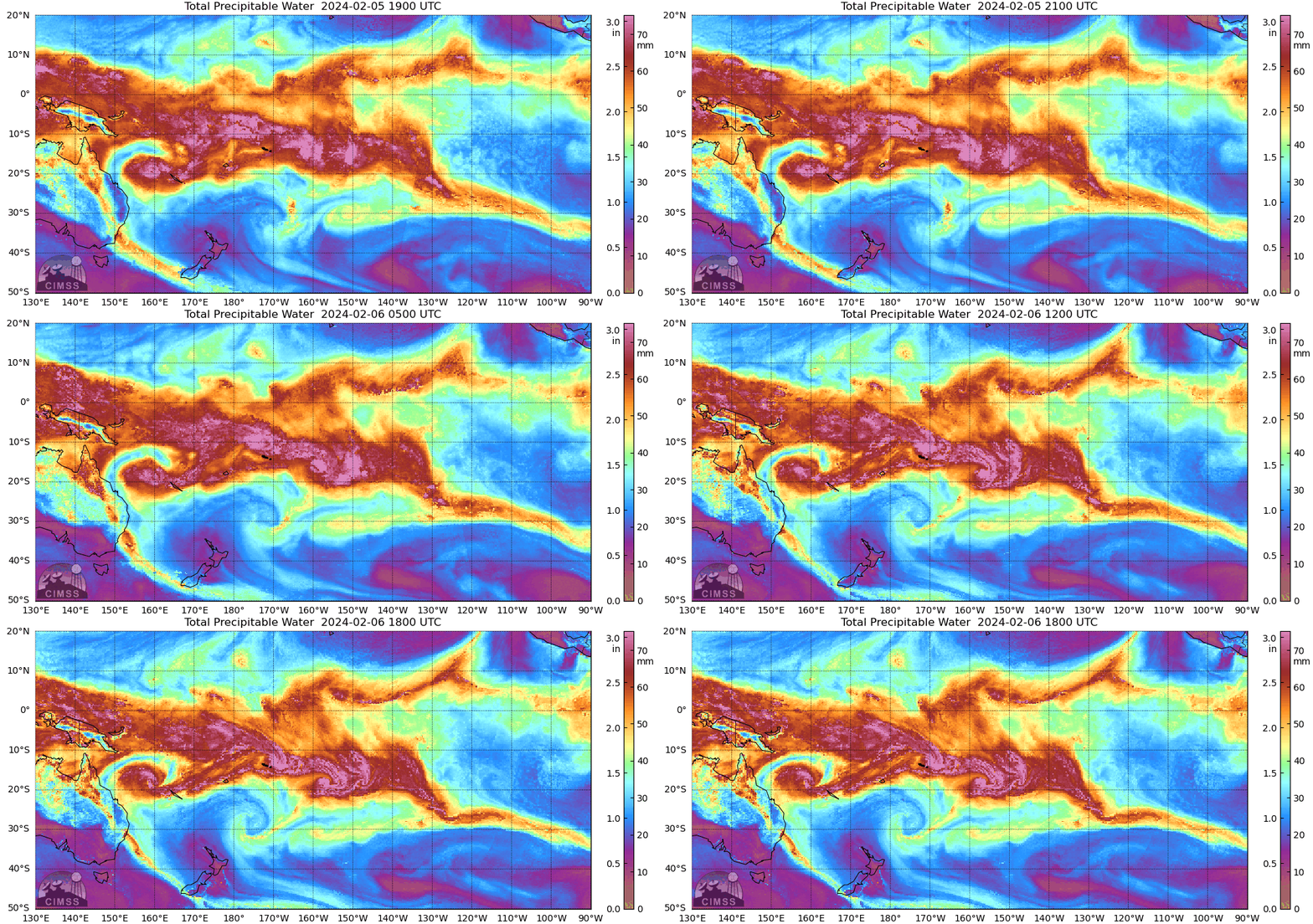
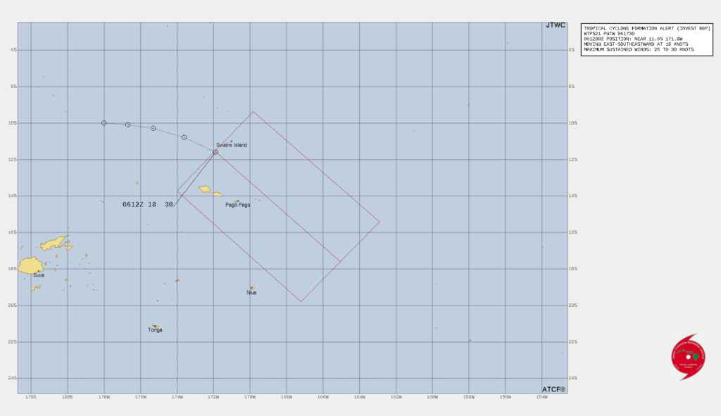
As tropical storm Nat moves away from the Samoan Islands and towards Tahiti, another Invest area, 98P, has developed north of the Samoan Islands. The animation above, from the MIMIC Total Precipitable Water site (link), shows a cyclonically-rotating concentration of moisture just north of Samoa, and moving east-southeastward toward Olosega and Ta’u. The Tropical Cyclone Formation Alert (TCFA) graphic (click here for text explanation) from the Joint Typhoon Warning Center (link), below, moves the center of the disturbed weather towards those islands. skirting the larger islands of Samoa. Flood watches and Heavy Surf Warnings are in effect for all of American Samoa.
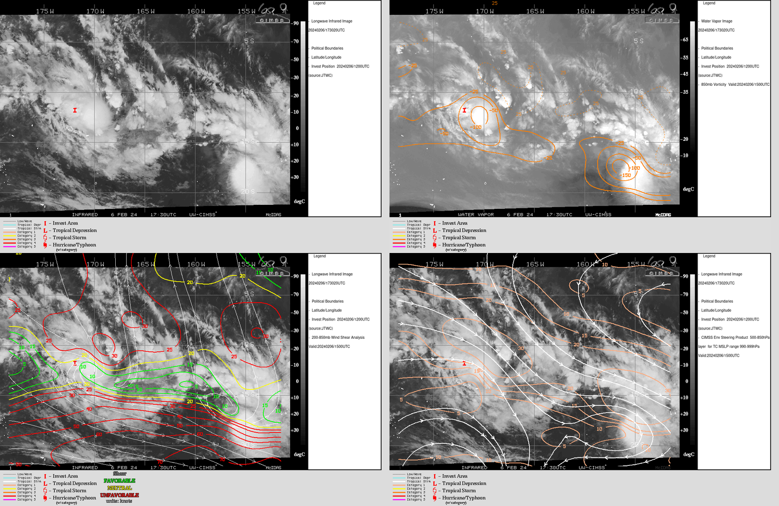
Imagery from the CIMSS Tropical Weather website, below, helps gauge the threat of the storm. The imagery shows the Invest location at 1200 UTC along with the 1730 UTC infrared imagery, then the Invest Location with the 1730 UTC water vapor imagery along with the 1500 UTC analysis of 850-mb vorticity (notice its motion east-southeastward from the 1200 UTC Invest location, and also the vorticity associated with Tropical Storm Nat at the eastern edge of the domain), then the 1500 UTC analysis of 200-850 mb shear overlain on top of the infrared imagery (note that Nat has moved poleward into stronger shear, but invest 98P to the north of Samoa is within a persistent corridor of low shear that has existed for days), and finally the dynamic layer mean motion appropriate for a fairly weak system, motion that moves the system towards the eastsoutheast.
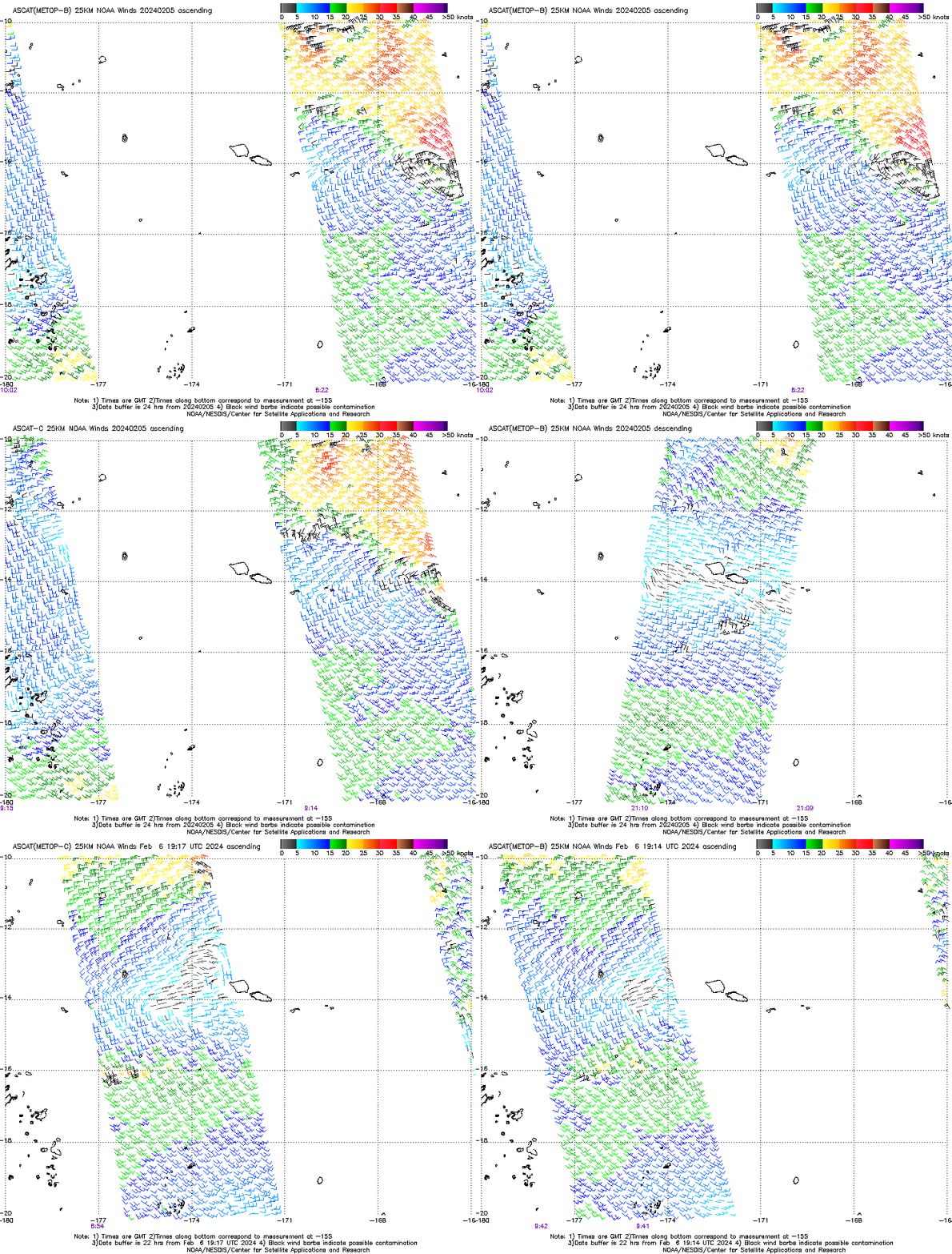
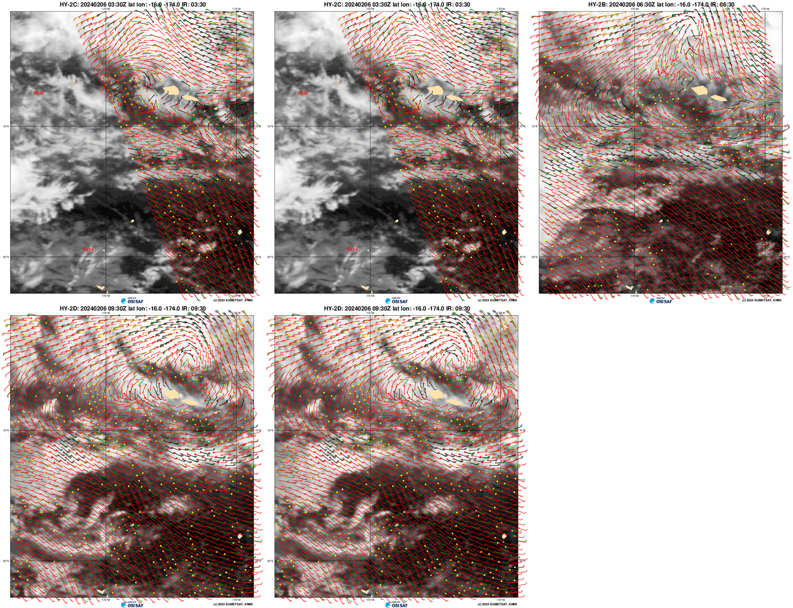
Scatterometry is a useful tool to find circulation centers, but observations over the center must happen! The animation below (from this source) shows MetopB and MetopC observations in the past 2 days. The circulation of Tropical Cyclone Nat is sampled well on the 5th, but the region north of Samoa, where 98P is developing, has not had good coverage.
However, HY-2B and HY-2C satellites from China (available at this website), shown below, had good coverage over the region, as shown below. The 0930 UTC image shows the circulation (with much stronger winds towards the Equator) associated with 98P.
GOES-West imagery (taken from the CSPP Geosphere site) over the South Pacific on 6 February, above, shows 98P north of American Samoa, and Tropical Storm Nat to the east. Nat is showing the effects of increasing shear as the low-level circulation starts to emerge from beneath the deep convection by the end of the animation. One of the GOES-West mesosectors has been positioned over Samoa to monitor the evolution of the system. A 2-hour animation, below, of visible imagery shows the active convection, and low-level flow to the northwest (north of Tutuila).
Added, 2200 UTC: Advisories on Tropical Depression 11P have started from JTWC and on Tropical Cyclone 08F from the Fiji RSMC. Despite the different numbers, they’re the same system.
The animation below (source), from 2130 UTC 6 February to 0120 UTC 7 February, shows the continued spin-up of the Tropical Depression in American Samoa waters. The GLM does not show lightning near the center of the storm. Meanwhile, Tropical Storm Nat, to the east, continues to exhibit characteristics of a sheared storm, with the low-level circulation separated from convection.
—————
Free Secure Email – Transcom Sigma
Transcom Hosting
Transcom Premium Domains
