Atmospheric Rivers Drench California
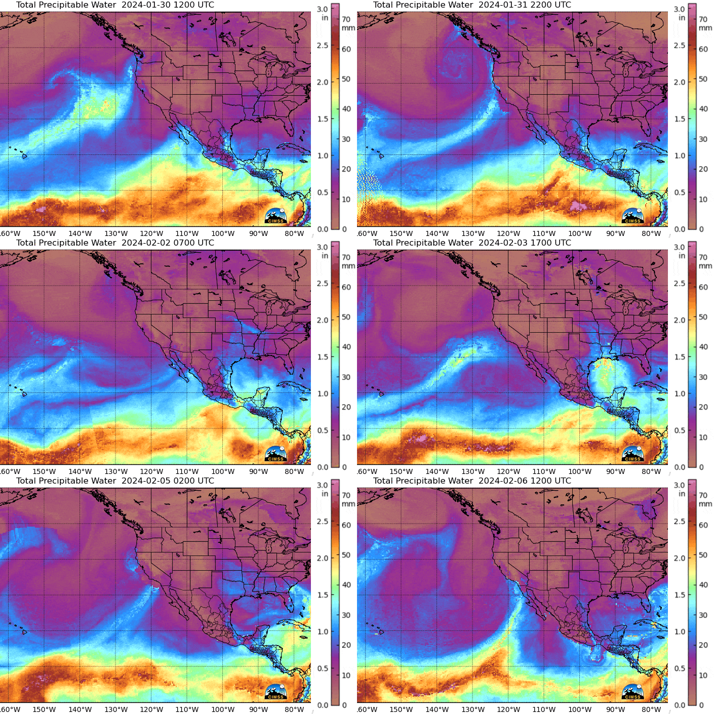
2024 has seen several strong storms hit the U.S. West Coast delivering repeated rounds of widespread rains and mountain snow, with Southern California experiencing the heaviest rainfall totals. Total Precipitable Water imagery (TPW) conveying data acquired by microwave sensors on polar-orbiting satellites is a key tool for meteorologists tracking atmospheric rivers associated with these storm systems, as seen in this loop from 30 January to 6 February.

Per the NWS Los Angeles, the following rainfall records were set in southwest California on February 5th alone:
– 2.93 inches in downtown Los Angeles (USC), surpassing the old record of 2.30 inches set in 1901. (adding to the 4.10 inches collected at this location on February 4th, also a daily record)
– 2.57 inches at the the Los Angeles International Airport, smashing the previous record of 1.42 inches in 1978.
– 2.19 inches at the Burbank Airport, breaking the old record of 1.46 inches set in 2009.
– 1.70 inches at the Palmdale Airport, more than double the old record of 0.61 inches from 1948.
– 1.49 inches at Lancaster Fox Field, tripling the old record of 0.48 inch set in 2009.

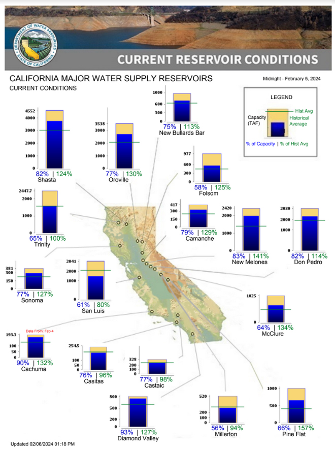
As seen in the accompanying graphic, a majority of the major water supply reservoirs in California are at or above historical averages, an astonishing rebound from the dire drought conditions at the end of 2022. This turn-around commenced last winter when an historic run of nine atmospheric rivers inundated California between December 2022 and January 2023.
Now the concern has shifted to damaging floods, falling trees, mudslides and debris flows.
—————
Free Secure Email – Transcom Sigma
Transcom Hosting
Transcom Premium Domains
