Microwave observations of heavy rain over southern California
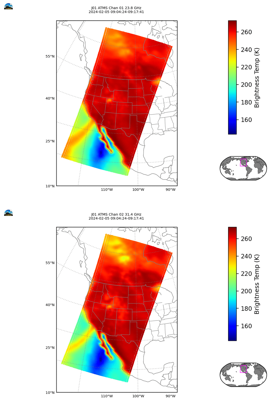
The Direct Broadcast antenna at the UW-Madison CIMSS can receive information over much of the contiguous United States. This includes the NOAA-20 overpass that acquired data around 0910 UTC over southern California during a frontal passage. NOAA-20 supports both the Visible Infrared Imaging Radiometer Suite (VIIRS) and the Advanced Technology Microwave Sounder (ATMS) instruments. Microwave imagery from ATMS, above, at 21.3 and 36.5 GHz, show the narrow stream of moisture flowing into southern California. Note the very cold brightness temperatures south of Baja California. In this region, clear skies are allowing information from the ocean surface to reach the satellite, but ocean water has very low emissivity at microwave frequencies/wavelengths; as a consequence, the computed brightness temperature (computed assuming a blackbody emission) is very cold.
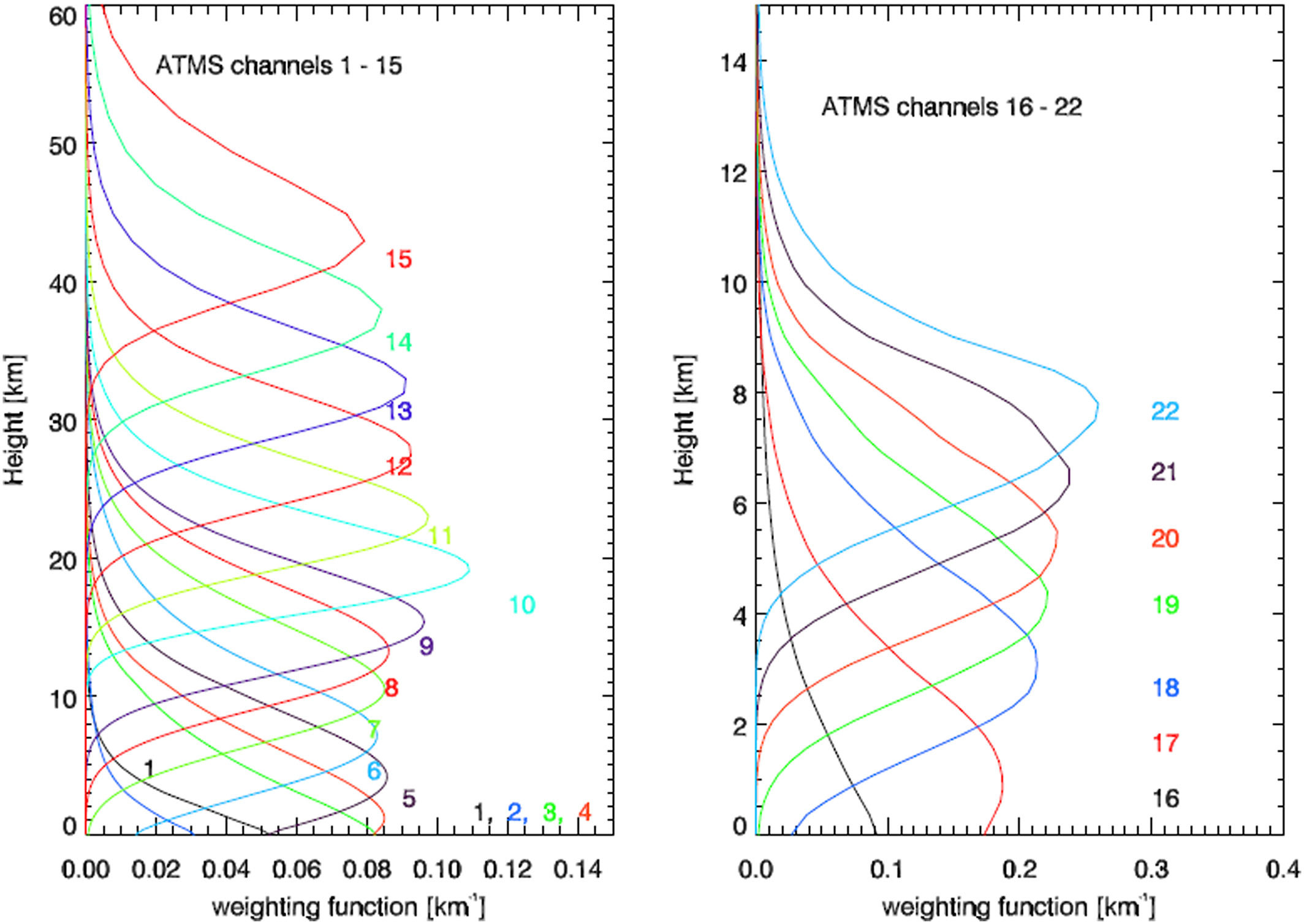
Weighting Functions for ATMS Bands 18-22, below (source), show that Band 22 receives information from higher in the atmosphere and Band 18 received information from lower in the atmosphere. All five frequencies are within a region where microwave energy is strongly absorbed by water vapor (as shown in this absorption spectrum figure from here). You can infer from the weighting functions that Band 22 is a region where water vapor absorption is strongest of the 5 channels, and Band 18 is in a region of the spectrum where water vapor absorption is weakest of these 5 channels.
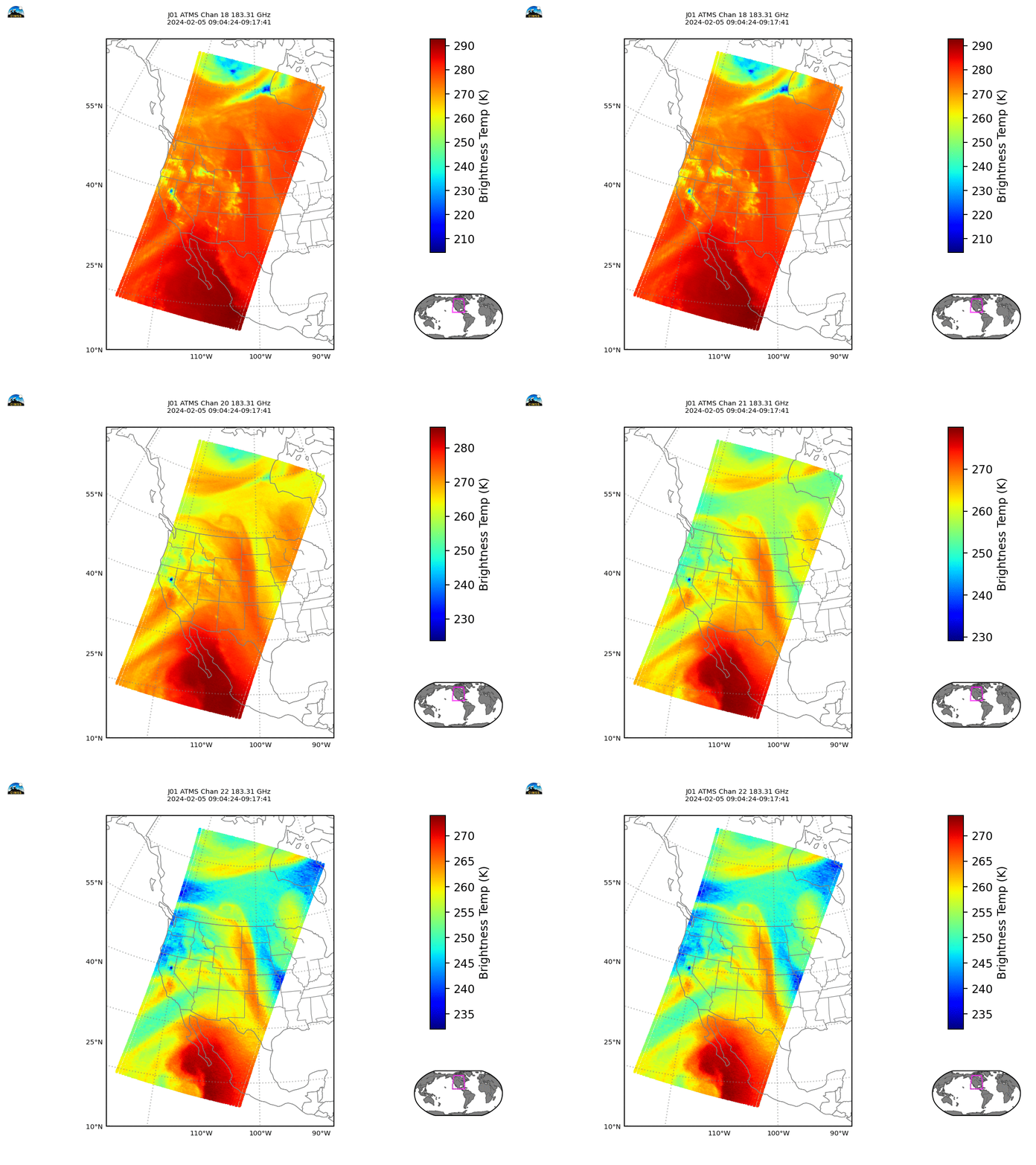
ATMS Brightness Temperatures for channels 18-22 are shown below. All show cooler temperatures over southern California (and in a band extending to the southwest of southern California). This suggests that water vapor is either more abundant in this region, or at higher altitudes (or both). These images give qualitative estimates of moisture. As noted above, the moisture band is fairly narrow.
MIRS software that is part of CSPP (software that is used at direct broadcast sites to process the signal from ATMS or VIIRS) can be used to create horizontal fields of temperature and dewpoint from the microwave information. These quantitative fields are shown below. The dewpoint fields show higher dewpoints that are especially concentrated at about 500 mb. A sharp northern edge to the moisture is also apparent.

MIRS temperature fields in the mid- to lower-troposphere, below, suggest a fairly sharp temperature gradient associated with the northern edge of the moist plume.

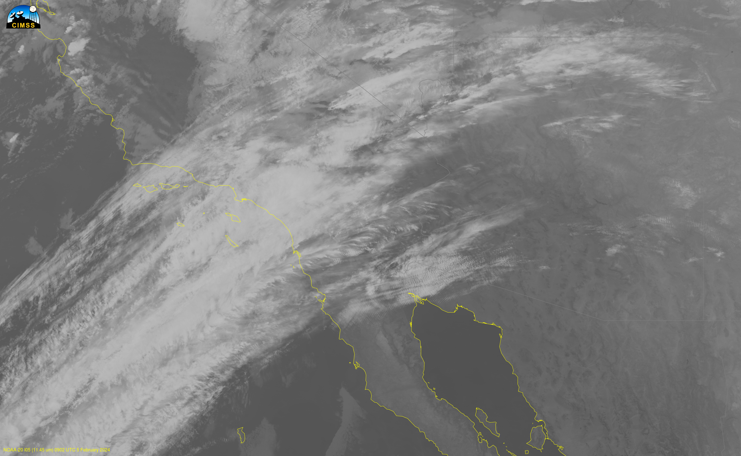
The I05 image (11.45 µm), below, from VIIRS, shows infrared information over southern California. The front affecting southern California is manifest as a relatively narrow band of cloudiness. Skies are mostly cloud-free south of Baja California. It’s easier to interpret the microwave imagery above if you have access to visible and infrared imagery at the same time. Of course, VIIRS and ATMS will both sample at the same times because they’re on the same satellite. It’s a good practice to use data from the visible (when available), infrared and microwave to better characterize atmospheric features.
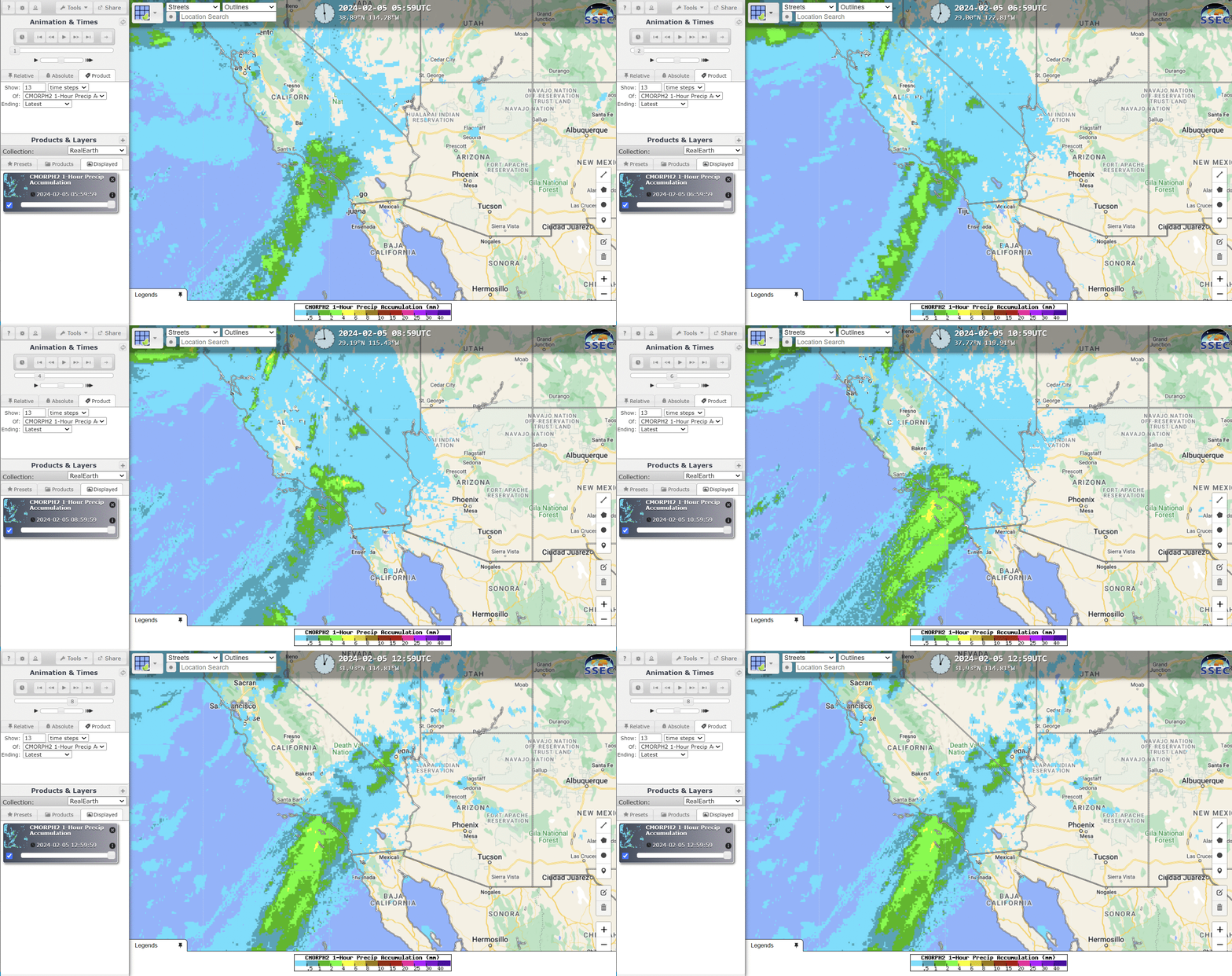
CMORPH-2 estimates also give information about rainfall. They are available at RealEarth (where you can search for CMORPH) or here. The animation below suggests steady rains from the Pacific into the San Gabriel/San Bernardino mountains.
—————
Free Secure Email – Transcom Sigma
Transcom Hosting
Transcom Premium Domains
