
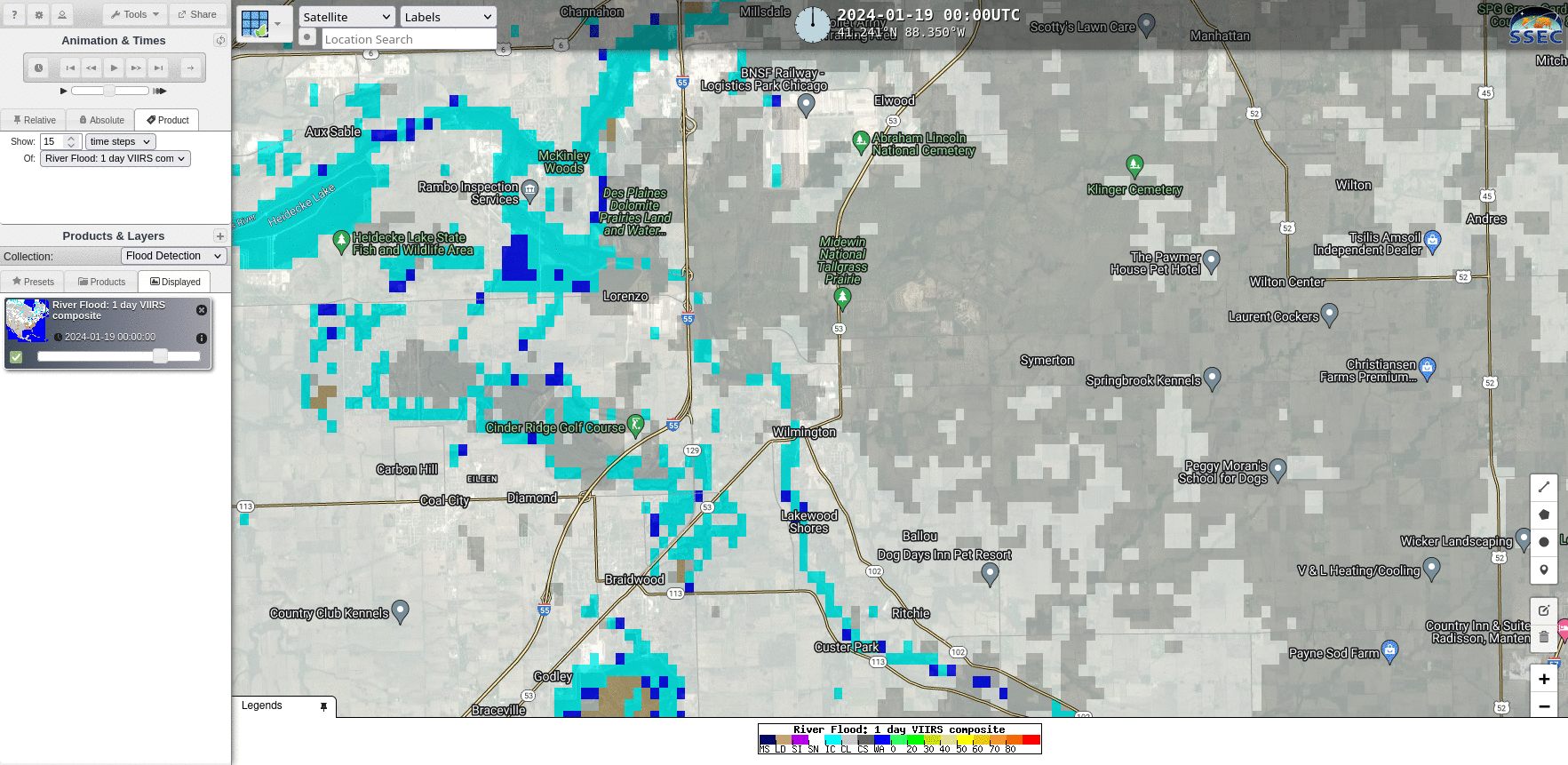
Ice Jam flooding on the Kankakee River in Illinois
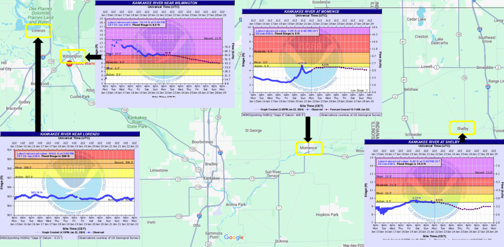
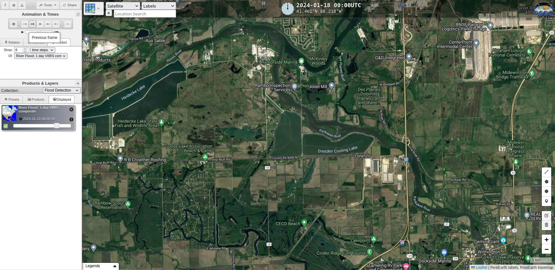
A cold snap in mid-January 2024 (Click here to see a High/Low temperature chart for Aurora Illinois from this site) led to rapid ice formation on the Kankakee River southwest of Chicago, and an ice jam with ice jam flooding subsequently developed. The map above shows different flood gauge records along the Kankakee (source). Flooding is occurring near the Wilmington IL flood gauge. The toggle below illustrates the small size of the Kankakee River relative to the 375-m VIIRS pixel size used in the Flood Product (available here)! Flood detection from an ice jam will be a challenge. (Editor’s note: I regret not clearing my Google search/cookies before creating this imagery, and shortly after searching for dog kennels)
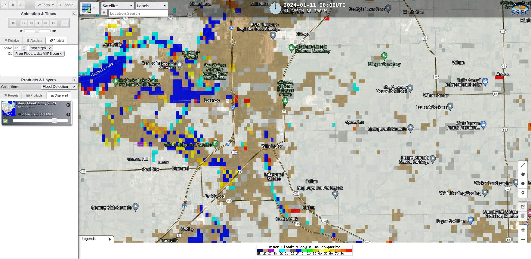
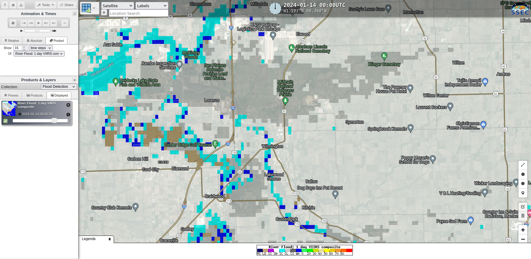
The animation below compares views on 11 January (when the ground was mostly bare), 13 January (after a snow storm and cold snap) and 14 January 2024 (12 January was a cloudy day). The domain is larger than shown in the toggle above. Note the change from bare ground on the 11th to snow-covered on the 13th, and the change from open water on the 11th to ice on the 14th. A single red pixel is present near Wilmington on the 13th; however, the river was not above flood stage at that time.
What happened from 14-20 January, specifically as the river exceeds flood stage on the 16th? The small river appears to be mostly ice-covered (cyan), with occasional water detections. There are more open water detections downstream of Lorenzo IL, where the river gauge does not suggest flood conditions. An important question would be: are the water detections close to Wilmington showing water associated with the ice jam? That’s a hard question to answer with this product.
Views from 19-21 January 2024, show, so more of the same. Ice cover with occasional open-water detection.
On 22-23 January, clouds prevented VIIRS flood detection. A news story on the 22nd (link) suggests the ice jam effects are lessening, in part because of the diversion of warm water from a power plant.
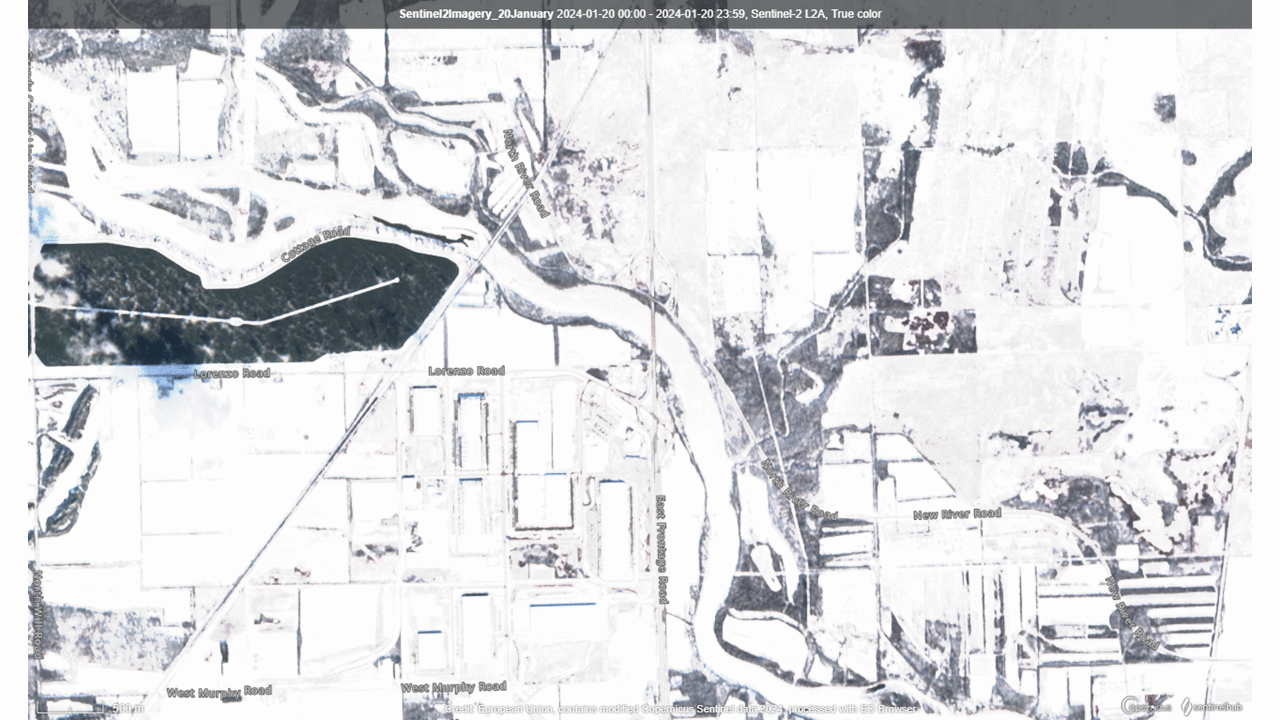
Sentinel-2 imagery from 20 January 2024 (link) can be matched to drone images show at this news link, as shown in the toggle below. In this region near the I-55 bridge, water has no overflown the river banks.
Thanks to Sarah Marquardt, NWS MKX, for alerting us to this event. A flood warning remains in effect for this event through 29 January 2024.
—————
Free Secure Email – Transcom Sigma
Transcom Hosting
Transcom Premium Domains