
Improvements to the CSPP Geosphere Site
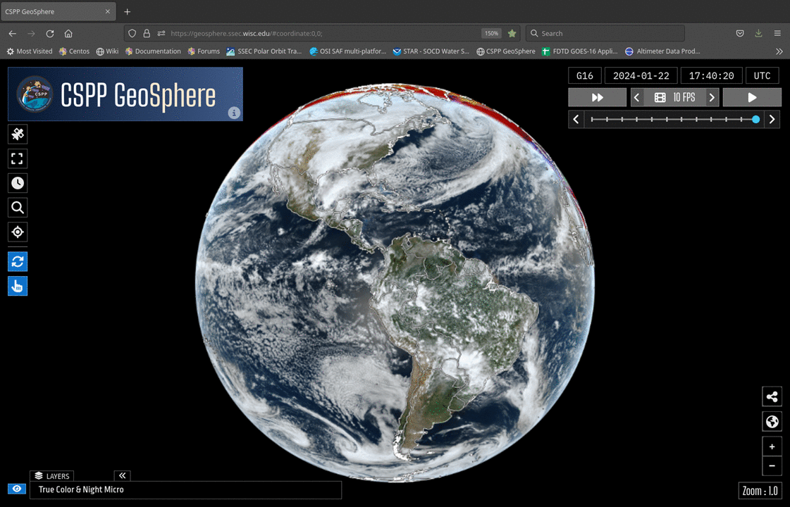
The CSPP Geosphere site uses cloud-compatible technology with an on-site cluster and CSPP-Geo software (including geo2grid) to provide high-quality imagery from GOES-East and GOES-West. The site has recently been upgraded, with two level 2 products added (Cloud-top Height and Cloud-top Temperature). In addition, the landing (front) page of the site has been improved, as shown in the toggle above. The displayed image remains True Color (day time) and Night Microphysics (night time), but icons have been added on the left (as indicated) to change the Satellite (GOES-East and GOES-West are available); to change the Sector (Mode 6: Full Disk, CONUS/PACUS, 2 Mesoscale Sectors; Mode 4: Full Disk); to select the number of Frames (Default: 12 timesteps, no times skipped); to select a location on which to center; to select a latitude/longitude point on which to center; to toggle on/off auto-reloading, and to toggle on/off a mouse probe. On the right hand side, lower right, are icons to bring up the share menu, and also to enlarge the image to fit the screen. In the bottom left is link to a menu to select the products to be displayed, as shown below.
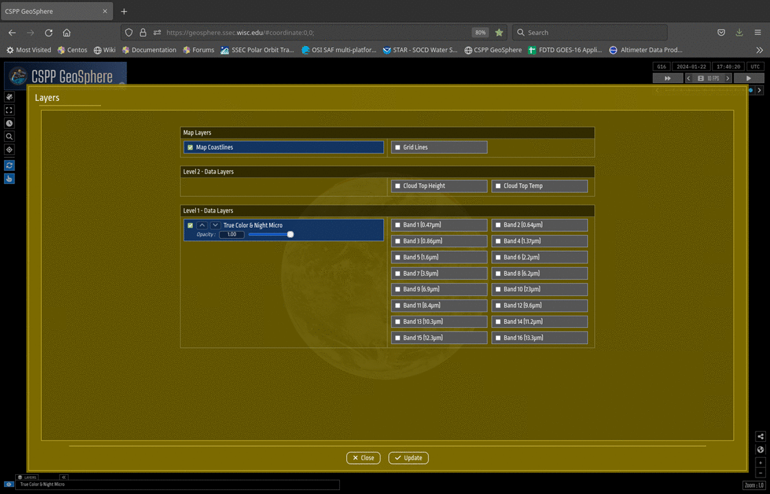
The Layers highlighted in Blue are what is currently displayed; these can be toggled off and on. Other layers that can be shown are in gray. Click a (grey) box to toggle on the band or product (or map/lat-lon grid); note that only three Bands/Level 2 fields can be displayed at once. When more than one field is displayed, they are overlain on top of each other, and can be toggled on and off for quick qualitative comparisons between fields. The Level 2 products — Cloud Top Height and Cloud Top Temperature — have information only where clouds are present, and are transparent otherwise.
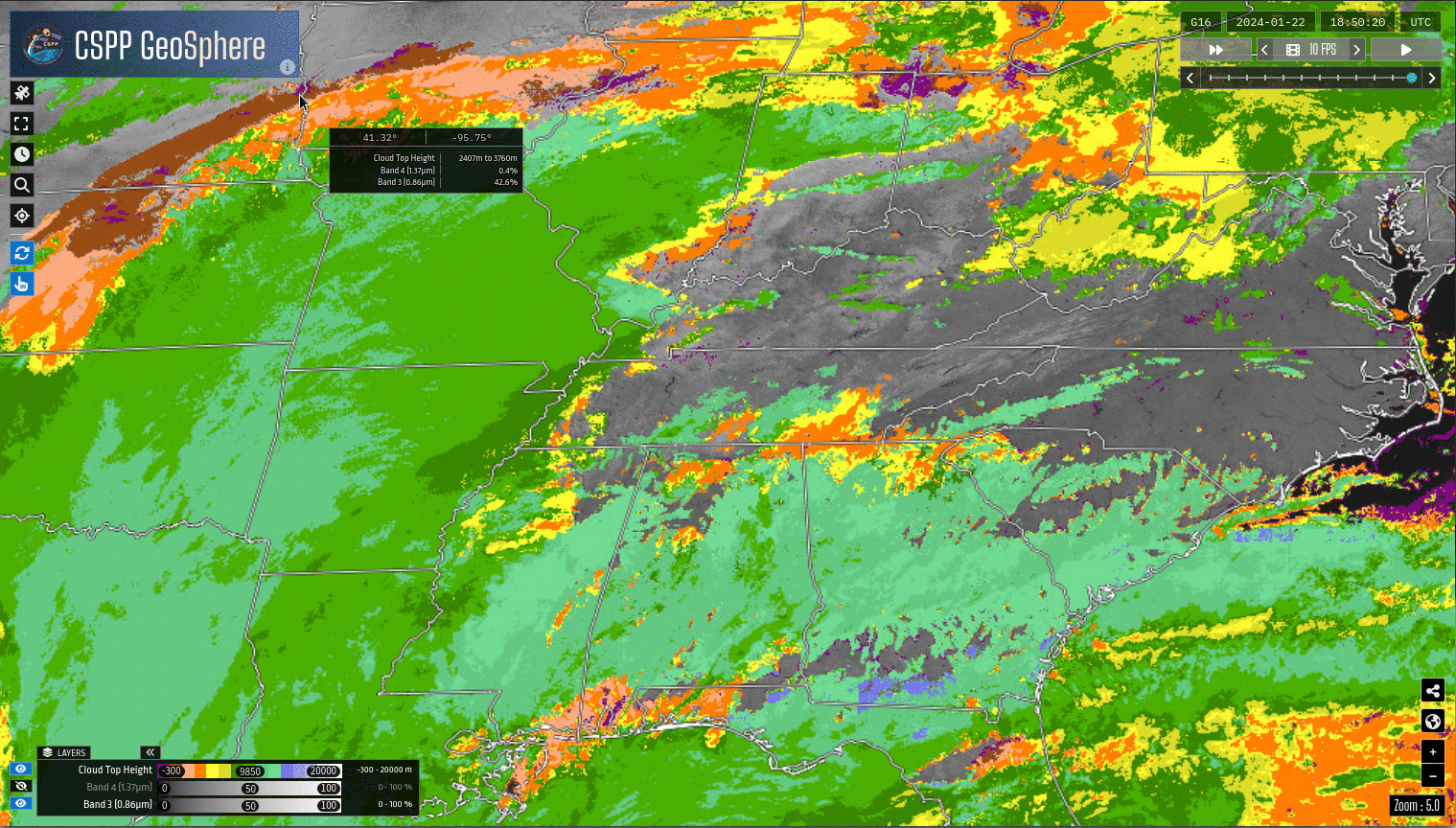
The screen capture below shows the result of two samplings at 1850 UTC on 22 January 2024 (Full Disk GOES-16 Data): for single band data, the probe is detecting the grey-scale in the 8-bit image, and uses knowledge of the enhancement to determine a brightness temperature or reflectance. For Level 2 products (Cloud Top Height and Cloud Top Temperature), the probe again detects the color shown, and displays the value range appropriate for the sensed color. In other words, the probe is not accessing the raw data used to create the image.
—————
Free Secure Email – Transcom Sigma
Transcom Hosting
Transcom Premium Domains