
1-minute imagery to monitor deep convection for flooding potential across American Samoa
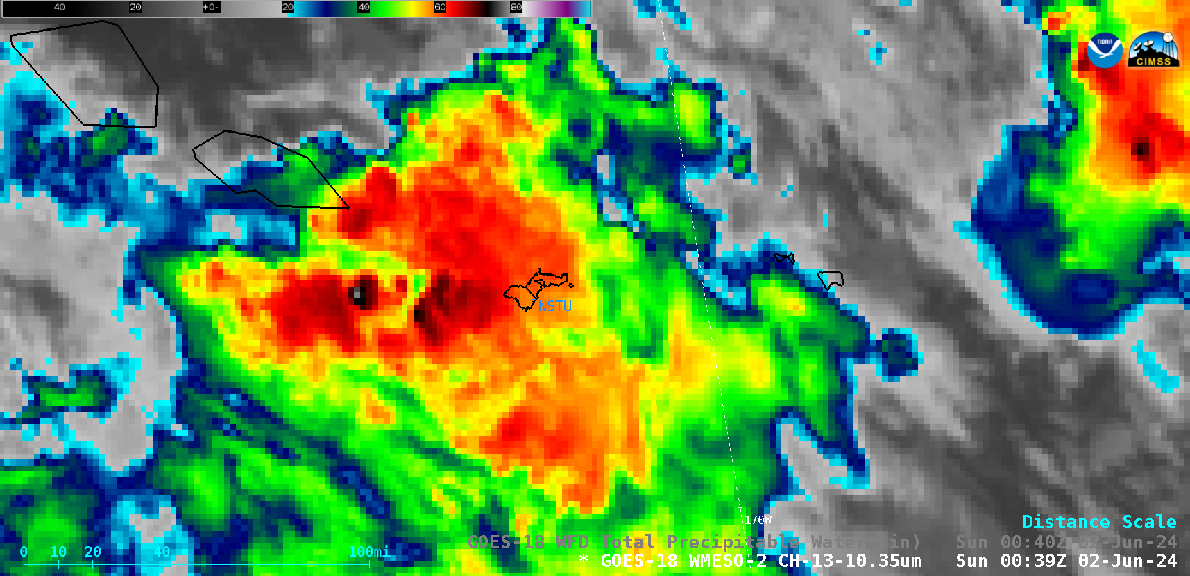
1-minute GOES-18 “Clean” Infrared Window (10.3 µm) images, from 0127 UTC on 01 June to 0059 UTC on 02 June; NSTU denotes the location of Pago Pago, American Samoa [click to play MP4 animation]
1-minute Mesoscale Domain Sector GOES-18 (GOES-West) “Clean” Infrared Window (10.3 µm) images (above) displayed areas of convection that moved across American Samoa on 01 June 2024 (the 1-minute imagery was requested by the NWS Pago Pago forecast office to monitor the approach of thunderstorms, since they had issued a Flood Watch for the islands). Although there was a break in the convective activity midway through the period, Pago Pago did receive heavy rainfall from thunderstorms that began to arrive just as the 1-minute imagery was ending.
A GOES-18 Infrared image showing a cold (-77.7ºC) thunderstorm overshooting top west of American Samoa at 0039 UTC on 02 June (below) included a cursor sample of the associated GOES-18 Cloud Top Height (50750 ft) and Rain Rate (1.90 in/hr) derived products at that location.
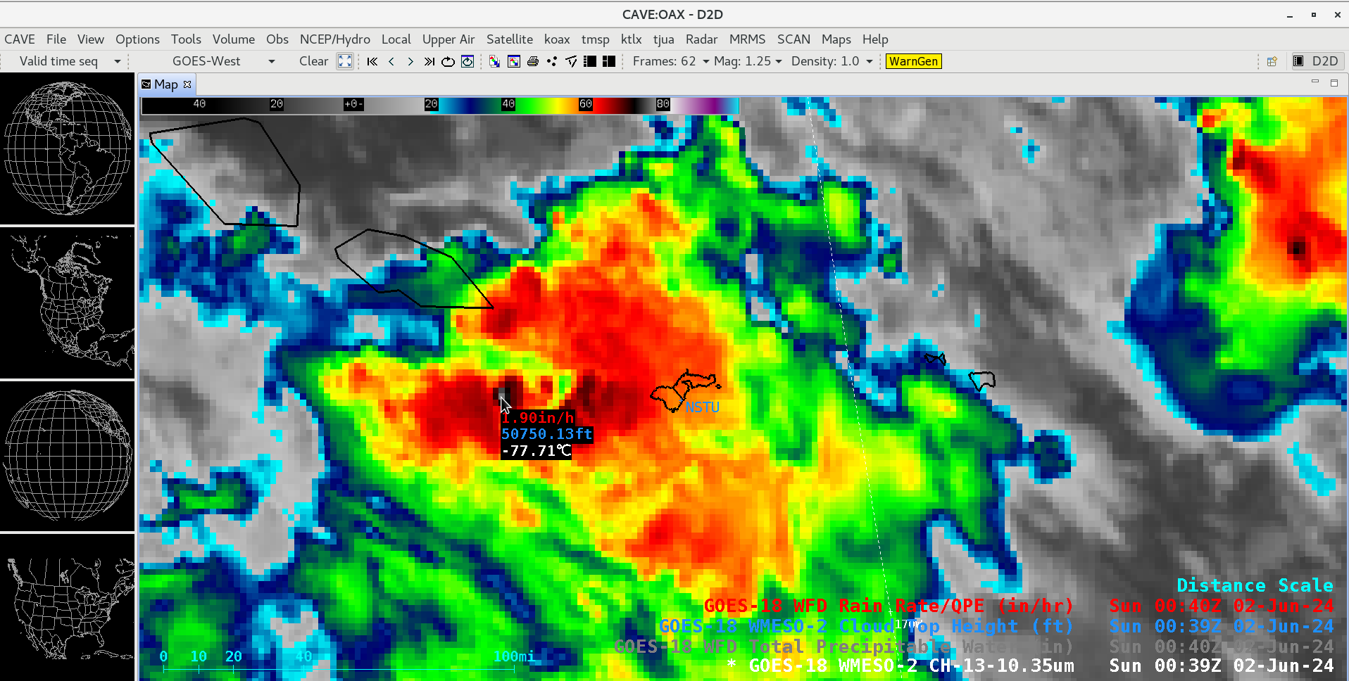
GOES-18 “Clean” Infrared Window (10.3 µm) image showing a cold thunderstorm overshooting top west of American Samoa at 0039 UTC on 02 June, which includes a cursor sample of the associated GOES-18 Cloud Top Height (blue) and Rain Rate (red) derived products [click to enlarge]
During a break in widespread cloud coverage across the region, the 10-minute Total Precipitable Water (TPW) derived product (in cloud-free regions) (below) showed a NW-SE corridor of TPW values in the 2.0 to 2.2 inch range across the Samoan Islands.
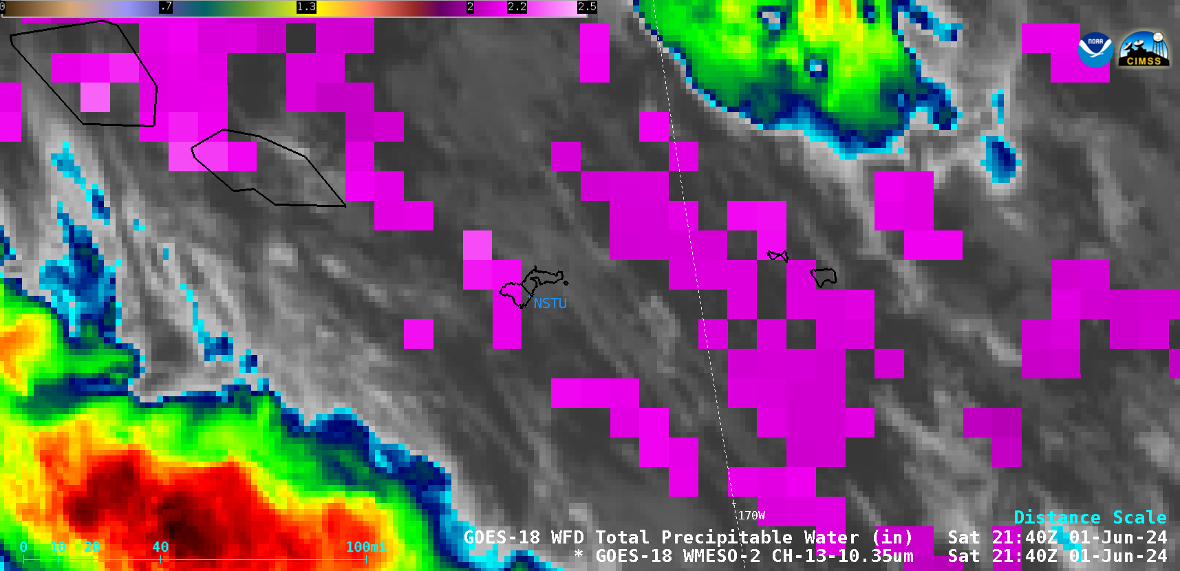
1-minute GOES-18 “Clean” Infrared Window (10.3 µm) images combined with the 10-minute Total Precipitable Water derived product (in cloud-free regions), from 1859 UTC on 01 June to 0000 UTC on 02 June; NSTU denotes the location of Pago Pago, American Samoa [click to play animated GIF | MP4]
The GOES-18 derived Total Precipitable Water values were less than the 2.62 inches obtained using rawinsonde data from Pago Pago, American Samoa at 0000 UTC on 02 June (below).
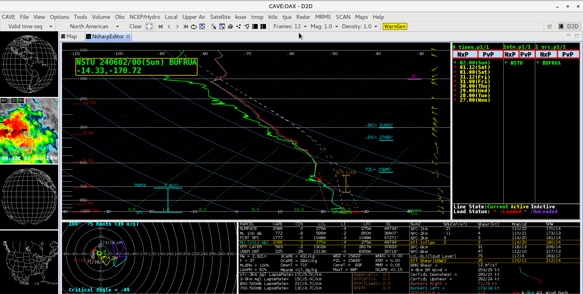
Plot of rawinsonde data from Pago Pago, American Samoa at 0000 UTC on 02 June [click to enlarge]
—————
Free Secure Email – Transcom Sigma
Transcom Hosting
Transcom Premium Domains