1-minute imagery to monitor convection across the Samoan Islands

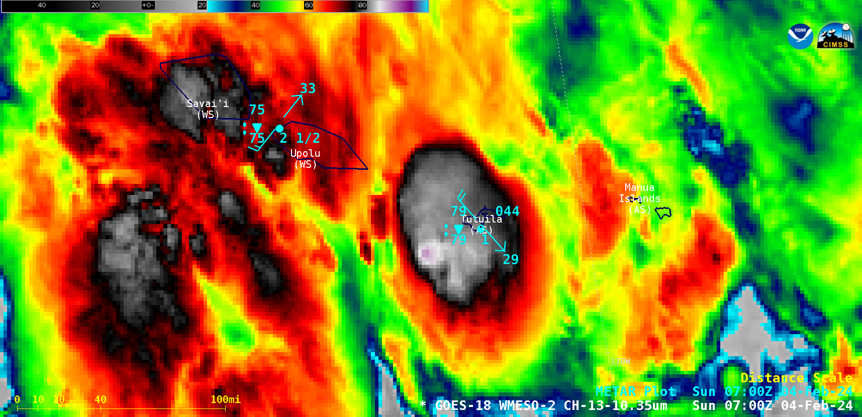
1-minute GOES-18 “Clean” Infrared Window (10.3 µm) images, from 0600-1200 UTC on 04 February [click to play animated GIF| MP4]
1-minute Mesoscale Domain Sector GOES-18 (GOES-West) “Clean” Infrared Window (10.3 µm) images (above) displayed a period of convective bursts near and over the American Samoa island of Tutuila on 04 February 2024 — which produced heavy rainfall (leading to flash flooding and landslides; during the 6-hour period ending at 1200 UTC, Pago Pago recorded 3.92 inches of rain), strong winds (gusting to 38 kts or 44 mph at Pago Pago, with wind gusts elsewhere estimated to 50 mph) and power outages across parts of the island (Local Storm Reports). The coldest cloud-top infrared brightness temperatures were in the -90 to -93ºC range (shades of purple embedded within brighter white regions) — which indicated that the stronger overshooting tops were ascending past the local tropopause, according to Pago Pago rawinsonde data.
These convective bursts developed as Tropical Disturbance TD06F was slowly approaching American Samoa (Fiji Meteorological Service surface analyses: 0300 UTC | 0600 UTC | 1200 UTC); TD06F continued to organize and intensify, eventually becoming Tropical Storm Nat at 1200 UTC on the following day (see this blog post for more information).
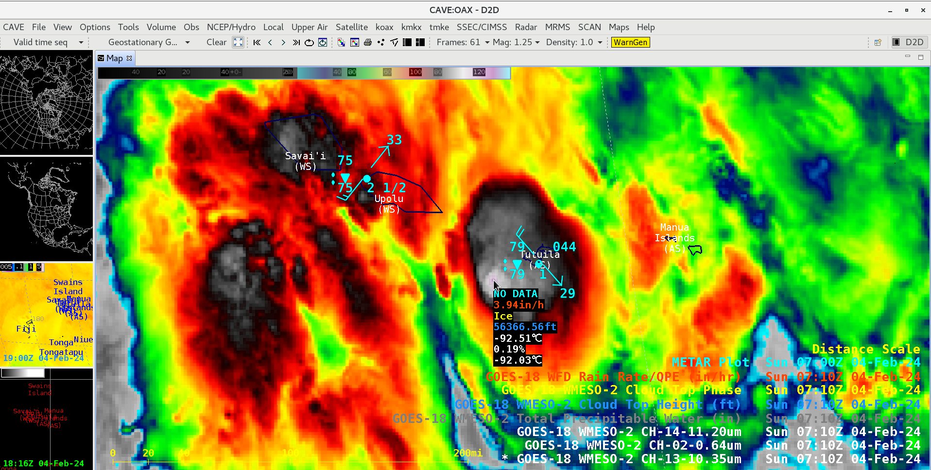
A GOES-18 Infrared image at 0710 UTC (below) included cursor sampling of the associated Level 2 derived product Rain Rate, Cloud Top Phase and Cloud Top Height — the derived Rain Rate at that cold (-92ºC) overshooting top was 3.94 inches per hour.

GOES-18 Infrared image at 0710 UTC on 04 February, with cursor sampling of the associated Level 2 Rain Rate, Cloud Top Phase and Cloud Top Height [click to enlarge]
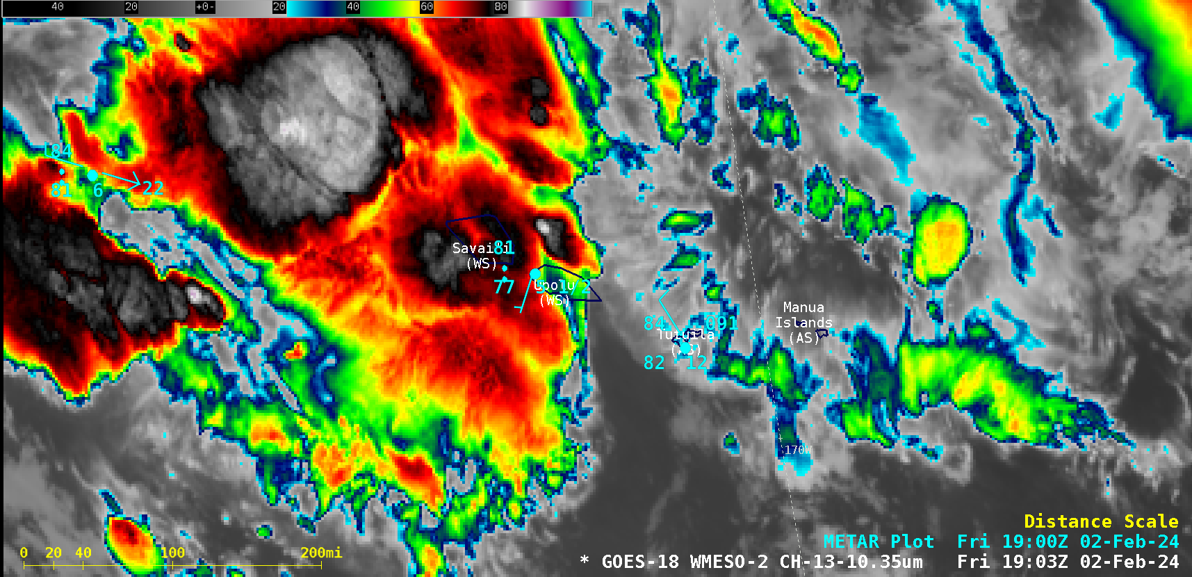
A larger-scale view during the 3-day period from 02-04 February is shown below. Clusters of deep convection first affected the islands of Western Samoa, before later forming over American Samoa. The South Pacific Convergence Zone (SPCZ) remained in the vicinity of the Samoan Islands during that time (1200 UTC surface analyses: 02 Feb | 03 Feb | 04 Feb), helping to focus convective development..

1-minute GOES-18 Infrared images, from 1200 UTC on 02 February to 1959 UTC on 04 February [click to play MP4 animation]
—————
Free Secure Email – Transcom Sigma
Transcom Hosting
Transcom Premium Domains
