1-minute GOES-18 imagery to monitor Flash Flooding potential across American Samoa

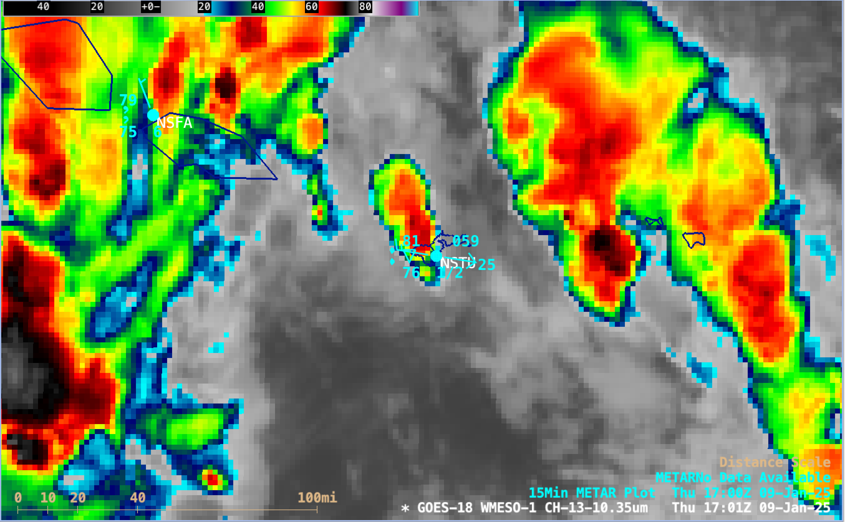
1-minute GOES-18 Clean Infrared Window (10.3 µm) images, from 0300-2300 UTC on 9th January [click to play MP4 animation]
Due to a lack of radar coverage over American Samoa, WSO Pago Pago requested 1-minute Mesoscale Domain Sector coverage over the islands during a prolonged period of heavy rainfall risk. GOES-18 (GOES-West) Clean Infrared Window (10.3 µm) images (above) displayed areas of deep convection that moved near and over the American Samoa island of Tutuila (where Pago Pago NSTU is located) on 9th January 2025 — which produced periods of moderate to heavy rainfall (leading to flash flooding and landslides, prompting the issuance of Flash Flood Warnings; Pago Pago received 3.19 inches of rainfall that day), strong winds (gusting 45 mph at Pago Pago, which led to flight cancellations) and power outages across parts of the islands. The coldest cloud-top infrared brightness temperatures were around -80ºC (shades of white embedded within dark black regions).
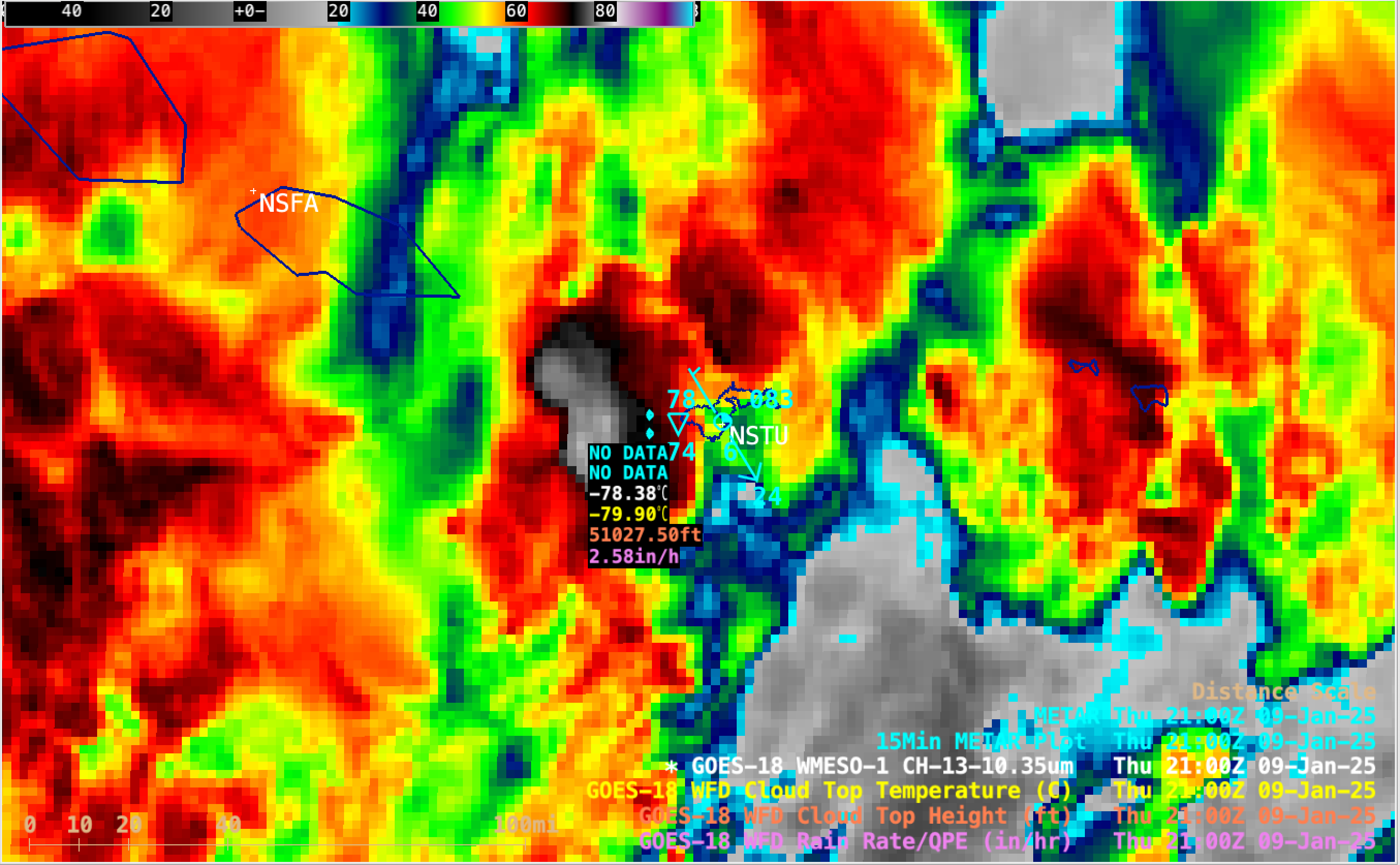
The GOES-18 Infrared image at 2100 UTC (below) included cursor samples of the Cloud Top Temperature, Cloud Top Height and Rain Rate Level 2 derived products for an area of convection that was approaching the island of Tutuila.

GOES-18 Infrared image at 2100 UTC, with cursor samples of the Cloud Top Temperature, Cloud Top Height and Rain Rate derived products for an area of convection that was approaching American Samoa [click to enlarge]
These thunderstorms and strong winds developed as Tropical Disturbance TD04F was located southwest of American Samoa (Fiji Meteorological Service surface analyses: 0300 UTC | 1230 UTC | 2100 UTC), in addition to the South Pacific Convergence Zone being oriented NW to SE across the Samoan Islands.
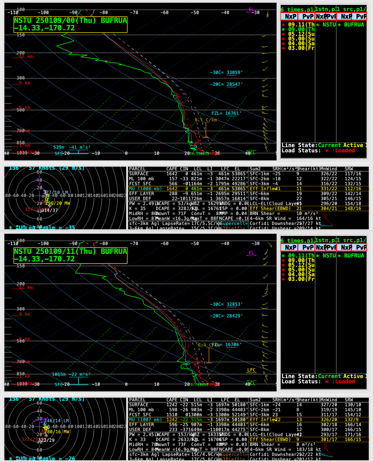
A toggle between plots of rawinsonde data from Pago Pago (below) depicted an atmosphere with deep moisture throughout the troposphere (Total Precipitable Water values of 2.45-2.49 in) and modest instability (CAPE values of 1242-1642 J/kg, and Lifted Index values of -3ºC).

Plots of rawinsonde data from Pago Pago at 0000 UTC and 1100 UTC on 9th January [click to enlarge]
—————
Free Secure Email – Transcom Sigma
Transcom Hosting
Transcom Premium Domains
